![](/images/other/stat-length.png)
![Trail On foot Larochette - Rundwanderweg L2 - Photo](https://media.geolcdn.com/t/1900/400/ext.pjpeg?maxdim=2&url=https%3A%2F%2Fmedia.geolcdn.com%2Ff%2Fcc5d345f-0895-4078-bfe8-94230a378280.jpeg)
Rundwanderweg L2
SityTrail - itinéraires balisés pédestres
Tous les sentiers balisés d’Europe PRO
![Length](/images/other/stat-length.png)
Length
8.1 km
![Max alt](https://static1.geolcdn.com/siteimages/upload/files/1508320355ic_sort_altitude_max_24dp.png)
Max alt
367 m
![Uphill gradient](https://static1.geolcdn.com/siteimages/upload/files/1508320355ic_sort_den_pos_24dp.png)
Uphill gradient
172 m
![Km-Effort](/images/other/stat-length.png)
Km-Effort
10.3 km
![Min alt](https://static1.geolcdn.com/siteimages/upload/files/1508320355ic_sort_altitude_min_24dp.png)
Min alt
276 m
![Downhill gradient](https://static1.geolcdn.com/siteimages/upload/files/1508320355ic_sort_den_neg_24dp.png)
Downhill gradient
169 m
![Boucle](https://static1.geolcdn.com/siteimages/upload/files/16400158638029165_repeat_loop_refresh_sync_direction_icon.png)
Boucle
No
Signpost
Creation date :
2022-02-09 14:24:23.06
Updated on :
2022-02-09 17:52:47.967
![On foot](https://static1.geolcdn.com/sitytour/trail-icons/100.png)
2h21
Difficulty : Easy
![Scan this QR Code to open this trail in the SityTrail application](https://capi.geolives.com/qq0zvz2zws4bq2lad0pu/sitytour/trails/3083123/qr.png?size=200)
FREE GPS app for hiking
About
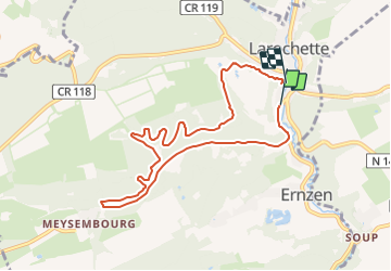
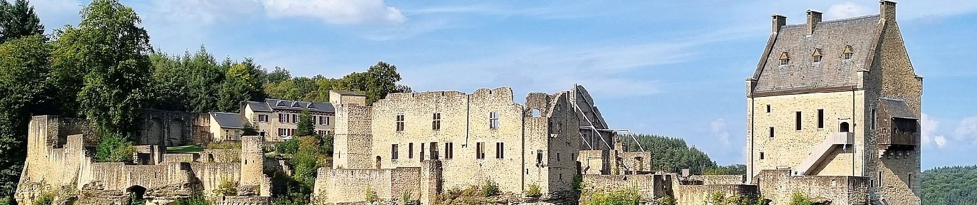
Trail On foot of 8.1 km to be discovered at Unknown, Canton Mersch, Larochette. This trail is proposed by SityTrail - itinéraires balisés pédestres.
Description
Symbol: Grünes L2 auf weißem Grund
Positioning
Country:
Luxembourg
Region :
Unknown
Department/Province :
Canton Mersch
Municipality :
Larochette
Location:
Unknown
Start:(Dec)
Start:(UTM)
299704 ; 5518012 (32U) N.
Comments
Trails nearby
![Trail Walking Larochette - MÜLLERTHAL (Larochette -superbe parcours ds les formations rocheuses) - Photo](https://media.geolcdn.com/t/375/260/ext.jpg?maxdim=2&url=https%3A%2F%2Fservices.sitytrail.com%2FGeolivesWS%2FDownloadMedia.ashx%3FTrailID%3D1016505%26Media%3Dfix__20180805123617.jpg)
![Walking Walking](https://static1.geolcdn.com/sitytour/trail-icons/101.png)
MÜLLERTHAL (Larochette -superbe parcours ds les formations rocheuses)
Walking
Easy
(1)
Larochette,
Unknown,
Canton Mersch,
Luxembourg
![](/images/other/stat-length.png)
12.5 km | 16.5 km-effort
3h 31min
![](https://static1.geolcdn.com/siteimages/upload/files/16400158638029165_repeat_loop_refresh_sync_direction_icon.png)
Yes
![Trail Walking Vallée de l'Ernz - 2023-06-12_15h25m40_Sentier_local_-_M4 - Photo](https://media.geolcdn.com/t/375/260/ext.jpg?maxdim=2&url=https%3A%2F%2Fmedia.geolcdn.com%2Ff%2Fdacd976c-3f88-4154-bdf1-ea23c611f16b.jpg)
![Walking Walking](https://static1.geolcdn.com/sitytour/trail-icons/101.png)
2023-06-12_15h25m40_Sentier_local_-_M4
Walking
Medium
(1)
Vallée de l'Ernz,
Unknown,
Canton Diekirch,
Luxembourg
![](/images/other/stat-length.png)
13.7 km | 19.5 km-effort
4h 25min
![](https://static1.geolcdn.com/siteimages/upload/files/16400158638029165_repeat_loop_refresh_sync_direction_icon.png)
Yes
![Trail On foot Larochette - Rundwanderweg L4 - Photo](https://media.geolcdn.com/t/375/260/ext.jpg?maxdim=2&url=https%3A%2F%2Fmedia.geolcdn.com%2Ff%2Fa5c036e0-acb1-47c1-a235-4038b32fbbbb.jpeg)
![On foot On foot](https://static1.geolcdn.com/sitytour/trail-icons/100.png)
Rundwanderweg L4
On foot
Easy
Larochette,
Unknown,
Canton Mersch,
Luxembourg
![](/images/other/stat-length.png)
10.9 km | 14.7 km-effort
3h 19min
![](https://static1.geolcdn.com/siteimages/upload/files/16400158638029165_repeat_loop_refresh_sync_direction_icon.png)
Yes
![Trail On foot Waldbillig - W1 Hiking Tour - Photo](https://media.geolcdn.com/t/375/260/ext.jpg?maxdim=2&url=https%3A%2F%2Fmedia.geolcdn.com%2Ff%2Fb0d3cca2-c926-40ca-a809-02e296f403e6.jpeg)
![On foot On foot](https://static1.geolcdn.com/sitytour/trail-icons/100.png)
W1 Hiking Tour
On foot
Easy
Waldbillig,
Unknown,
Canton Echternach,
Luxembourg
![](/images/other/stat-length.png)
6.8 km | 8.4 km-effort
1h 54min
![](https://static1.geolcdn.com/siteimages/upload/files/16400158638029165_repeat_loop_refresh_sync_direction_icon.png)
Yes
![Trail On foot Waldbillig - W5 Hiking Tour - Photo](https://media.geolcdn.com/t/375/260/ext.jpg?maxdim=2&url=https%3A%2F%2Fmedia.geolcdn.com%2Ff%2Fb005563f-bb5b-40b3-abae-5a4b2fd000ce.jpeg)
![On foot On foot](https://static1.geolcdn.com/sitytour/trail-icons/100.png)
W5 Hiking Tour
On foot
Easy
Waldbillig,
Unknown,
Canton Echternach,
Luxembourg
![](/images/other/stat-length.png)
10.2 km | 13.7 km-effort
3h 6min
![](https://static1.geolcdn.com/siteimages/upload/files/16400158638029165_repeat_loop_refresh_sync_direction_icon.png)
Yes
![Trail On foot Vallée de l'Ernz - M5 - Medernach - Photo](https://media.geolcdn.com/t/375/260/ext.jpg?maxdim=2&url=https%3A%2F%2Fmedia.geolcdn.com%2Ff%2F6cc8ed90-52b8-4a87-9228-0b634ccd3cda.jpeg)
![On foot On foot](https://static1.geolcdn.com/sitytour/trail-icons/100.png)
M5 - Medernach
On foot
Easy
Vallée de l'Ernz,
Unknown,
Canton Diekirch,
Luxembourg
![](/images/other/stat-length.png)
8 km | 10.7 km-effort
2h 25min
![](https://static1.geolcdn.com/siteimages/upload/files/16400158638029165_repeat_loop_refresh_sync_direction_icon.png)
Yes
![Trail On foot Larochette - M4 - Medernach - Photo](https://media.geolcdn.com/t/375/260/ext.jpg?maxdim=2&url=https%3A%2F%2Fmedia.geolcdn.com%2Ff%2F2f12458a-4803-41cc-96f8-786d421f32c5.jpeg)
![On foot On foot](https://static1.geolcdn.com/sitytour/trail-icons/100.png)
M4 - Medernach
On foot
Easy
(1)
Larochette,
Unknown,
Canton Mersch,
Luxembourg
![](/images/other/stat-length.png)
7.6 km | 10 km-effort
2h 16min
![](https://static1.geolcdn.com/siteimages/upload/files/16400158638029165_repeat_loop_refresh_sync_direction_icon.png)
Yes
![Trail On foot Larochette - L5 - Larochette - Photo](https://media.geolcdn.com/t/375/260/ext.jpg?maxdim=2&url=https%3A%2F%2Fmedia.geolcdn.com%2Ff%2F2f12458a-4803-41cc-96f8-786d421f32c5.jpeg)
![On foot On foot](https://static1.geolcdn.com/sitytour/trail-icons/100.png)
L5 - Larochette
On foot
Easy
(1)
Larochette,
Unknown,
Canton Mersch,
Luxembourg
![](/images/other/stat-length.png)
6.6 km | 9 km-effort
2h 2min
![](https://static1.geolcdn.com/siteimages/upload/files/16400158638029165_repeat_loop_refresh_sync_direction_icon.png)
Yes
![Trail Mountain bike Larochette - Larochette - Photo](https://media.geolcdn.com/t/375/260/ext.jpg?maxdim=2&url=https%3A%2F%2Fmedia.geolcdn.com%2Ff%2Feea053d1-39f6-4ee7-9a7f-ea6ed1b2ea36.jpg)
![Mountain bike Mountain bike](https://static1.geolcdn.com/sitytour/trail-icons/202.png)
Larochette
Mountain bike
Difficult
Larochette,
Unknown,
Canton Mersch,
Luxembourg
![](/images/other/stat-length.png)
26 km | 35 km-effort
2h 37min
![](https://static1.geolcdn.com/siteimages/upload/files/16400158638029165_repeat_loop_refresh_sync_direction_icon.png)
Yes
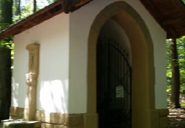
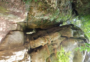
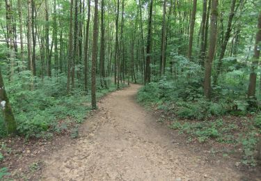
Beau parcours forestier assez facile (de nombreux escaliers à la fin du parcours)