![](/images/other/stat-length.png)
![Trail Mountain bike Péruwelz - Cross-border route of the Vergne - Photo](https://media.geolcdn.com/t/1900/400/ext.pjpeg?maxdim=2&url=https%3A%2F%2Fpivotmedia.tourismewallonie.be%2FANX-02-000EXG%2FANX-02-000EXG.jpg)
Cross-border route of the Vergne
Commissariat général au Tourisme
Randonnées du CGT GUIDE+
![Length](/images/other/stat-length.png)
Length
18.8 km
![Max alt](https://static1.geolcdn.com/siteimages/upload/files/1508320355ic_sort_altitude_max_24dp.png)
Max alt
33 m
![Uphill gradient](https://static1.geolcdn.com/siteimages/upload/files/1508320355ic_sort_den_pos_24dp.png)
Uphill gradient
83 m
![Km-Effort](/images/other/stat-length.png)
Km-Effort
19.9 km
![Min alt](https://static1.geolcdn.com/siteimages/upload/files/1508320355ic_sort_altitude_min_24dp.png)
Min alt
13 m
![Downhill gradient](https://static1.geolcdn.com/siteimages/upload/files/1508320355ic_sort_den_neg_24dp.png)
Downhill gradient
82 m
![Boucle](https://static1.geolcdn.com/siteimages/upload/files/16400158638029165_repeat_loop_refresh_sync_direction_icon.png)
Boucle
Yes
Creation date :
2022-02-08 11:36:35.362
Updated on :
2022-02-21 10:18:02.477
![Mountain bike](https://static1.geolcdn.com/sitytour/trail-icons/202.png)
1h22
Difficulty : Easy
![Scan this QR Code to open this trail in the SityTrail application](https://capi.geolives.com/qq0zvz2zws4bq2lad0pu/sitytour/trails/3081406/qr.png?size=200)
FREE GPS app for hiking
About
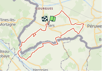
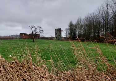
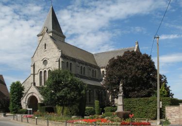
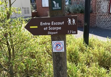
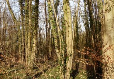
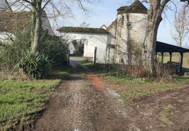
Trail Mountain bike of 18.8 km to be discovered at Wallonia, Hainaut, Péruwelz. This trail is proposed by Commissariat général au Tourisme.
Description
Trail created by Wallonie Picarde (Antenne Tournai) .
This circuit is only available in French and in Dutch. Please feel free to download the FR map card.
Positioning
Country:
Belgium
Region :
Wallonia
Department/Province :
Hainaut
Municipality :
Péruwelz
Location:
Unknown
Start:(Dec)
Start:(UTM)
537833 ; 5595316 (31U) N.
Comments
Trails nearby
![Trail Walking Hergnies - Entre terre et eaux - Hergnies - Photo](https://media.geolcdn.com/t/375/260/ext.jpg?maxdim=2&url=https%3A%2F%2Fservices.sitytrail.com%2FGeolivesWS%2FDownloadMedia.ashx%3FTrailID%3D111915%26Media%3D8943_6.jpg)
![Walking Walking](https://static1.geolcdn.com/sitytour/trail-icons/101.png)
Entre terre et eaux - Hergnies
Walking
Difficult
(2)
Hergnies,
Hauts-de-France,
Nord,
France
![](/images/other/stat-length.png)
13.2 km | 13.9 km-effort
3h 19min
![](https://static1.geolcdn.com/siteimages/upload/files/16400158638029165_repeat_loop_refresh_sync_direction_icon.png)
Yes
![Trail Walking Péruwelz - PERUWELZ _ Marche Fédérale _ HT _ 14/05/2023 - Photo](https://media.geolcdn.com/t/375/260/5fb5656f-b658-42f9-b5fd-1aa9924cc25a.jpg&format=jpg&maxdim=2)
![Walking Walking](https://static1.geolcdn.com/sitytour/trail-icons/101.png)
PERUWELZ _ Marche Fédérale _ HT _ 14/05/2023
Walking
Medium
Péruwelz,
Wallonia,
Hainaut,
Belgium
![](/images/other/stat-length.png)
22 km | 24 km-effort
5h 32min
![](https://static1.geolcdn.com/siteimages/upload/files/16400158638029165_repeat_loop_refresh_sync_direction_icon.png)
Yes
![Trail Walking Flines-lès-Mortagne - De Flines les Mortane à Bernissart (Belgique) - Photo](https://media.geolcdn.com/t/375/260/ca739f87-71b6-494f-8d4f-d2141a94b6cf.jpg&format=jpg&maxdim=2)
![Walking Walking](https://static1.geolcdn.com/sitytour/trail-icons/101.png)
De Flines les Mortane à Bernissart (Belgique)
Walking
Medium
Flines-lès-Mortagne,
Hauts-de-France,
Nord,
France
![](/images/other/stat-length.png)
26 km | 27 km-effort
6h 42min
![](https://static1.geolcdn.com/siteimages/upload/files/16400158638029165_repeat_loop_refresh_sync_direction_icon.png)
No
![Trail Walking Péruwelz - CALLENELLE _ Marche Fédérale _ HAIT _ 8/01/2022 - Photo](https://media.geolcdn.com/t/375/260/09c08405-e580-4a6b-bb6b-50c70ee88d38.jpg&format=jpg&maxdim=2)
![Walking Walking](https://static1.geolcdn.com/sitytour/trail-icons/101.png)
CALLENELLE _ Marche Fédérale _ HAIT _ 8/01/2022
Walking
Medium
Péruwelz,
Wallonia,
Hainaut,
Belgium
![](/images/other/stat-length.png)
21 km | 22 km-effort
5h 1min
![](https://static1.geolcdn.com/siteimages/upload/files/16400158638029165_repeat_loop_refresh_sync_direction_icon.png)
Yes
![Walking Walking](https://static1.geolcdn.com/sitytour/trail-icons/101.png)
GG2-Ha-28_Péruwelz-Tournai (2021-11-04)
Walking
Medium
Péruwelz,
Wallonia,
Hainaut,
Belgium
![](/images/other/stat-length.png)
46 km | 50 km-effort
11h 22min
![](https://static1.geolcdn.com/siteimages/upload/files/16400158638029165_repeat_loop_refresh_sync_direction_icon.png)
No
![Trail Walking Nivelle - Nivelle- circuit Nivelle-Mortagne-Chateau l'abbaye - Photo](https://media.geolcdn.com/t/375/260/d91e613a-8448-41fc-bfd3-8fd05bd73b48.jpg&format=jpg&maxdim=2)
![Walking Walking](https://static1.geolcdn.com/sitytour/trail-icons/101.png)
Nivelle- circuit Nivelle-Mortagne-Chateau l'abbaye
Walking
Easy
(1)
Nivelle,
Hauts-de-France,
Nord,
France
![](/images/other/stat-length.png)
11.5 km | 12.2 km-effort
2h 30min
![](https://static1.geolcdn.com/siteimages/upload/files/16400158638029165_repeat_loop_refresh_sync_direction_icon.png)
Yes
![Trail Walking Château-l'Abbaye - château l'abbaye. entre Escaut et Scarpe - Photo](https://media.geolcdn.com/t/375/260/21c122b9-cbf8-4e60-94a2-4e2f3c16b33a.jpg&format=jpg&maxdim=2)
![Walking Walking](https://static1.geolcdn.com/sitytour/trail-icons/101.png)
château l'abbaye. entre Escaut et Scarpe
Walking
Medium
(1)
Château-l'Abbaye,
Hauts-de-France,
Nord,
France
![](/images/other/stat-length.png)
8 km | 8.4 km-effort
1h 27min
![](https://static1.geolcdn.com/siteimages/upload/files/16400158638029165_repeat_loop_refresh_sync_direction_icon.png)
Yes
![Trail On foot Péruwelz - 2021-02-17 11:38:21 - Photo](https://media.geolcdn.com/t/375/260/5055c7f9-3163-4866-b4bc-b6fa239b330b.jpg&format=jpg&maxdim=2)
![On foot On foot](https://static1.geolcdn.com/sitytour/trail-icons/100.png)
2021-02-17 11:38:21
On foot
Very easy
Péruwelz,
Wallonia,
Hainaut,
Belgium
![](/images/other/stat-length.png)
7.8 km | 8.5 km-effort
2h 0min
![](https://static1.geolcdn.com/siteimages/upload/files/16400158638029165_repeat_loop_refresh_sync_direction_icon.png)
Yes
![Trail Walking Péruwelz - roucourt 20 km 16 février 2021 - Photo](https://media.geolcdn.com/t/375/260/f847f3a8-68b8-4203-818a-f0ded88cb5ef.jpg&format=jpg&maxdim=2)
![Walking Walking](https://static1.geolcdn.com/sitytour/trail-icons/101.png)
roucourt 20 km 16 février 2021
Walking
Very easy
Péruwelz,
Wallonia,
Hainaut,
Belgium
![](/images/other/stat-length.png)
22 km | 24 km-effort
3h 45min
![](https://static1.geolcdn.com/siteimages/upload/files/16400158638029165_repeat_loop_refresh_sync_direction_icon.png)
Yes