


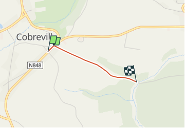

8 km | 9.8 km-effort


Randonnées du CGT GUIDE+


FREE GPS app for hiking
 SityTrail
IGN / Geographical institutes
SityTrail World
The world is yours!
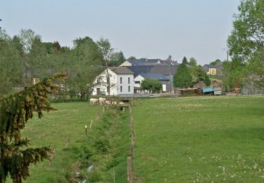
Trail On foot of 1.2 km to be discovered at Wallonia, Luxembourg, Vaux-sur-Sûre. This trail is proposed by Commissariat général au Tourisme.
Trail created by Haute-Süre Forêt d'Anlier en Ardenne.
On foot

Walking
Walking

Cycle
On foot
On foot
Mountain bike

Running
Walking