22 km | 26 km-effort
Vallée de l'Ourthe
Commissariat général au Tourisme
Randonnées du CGT GUIDE+
Length
28 km
Max alt
496 m
Uphill gradient
681 m
Km-Effort
37 km
Min alt
387 m
Downhill gradient
681 m
Boucle
Yes
Creation date :
2022-02-08 11:31:26.787
Updated on :
2022-02-21 10:12:47.58
8h19
Difficulty : Difficult
FREE GPS app for hiking
About
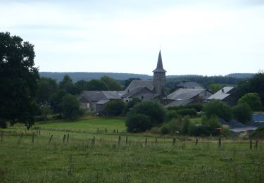
Trail On foot of 28 km to be discovered at Wallonia, Luxembourg, Gouvy. This trail is proposed by Commissariat général au Tourisme.
Description
Trail created by Haute Ardenne.
Positioning
Country:
Belgium
Region :
Wallonia
Department/Province :
Luxembourg
Municipality :
Gouvy
Location:
Unknown
Start:(Dec)
Start:(UTM)
704566 ; 5562642 (31U) N.
Comments
Trails nearby
15 juli 2012
Walking
Very easy
(1)
Gouvy,
Wallonia,
Luxembourg,
Belgium
5.1 km | 6.1 km-effort
1h 53min
Yes
Promenade vers la réserve naturelle "Chi Fontaine" - Gouvy
Walking
Easy
(5)
Gouvy,
Wallonia,
Luxembourg,
Belgium
4.4 km | 5.3 km-effort
1h 11min
Yes
Au fil de l'eau - Gouvy
Walking
Medium
(1)
Gouvy,
Wallonia,
Luxembourg,
Belgium
7.3 km | 9.6 km-effort
2h 11min
Yes
RB-Lu-29_Courtil_variante
Walking
Very difficult
(1)
Gouvy,
Wallonia,
Luxembourg,
Belgium
28 km | 34 km-effort
7h 47min
Yes
RB-Lu-29_Courtil_via-racc
Walking
Difficult
Gouvy,
Wallonia,
Luxembourg,
Belgium
15.3 km | 18.8 km-effort
4h 16min
Yes
Cherain - Gouvy
Walking
Easy
(1)
Gouvy,
Wallonia,
Luxembourg,
Belgium
8.9 km | 11.3 km-effort
2h 23min
Yes
GrWandARd 33:Brisy bossen en weiden aan de Oost-Ourthe
On foot
Easy
Gouvy,
Wallonia,
Luxembourg,
Belgium
8.6 km | 10.5 km-effort
2h 23min
Yes