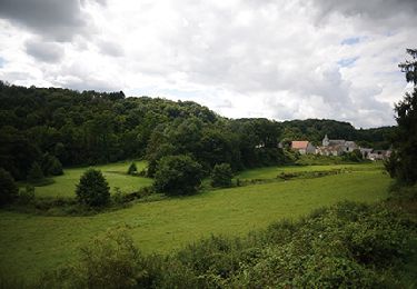
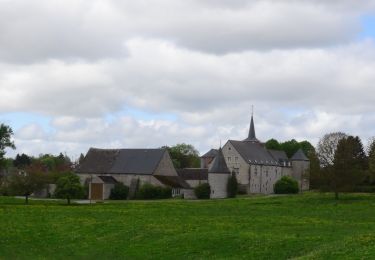
Trail On foot Anhée - Beau chêne - Photo

Beau chêne

Randonnées du CGT GUIDE+

© OpenStreetMap contributors
Length
Length
8.8 km
Max alt
Max alt
283 m
Uphill gradient
Uphill gradient
210 m
Km-Effort
Km-Effort  
11.6 km
Min alt
Min alt
180 m
Downhill gradient
Downhill gradient
210 m
Boucle
Boucle
Yes
Creation date :
2022-02-08 11:31:21.819
Updated on :
2022-02-21 10:12:42.412

(0 Reviews)

On foot
On foot
2h38
Difficulty : Easy

Scan this QR Code to open this trail in the SityTrail application

FREE GPS app for hiking

Logo SityTrail SityTrail

IGN / Geographical institutes

Download SityTrail from the App Store Download SityTrail from Google Play

Logo SityTrail SityTrail World

The world is yours!

Download SityTrail from the App Store Download SityTrail from Google Play Download SityTrail on Huawei AppGallery

About

Trail On foot of 8.8 km to be discovered at Wallonia, Namur, Anhée. This trail is proposed by Commissariat général au Tourisme.

Description

Trail created by Vallée de la Meuse Namur-Dinant.


Departure : Maredret Art Gallery.

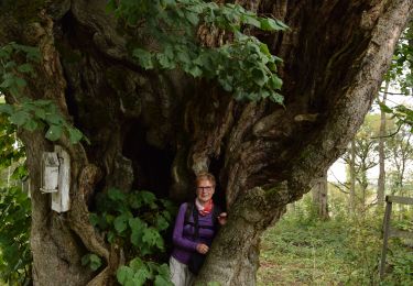
At the end of the gallery, take the rue des Artisans to the right. At the crossroads, turn left onto rue Neuve Niole. Shortly after, take the rue des Laids Monts which goes up to the left to take you to the abbey of Maredret. At the next crossroads, don't go to the abbey of Maredsous, but turn right. At the next 4 arms, go straight on and enter the wood. At the Y, turn left. Leave the fork of the Chenoy farm on the left and continue towards the sources of Biert. Turn left along the wood. At the chapel of Chertin, turn right towards Biert le Roi. After 1Km, turn right towards the farm of the beautiful Oak that we bypass. At the T-junction, after 600m, leave the left branch which leads to the Beau Chêne castle and take to the right to return to the abbeys. But at the 4 arms, go down to the left and follow the enclosure of the abbey of Maredret. At the chapel Notre-Dame de Grâce, turn left, then, 200m later, a path to the right that goes back to the farm of the Cour. Turn right and go down to the starting point.


Elevation profile

Positioning

Country:
Belgium
Region :
Wallonia
Department/Province :
Namur
Municipality :
Anhée
Location:
Unknown
Start:(UTM)
624664 ; 5573551 (31U) N.

Trails nearby

Trail Walking Mettet - RB-Na-23-Sur le plateau de l’Entre-Sambre-et-Meuse - Photo
Walking
PRO

Walking

Very difficult
(8)
Mettet, Wallonia, Namur, Belgium
24 km | 29 km-effort
6h 39min
Yes
Trail Walking Anhée - RB-Na-22-raccourci_Vignobles-et-Jardins-d’eau - Photo
Walking
PRO

Walking

Very difficult
(6)
Anhée, Wallonia, Namur, Belgium
16.7 km | 21 km-effort
4h 52min
Yes
Trail Walking Anhée - RB-Na-22_Vignobles-et-Jardins-d’eau - Photo
Walking
PRO

Walking

Very difficult
(11)
Anhée, Wallonia, Namur, Belgium
19.5 km | 25 km-effort
5h 46min
Yes
Trail Walking Anhée - RB-Na-16 - Paysages de la Molignée - Photo
Walking
PRO

Walking

Medium
(19)
Anhée, Wallonia, Namur, Belgium
18.3 km | 24 km-effort
5h 13min
Yes
Trail Walking Mettet - RB-Na-23-racc-Sur le plateau de l’Entre-Sambre-et-Meuse - Photo
Walking
PRO

Walking

Difficult
(8)
Mettet, Wallonia, Namur, Belgium
14 km | 16.7 km-effort
3h 47min
Yes
Trail Walking Anhée - RB-Na-16 Raccourci - Paysages de la Molignée - Photo
Walking
PRO

Walking

Easy
(17)
Anhée, Wallonia, Namur, Belgium
13 km | 16.6 km-effort
3h 40min
Yes
Trail Walking Anhée - Balade de l'abbaye de Maredsous à Ermeton-sur-Biert - Photo
Walking
GUIDE
Desrumaux

Walking

Easy
(4)
Anhée, Wallonia, Namur, Belgium
9.2 km | 11.9 km-effort
2h 32min
Yes
Trail Walking Anhée - Sosoye - Circuit Natura 2000, des sites qui valent le détour - Na11 - Photo
Walking
GUIDE+

Walking

Medium
(6)
Anhée, Wallonia, Namur, Belgium
4.9 km | 6.3 km-effort
1h 21min
Yes
Trail Walking Anhée - Balade à Denée - Photo
Walking
GUIDE
Desrumaux

Walking

Very easy
(1)
Anhée, Wallonia, Namur, Belgium
5.8 km | 7.4 km-effort
1h 35min
Yes


Close
My subscriptions