![](/images/other/stat-length.png)
![Trail Equestrian Fleurus - Wagnelée - Marbais - Villers Perwin 01/06/2014 - Photo](https://media.geolcdn.com/t/1900/400/ext.pjpeg?maxdim=2&url=https%3A%2F%2Fstatic1.geolcdn.com%2Fsiteimages%2Fupload%2Ffiles%2F1524743154cheval.jpg)
Wagnelée - Marbais - Villers Perwin 01/06/2014
philadelphie
User
![Length](/images/other/stat-length.png)
Length
14.8 km
![Max alt](https://static1.geolcdn.com/siteimages/upload/files/1508320355ic_sort_altitude_max_24dp.png)
Max alt
163 m
![Uphill gradient](https://static1.geolcdn.com/siteimages/upload/files/1508320355ic_sort_den_pos_24dp.png)
Uphill gradient
120 m
![Km-Effort](/images/other/stat-length.png)
Km-Effort
16.4 km
![Min alt](https://static1.geolcdn.com/siteimages/upload/files/1508320355ic_sort_altitude_min_24dp.png)
Min alt
136 m
![Downhill gradient](https://static1.geolcdn.com/siteimages/upload/files/1508320355ic_sort_den_neg_24dp.png)
Downhill gradient
118 m
![Boucle](https://static1.geolcdn.com/siteimages/upload/files/16400158638029165_repeat_loop_refresh_sync_direction_icon.png)
Boucle
Yes
Creation date :
2014-12-10 00:00:00.0
Updated on :
2014-12-10 00:00:00.0
![Equestrian](https://static1.geolcdn.com/sitytour/trail-icons/300.png)
2h04
Difficulty : Easy
![Scan this QR Code to open this trail in the SityTrail application](https://capi.geolives.com/qq0zvz2zws4bq2lad0pu/sitytour/trails/307358/qr.png?size=200)
FREE GPS app for hiking
About
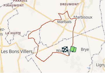
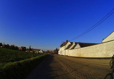
Trail Equestrian of 14.8 km to be discovered at Wallonia, Hainaut, Fleurus. This trail is proposed by philadelphie.
Description
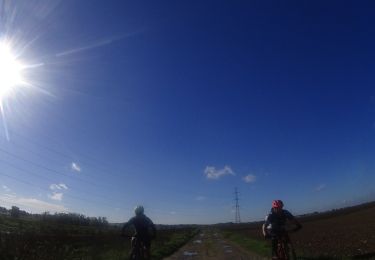
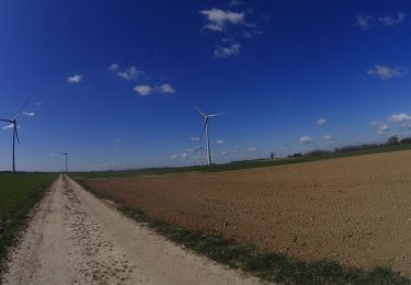
Balade sympa et pas trop difficile en passant par le village de Marbais et les champs.
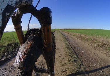
Attention aux chevaux pieds nus/sensibles, certains passages sont modérément "caillouteux".
Positioning
Country:
Belgium
Region :
Wallonia
Department/Province :
Hainaut
Municipality :
Fleurus
Location:
Wagnelée
Start:(Dec)
Start:(UTM)
609061 ; 5597506 (31U) N.
Comments
Trails nearby
![Trail Walking Les Bons Villers - #221021 - Mellet, Champ Chassart et Saint Fiacre - Photo](https://media.geolcdn.com/t/375/260/3aea599a-a468-40e9-9bb3-55e086e309d4.jpg&format=jpg&maxdim=2)
![Walking Walking](https://static1.geolcdn.com/sitytour/trail-icons/101.png)
#221021 - Mellet, Champ Chassart et Saint Fiacre
Walking
Medium
(1)
Les Bons Villers,
Wallonia,
Hainaut,
Belgium
![](/images/other/stat-length.png)
8.6 km | 9.3 km-effort
2h 7min
![](https://static1.geolcdn.com/siteimages/upload/files/16400158638029165_repeat_loop_refresh_sync_direction_icon.png)
Yes
![Trail Walking Villers-la-Ville - Promenade du Vieux Chemin par Jumerée - Photo](https://media.geolcdn.com/t/375/260/98a61bdd-adf2-4fdc-b588-eebaec3193ad.jpg&format=jpg&maxdim=2)
![Walking Walking](https://static1.geolcdn.com/sitytour/trail-icons/101.png)
Promenade du Vieux Chemin par Jumerée
Walking
Medium
(1)
Villers-la-Ville,
Wallonia,
Walloon Brabant,
Belgium
![](/images/other/stat-length.png)
4.9 km | 5.9 km-effort
1h 15min
![](https://static1.geolcdn.com/siteimages/upload/files/16400158638029165_repeat_loop_refresh_sync_direction_icon.png)
Yes
![Trail On foot Villers-la-Ville - L'hydragraphie autour de l'école - Photo](https://media.geolcdn.com/t/375/260/02bd6b9c-5606-44af-971a-1ff1c27c7592.jpg&format=jpg&maxdim=2)
![On foot On foot](https://static1.geolcdn.com/sitytour/trail-icons/100.png)
L'hydragraphie autour de l'école
On foot
Easy
(1)
Villers-la-Ville,
Wallonia,
Walloon Brabant,
Belgium
![](/images/other/stat-length.png)
1.7 km | 1.9 km-effort
26min
![](https://static1.geolcdn.com/siteimages/upload/files/16400158638029165_repeat_loop_refresh_sync_direction_icon.png)
Yes
![Mountain bike Mountain bike](https://static1.geolcdn.com/sitytour/trail-icons/202.png)
VTT sur saint -amand
Mountain bike
Very difficult
Fleurus,
Wallonia,
Hainaut,
Belgium
![](/images/other/stat-length.png)
40 km | 46 km-effort
3h 10min
![](https://static1.geolcdn.com/siteimages/upload/files/16400158638029165_repeat_loop_refresh_sync_direction_icon.png)
Yes
![Mountain bike Mountain bike](https://static1.geolcdn.com/sitytour/trail-icons/202.png)
les fleche de fleurus
Mountain bike
Difficult
Fleurus,
Wallonia,
Hainaut,
Belgium
![](/images/other/stat-length.png)
32 km | 35 km-effort
2h 25min
![](https://static1.geolcdn.com/siteimages/upload/files/16400158638029165_repeat_loop_refresh_sync_direction_icon.png)
Yes
![Mountain bike Mountain bike](https://static1.geolcdn.com/sitytour/trail-icons/202.png)
ransart 03-04
Mountain bike
Very difficult
Fleurus,
Wallonia,
Hainaut,
Belgium
![](/images/other/stat-length.png)
54 km | 62 km-effort
4h 17min
![](https://static1.geolcdn.com/siteimages/upload/files/16400158638029165_repeat_loop_refresh_sync_direction_icon.png)
Yes
![Mountain bike Mountain bike](https://static1.geolcdn.com/sitytour/trail-icons/202.png)
Corroy-le-châteaux
Mountain bike
Very difficult
Fleurus,
Wallonia,
Hainaut,
Belgium
![](/images/other/stat-length.png)
43 km | 47 km-effort
3h 16min
![](https://static1.geolcdn.com/siteimages/upload/files/16400158638029165_repeat_loop_refresh_sync_direction_icon.png)
Yes
![Walking Walking](https://static1.geolcdn.com/sitytour/trail-icons/101.png)
Balade à Mellet
Walking
Difficult
Les Bons Villers,
Wallonia,
Hainaut,
Belgium
![](/images/other/stat-length.png)
10.3 km | 11.5 km-effort
3h 50min
![](https://static1.geolcdn.com/siteimages/upload/files/16400158638029165_repeat_loop_refresh_sync_direction_icon.png)
Yes
![Mountain bike Mountain bike](https://static1.geolcdn.com/sitytour/trail-icons/202.png)
VTT hepignie 1
Mountain bike
Very easy
Fleurus,
Wallonia,
Hainaut,
Belgium
![](/images/other/stat-length.png)
49 km | 55 km-effort
Unknown
![](https://static1.geolcdn.com/siteimages/upload/files/16400158638029165_repeat_loop_refresh_sync_direction_icon.png)
Yes