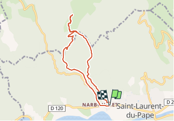
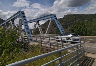
![](/images/other/stat-length.png)
![Trail Walking Saint-Laurent-du-Pape - St Laurent du Pape Tour de Haute SERRE - Photo](https://media.geolcdn.com/t/1900/400/ext.pjpeg?maxdim=2&url=https%3A%2F%2Fstatic1.geolcdn.com%2Fsiteimages%2Fupload%2Ffiles%2F1553511878bg_sport_marche.png)
St Laurent du Pape Tour de Haute SERRE
TOULAUDIN
User
![Length](/images/other/stat-length.png)
![Max alt](https://static1.geolcdn.com/siteimages/upload/files/1508320355ic_sort_altitude_max_24dp.png)
![Uphill gradient](https://static1.geolcdn.com/siteimages/upload/files/1508320355ic_sort_den_pos_24dp.png)
![Km-Effort](/images/other/stat-length.png)
![Min alt](https://static1.geolcdn.com/siteimages/upload/files/1508320355ic_sort_altitude_min_24dp.png)
![Downhill gradient](https://static1.geolcdn.com/siteimages/upload/files/1508320355ic_sort_den_neg_24dp.png)
![Boucle](https://static1.geolcdn.com/siteimages/upload/files/16400158638029165_repeat_loop_refresh_sync_direction_icon.png)
![Walking](https://static1.geolcdn.com/sitytour/trail-icons/101.png)
2h33
Difficulty : Easy
![Scan this QR Code to open this trail in the SityTrail application](https://capi.geolives.com/qq0zvz2zws4bq2lad0pu/sitytour/trails/3070170/qr.png?size=200)
FREE GPS app for hiking
About
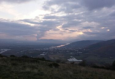
Trail Walking of 8 km to be discovered at Auvergne-Rhône-Alpes, Ardèche, Saint-Laurent-du-Pape. This trail is proposed by TOULAUDIN.
Description
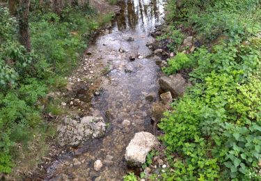
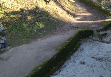
trace enregistrée : boucle ( on peut aller jusqu'à Pierre Gourde ) la montée se fait sur un chemin dans une gorges .attention pour le retour non balisé il faut traverser le ruisseau de la crotte car le tracé de la carte ne passe pas ,il y a d'importantes chutes d'arbres
et je n'ai pas trouvé le passage et c'est beaucoup mieux d'e l'autre côté du ruisseau ,large chemin.à noter la montée sur Pierre Gourde est pentu et beaucoup de petit gravier très instable à la descente
Positioning
Comments
Trails nearby
![Trail Walking Saint-Laurent-du-Pape - 07 st Laurent du pape P Gourde 060521 - Photo](https://media.geolcdn.com/t/375/260/ab7e67df-3108-4810-a988-7cdece498721.jpg&format=jpg&maxdim=2)
![Walking Walking](https://static1.geolcdn.com/sitytour/trail-icons/101.png)
Walking
![](/images/other/stat-length.png)
![](https://static1.geolcdn.com/siteimages/upload/files/16400158638029165_repeat_loop_refresh_sync_direction_icon.png)
![Trail Walking La Voulte-sur-Rhône - La Voulte Via-Rhôna 7KM - Photo](https://media.geolcdn.com/t/375/260/620eea2b-7c65-44be-a1eb-b1fcfc74c039.jpg&format=jpg&maxdim=2)
![Walking Walking](https://static1.geolcdn.com/sitytour/trail-icons/101.png)
Walking
![](/images/other/stat-length.png)
![](https://static1.geolcdn.com/siteimages/upload/files/16400158638029165_repeat_loop_refresh_sync_direction_icon.png)
![Trail Walking Beauchastel - Beauchastel. / Pierre Gourde - Photo](https://media.geolcdn.com/t/375/260/ext.jpg?maxdim=2&url=https%3A%2F%2Fservices.sitytrail.com%2FGeolivesWS%2FDownloadMedia.ashx%3FTrailID%3D500378%26Media%3Dfix__20151206162513.jpg)
![Walking Walking](https://static1.geolcdn.com/sitytour/trail-icons/101.png)
Walking
![](/images/other/stat-length.png)
![](https://static1.geolcdn.com/siteimages/upload/files/16400158638029165_repeat_loop_refresh_sync_direction_icon.png)
![Trail Road bike La Voulte-sur-Rhône - 07 la voulte privas voie payre - Photo](https://media.geolcdn.com/t/375/260/a0a6e94a-154b-402d-a870-cb27302170ee.jpg&format=jpg&maxdim=2)
![Road bike Road bike](https://static1.geolcdn.com/sitytour/trail-icons/201.png)
Road bike
![](/images/other/stat-length.png)
![](https://static1.geolcdn.com/siteimages/upload/files/16400158638029165_repeat_loop_refresh_sync_direction_icon.png)
![Trail Walking La Voulte-sur-Rhône - La Voulte ViaRhona 6,5km - Photo](https://media.geolcdn.com/t/375/260/9614651f-4007-44ca-9c3c-97a6e4ce7270.jpg&format=jpg&maxdim=2)
![Walking Walking](https://static1.geolcdn.com/sitytour/trail-icons/101.png)
Walking
![](/images/other/stat-length.png)
![](https://static1.geolcdn.com/siteimages/upload/files/16400158638029165_repeat_loop_refresh_sync_direction_icon.png)
![Trail Walking Saint-Laurent-du-Pape - Pierre gourde TeD Christian - Photo](https://media.geolcdn.com/t/375/260/ext.jpg?maxdim=2&url=https%3A%2F%2Fstatic1.geolcdn.com%2Fsiteimages%2Fupload%2Ffiles%2F1553511878bg_sport_marche.png)
![Walking Walking](https://static1.geolcdn.com/sitytour/trail-icons/101.png)
Walking
![](/images/other/stat-length.png)
![](https://static1.geolcdn.com/siteimages/upload/files/16400158638029165_repeat_loop_refresh_sync_direction_icon.png)
![Trail Walking Saint-Georges-les-Bains - Saint Georges les Bains - Photo](https://media.geolcdn.com/t/375/260/e93486d4-d5f4-4b3e-8536-d4298013ea4d.jpg&format=jpg&maxdim=2)
![Walking Walking](https://static1.geolcdn.com/sitytour/trail-icons/101.png)
Walking
![](/images/other/stat-length.png)
![](https://static1.geolcdn.com/siteimages/upload/files/16400158638029165_repeat_loop_refresh_sync_direction_icon.png)
![Trail Walking Saint-Georges-les-Bains - col de Rotison - Photo](https://media.geolcdn.com/t/375/260/8c3d1009-c72f-4ec6-bf61-7a2fde476dc2.jpg&format=jpg&maxdim=2)
![Walking Walking](https://static1.geolcdn.com/sitytour/trail-icons/101.png)
Walking
![](/images/other/stat-length.png)
![](https://static1.geolcdn.com/siteimages/upload/files/16400158638029165_repeat_loop_refresh_sync_direction_icon.png)
![Trail Walking Saint-Laurent-du-Pape - 07 st Laurent du pape zel - Photo](https://media.geolcdn.com/t/375/260/e32d23cf-7d2c-48ae-91cd-162887108580.jpg&format=jpg&maxdim=2)
![Walking Walking](https://static1.geolcdn.com/sitytour/trail-icons/101.png)
Walking
![](/images/other/stat-length.png)
![](https://static1.geolcdn.com/siteimages/upload/files/16400158638029165_repeat_loop_refresh_sync_direction_icon.png)