Trail Walking Conflans-sur-Seine - au départ de CONFLANS sur SEINE - Photo

au départ de CONFLANS sur SEINE

© OpenStreetMap contributors
Length
Length
15.7 km
Max alt
Max alt
122 m
Uphill gradient
Uphill gradient
138 m
Km-Effort
Km-Effort  
17.5 km
Min alt
Min alt
63 m
Downhill gradient
Downhill gradient
136 m
Boucle
Boucle
No
Creation date :
2022-01-30 08:17:38.26
Updated on :
2022-01-31 21:17:27.219

(0 Reviews)

Walking
Walking
3h17
Difficulty : Easy

Scan this QR Code to open this trail in the SityTrail application

FREE GPS app for hiking

Logo SityTrail SityTrail

IGN / Geographical institutes

Download SityTrail from the App Store Download SityTrail from Google Play

Logo SityTrail SityTrail World

The world is yours!

Download SityTrail from the App Store Download SityTrail from Google Play Download SityTrail on Huawei AppGallery

About

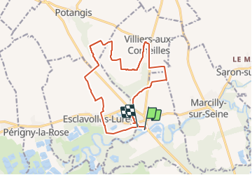
Trail Walking of 15.7 km to be discovered at Grand Est, Marne, Conflans-sur-Seine. This trail is proposed by jeannine grandjean.

Description

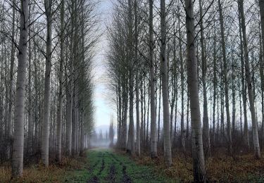
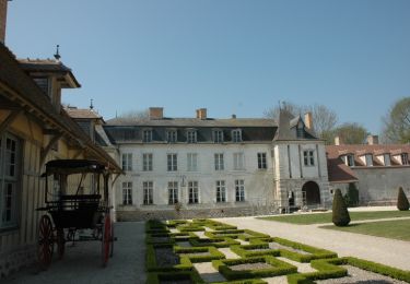
Départ sur le parking situé sous le pont de la Seine ;  passer à côté du camping et de l'école ; on traverse une partie du village de Villiers aux Corneilles. Puis rejoindre la ferme du Perré en longeant le ruisseau de Potangis ; traverser Esclavolles-Lurey puis bifurquer à la maison des Eaux pour rejoindre la Seine.

Elevation profile

Photos

Positioning

Country:
France
Region :
Grand Est
Department/Province :
Marne
Municipality :
Conflans-sur-Seine
Location:
Unknown
Start:(UTM)
550130 ; 5377557 (31U) N.

Trails nearby

Trail Walking Crancey - Entre CRANCEY et PONT SUR SEINE - Photo
Walking
jeannine grandjean

Walking

Medium
Crancey, Grand Est, Aube, France
10.2 km | 11.5 km-effort
2h 25min
Yes
Trail Walking Conflans-sur-Seine - ENTRE CONFLANS SUR SEINE ET MARCILLY SUR SEINE - Photo
Walking
jeannine grandjean

Walking

Medium
Conflans-sur-Seine, Grand Est, Marne, France
10.7 km | 11.7 km-effort
2h 39min
Yes
Trail Walking Potangis - Boucle Potangis Le Perre Chantemerle Bethon - Photo
Walking
NANE51

Walking

Easy
Potangis, Grand Est, Marne, France
16.4 km | 19.6 km-effort
3h 33min
Yes
Trail Walking Saron-sur-Aube - Boucle Saron les éoliennes  - Photo
Walking
NANE51

Walking

Saron-sur-Aube, Grand Est, Marne, France
9.1 km | 10 km-effort
1h 51min
Yes
Trail Nordic walking Romilly-sur-Seine - la Béchère 6 décembre 2021 - Photo
Nordic walking
jeannine grandjean

Nordic walking

Medium
Romilly-sur-Seine, Grand Est, Aube, France
8.5 km | 9 km-effort
1h 36min
Yes
Trail Walking Romilly-sur-Seine - Le Gué de Bailly - Photo
Walking
NANE51

Walking

(1)
Romilly-sur-Seine, Grand Est, Aube, France
11.5 km | 12.1 km-effort
2h 57min
Yes
Trail Cycle Romilly-sur-Seine - Balade en bord de Seine - Romilly sur Seine - Photo
Cycle
tracegps

Cycle

Medium
Romilly-sur-Seine, Grand Est, Aube, France
58 km | 62 km-effort
2h 30min
Yes
Trail Walking Esclavolles-Lurey - esclavolles-lurey, Périgny  - Photo
Walking
cacal51

Walking

Easy
Esclavolles-Lurey, Grand Est, Marne, France
9.8 km | 11 km-effort
1h 58min
Yes
Trail Walking Esclavolles-Lurey - Boucle Esclavoles Perigny les éoliennes  - Photo
Walking
NANE51

Walking

Easy
Esclavolles-Lurey, Grand Est, Marne, France
12.6 km | 14.1 km-effort
2h 55min
Yes


Close
My subscriptions