


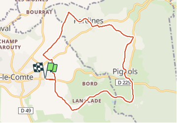

8.6 km | 11.2 km-effort

User GUIDE


FREE GPS app for hiking
 SityTrail
IGN / Geographical institutes
SityTrail World
The world is yours!
Trail Walking of 10 km to be discovered at Auvergne-Rhône-Alpes, Puy-de-Dôme, Vic-le-Comte. This trail is proposed by jagarnier.
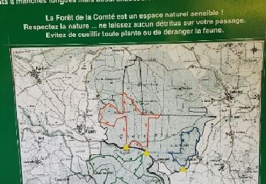
Une randonnée riche pour ses bâtiments historiques, sa diversité géologique, la faune et flore de la forêt de la Comté ou encore pour ses 4 ruisseaux qui parcourent ce territoire et son patrimoine rural lié à la vigne.


Walking

Walking

Walking

Walking

On foot

On foot

On foot

On foot
Walking