


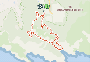

8.6 km | 12.5 km-effort


User


FREE GPS app for hiking
 SityTrail
IGN / Geographical institutes
SityTrail World
The world is yours!
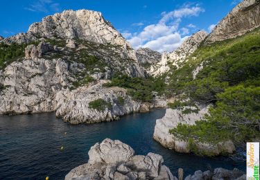
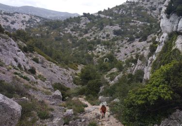
Trail Walking of 11.7 km to be discovered at Provence-Alpes-Côte d'Azur, Bouches-du-Rhône, Marseille. This trail is proposed by Daniel.BRUN-PICARD.
Nous avons fait demi-tour au km 3,85 car le passage quasi vertical en main-courante sur quelques mètres (chaines) était trop impressionnant.


Walking

Walking

Walking

Walking

Walking

Walking
Walking

Running
Walking