![](/images/other/stat-length.png)
![Trail Walking Saint-Mathieu-de-Tréviers - st_mathieu_treviers_tour_Sales_Lac_Ceceles - Photo](https://media.geolcdn.com/t/1900/400/7d500790-db26-4784-ae8b-78ebd94f8bbd.jpg&format=pjpeg&maxdim=2)
st_mathieu_treviers_tour_Sales_Lac_Ceceles
v.rabot
User
![Length](/images/other/stat-length.png)
![Max alt](https://static1.geolcdn.com/siteimages/upload/files/1508320355ic_sort_altitude_max_24dp.png)
![Uphill gradient](https://static1.geolcdn.com/siteimages/upload/files/1508320355ic_sort_den_pos_24dp.png)
![Km-Effort](/images/other/stat-length.png)
![Min alt](https://static1.geolcdn.com/siteimages/upload/files/1508320355ic_sort_altitude_min_24dp.png)
![Downhill gradient](https://static1.geolcdn.com/siteimages/upload/files/1508320355ic_sort_den_neg_24dp.png)
![Boucle](https://static1.geolcdn.com/siteimages/upload/files/16400158638029165_repeat_loop_refresh_sync_direction_icon.png)
![Walking](https://static1.geolcdn.com/sitytour/trail-icons/101.png)
5h29
Difficulty : Medium
![Scan this QR Code to open this trail in the SityTrail application](https://capi.geolives.com/qq0zvz2zws4bq2lad0pu/sitytour/trails/3058116/qr.png?size=200)
FREE GPS app for hiking
About
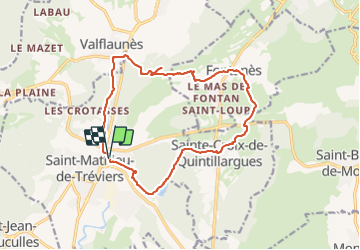
Trail Walking of 16.6 km to be discovered at Occitania, Hérault, Saint-Mathieu-de-Tréviers. This trail is proposed by v.rabot.
Description
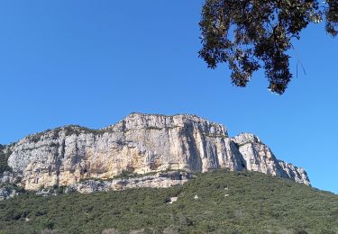
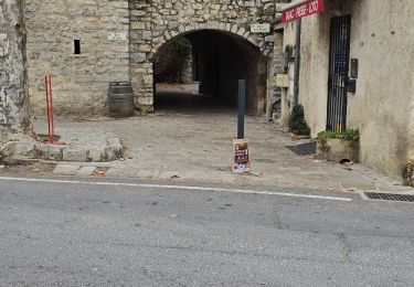
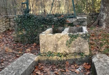
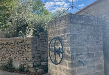
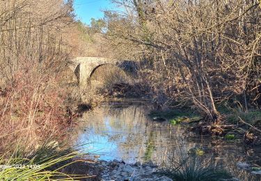
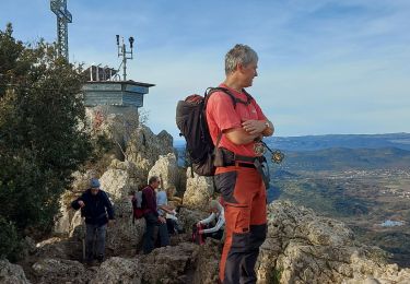
Le chemin montant aux tours de Sales est caillouteux et nécessitent de bonnes chaussures. Les bâtons sont bienvenus. Après la traversée des vignobles du château de la roque, on gagne Fontanès puis on se dirige vers saint croix de Quintillargues. Après avoir traversé la D1, il faut avancer à travers la garrigue pour rejoindre la spirale, de même pour rejoindre sainte croix de Quintillargues. Passage au lac de Cécélés puis retour à Saint Mathieu de Tréviers.
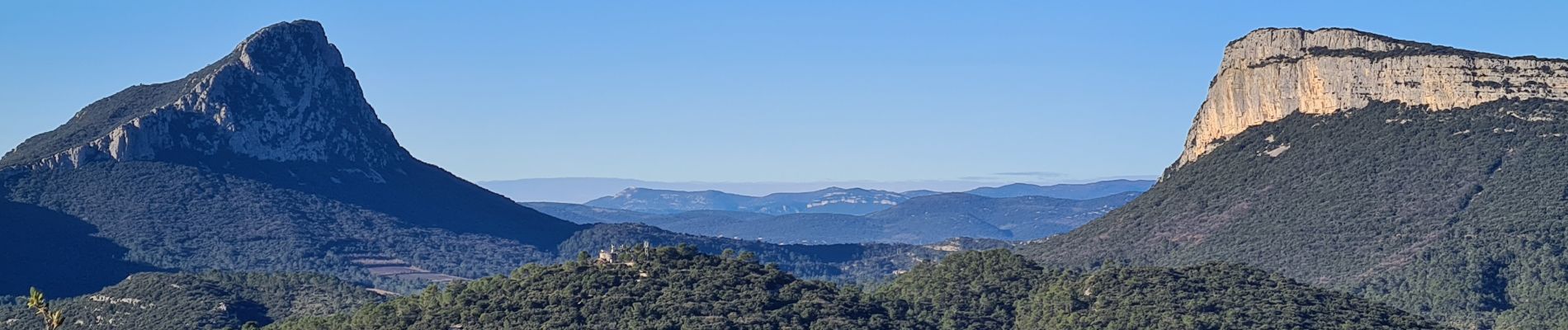
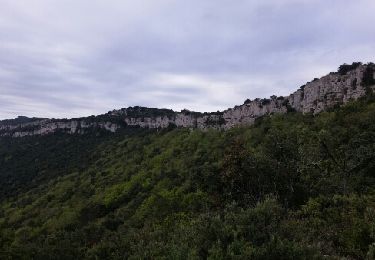
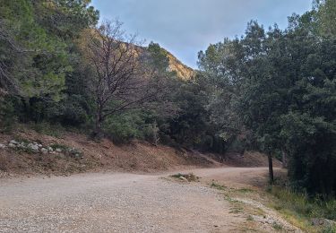
Positioning
Comments
Trails nearby
![Trail Walking Valflaunès - l hortus - Photo](https://media.geolcdn.com/t/375/260/ext.jpg?maxdim=2&url=https%3A%2F%2Fservices.sitytrail.com%2FGeolivesWS%2FDownloadMedia.ashx%3FTrailID%3D557567%26Media%3Dfix__20160417104921.jpg)
![Walking Walking](https://static1.geolcdn.com/sitytour/trail-icons/101.png)
Walking
![](/images/other/stat-length.png)
![](https://static1.geolcdn.com/siteimages/upload/files/16400158638029165_repeat_loop_refresh_sync_direction_icon.png)
![Trail Walking Sainte-Croix-de-Quintillargues - Ste Croix de Quintillargues - Photo](https://media.geolcdn.com/t/375/260/ext.jpg?maxdim=2&url=https%3A%2F%2Fstatic1.geolcdn.com%2Fsiteimages%2Fupload%2Ffiles%2F1553511878bg_sport_marche.png)
![Walking Walking](https://static1.geolcdn.com/sitytour/trail-icons/101.png)
Walking
![](/images/other/stat-length.png)
![](https://static1.geolcdn.com/siteimages/upload/files/16400158638029165_repeat_loop_refresh_sync_direction_icon.png)
![Trail Walking Valflaunès - 3 les falaises de l'Hortus du 20/01/2025 - Photo](https://media.geolcdn.com/t/375/260/f6f0891e-d644-41eb-bb85-0eb1282e6889.jpg&format=jpg&maxdim=2)
![Walking Walking](https://static1.geolcdn.com/sitytour/trail-icons/101.png)
Walking
![](/images/other/stat-length.png)
![](https://static1.geolcdn.com/siteimages/upload/files/16400158638029165_repeat_loop_refresh_sync_direction_icon.png)
![Trail Walking Valflaunès - l'Hortus crêtes - Photo](https://media.geolcdn.com/t/375/260/8ba1a285-4e0d-4a16-95c0-7302eff43924.jpg&format=jpg&maxdim=2)
![Walking Walking](https://static1.geolcdn.com/sitytour/trail-icons/101.png)
Walking
![](/images/other/stat-length.png)
![](https://static1.geolcdn.com/siteimages/upload/files/16400158638029165_repeat_loop_refresh_sync_direction_icon.png)
![Trail Walking Les Matelles - Matelles_St-Jean-de-cucules - Photo](https://media.geolcdn.com/t/375/260/4f08b422-0369-44bd-a1db-b500a88dc597.jpg&format=jpg&maxdim=2)
![Walking Walking](https://static1.geolcdn.com/sitytour/trail-icons/101.png)
Walking
![](/images/other/stat-length.png)
![](https://static1.geolcdn.com/siteimages/upload/files/16400158638029165_repeat_loop_refresh_sync_direction_icon.png)
![Trail Walking Valflaunès - L'hortus et château de Vivourès - Photo](https://media.geolcdn.com/t/375/260/d44f13ad-be4c-4470-90dd-904594bb1650.jpg&format=jpg&maxdim=2)
![Walking Walking](https://static1.geolcdn.com/sitytour/trail-icons/101.png)
Walking
![](/images/other/stat-length.png)
![](https://static1.geolcdn.com/siteimages/upload/files/16400158638029165_repeat_loop_refresh_sync_direction_icon.png)
![Trail sport Fontanès - Fontanes - Photo](https://media.geolcdn.com/t/375/260/1d9c4f50-de68-4de6-a46d-3eba75c7d0ac.jpg&format=jpg&maxdim=2)
![Trail Walking Vacquières - chapelle D'Aleyrac vers vacquieres parc du duc - Photo](https://media.geolcdn.com/t/375/260/1016cbc1-84d7-4082-b269-d91c1919b57d.jpg&format=jpg&maxdim=2)
![Walking Walking](https://static1.geolcdn.com/sitytour/trail-icons/101.png)
Walking
![](/images/other/stat-length.png)
![](https://static1.geolcdn.com/siteimages/upload/files/16400158638029165_repeat_loop_refresh_sync_direction_icon.png)
![Trail Walking Saint-Mathieu-de-Tréviers - Autour du pic saint loup - Photo](https://media.geolcdn.com/t/375/260/f3f4b421-c7e4-49f6-aba4-bbc18a39b773.jpg&format=jpg&maxdim=2)
![Walking Walking](https://static1.geolcdn.com/sitytour/trail-icons/101.png)
Walking
![](/images/other/stat-length.png)
![](https://static1.geolcdn.com/siteimages/upload/files/16400158638029165_repeat_loop_refresh_sync_direction_icon.png)