Trail Walking Unknown - Cap vert 17 janv 22 - Photo

Cap vert 17 janv 22

 gdruet
gdruet

User

© OpenStreetMap contributors
Length
Length
48 km
Max alt
Max alt
1470 m
Uphill gradient
Uphill gradient
1675 m
Km-Effort
Km-Effort  
66 km
Min alt
Min alt
0 m
Downhill gradient
Downhill gradient
466 m
Boucle
Boucle
No
Creation date :
2022-01-17 07:52:29.029
Updated on :
2022-03-11 13:08:52.483

(0 Reviews)

Walking
Walking
4h35
Difficulty : Easy

Scan this QR Code to open this trail in the SityTrail application

FREE GPS app for hiking

Logo SityTrail SityTrail

IGN / Geographical institutes

Download SityTrail from the App Store Download SityTrail from Google Play

Logo SityTrail SityTrail World

The world is yours!

Download SityTrail from the App Store Download SityTrail from Google Play Download SityTrail on Huawei AppGallery

About

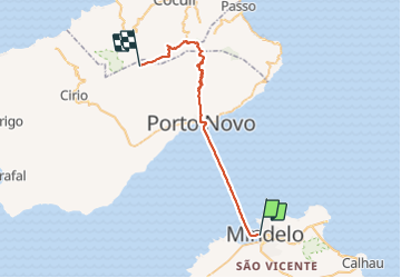
Trail Walking of 48 km to be discovered at Unknown, São Vicente. This trail is proposed by gdruet.

Description

Cap Vert 2

Elevation profile

Positioning

Country:
Cape Verde
Region :
Unknown
Department/Province :
São Vicente
Municipality :
Unknown
Location:
Unknown
Start:(UTM)
713751 ; 1868116 (26Q) N.

Trails nearby

Trail Walking  - cap Vert jour 0 - Photo
Walking
etak

Walking

Very easy
, Unknown, São Vicente, Cape Verde
3.9 km | 4.4 km-effort
2h 27min
Yes
Trail Walking  - Arrivée à Mindelo  - Photo
Walking
PatriceCocuaud

Walking

Very easy
, Unknown, São Vicente, Cape Verde
6.7 km | 7.8 km-effort
2h 16min
No
Trail On foot  - 2019-01-28 de 09h00 a 10h21 - Bateau de Mindelo à porto Novo - GT800 - Photo
On foot
stal38

On foot

Very easy
, Unknown, São Vicente, Cape Verde
17.2 km | 17.2 km-effort
Unknown
No
Trail Walking  - 2023 10 Cap vert t 1 - Photo
Walking
michel1025

Walking

Easy
, Unknown, São Vicente, Cape Verde
2.3 km | 2.6 km-effort
42min
Yes


Close
My subscriptions