![](/images/other/stat-length.png)
![Trail Cycle Prissé - Haut Baujolais - Photo](https://media.geolcdn.com/t/1900/400/ext.pjpeg?maxdim=2&url=https%3A%2F%2Fstatic1.geolcdn.com%2Fsiteimages%2Fupload%2Ffiles%2F1524743154velo.jpg)
Haut Baujolais
bosses21
User
![Length](/images/other/stat-length.png)
![Max alt](https://static1.geolcdn.com/siteimages/upload/files/1508320355ic_sort_altitude_max_24dp.png)
![Uphill gradient](https://static1.geolcdn.com/siteimages/upload/files/1508320355ic_sort_den_pos_24dp.png)
![Km-Effort](/images/other/stat-length.png)
![Min alt](https://static1.geolcdn.com/siteimages/upload/files/1508320355ic_sort_altitude_min_24dp.png)
![Downhill gradient](https://static1.geolcdn.com/siteimages/upload/files/1508320355ic_sort_den_neg_24dp.png)
![Boucle](https://static1.geolcdn.com/siteimages/upload/files/16400158638029165_repeat_loop_refresh_sync_direction_icon.png)
![Cycle](https://static1.geolcdn.com/sitytour/trail-icons/200.png)
7h00
Difficulty : Difficult
![Scan this QR Code to open this trail in the SityTrail application](https://capi.geolives.com/qq0zvz2zws4bq2lad0pu/sitytour/trails/305328/qr.png?size=200)
FREE GPS app for hiking
About
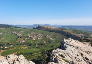
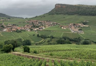
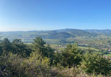
Trail Cycle of 104 km to be discovered at Bourgogne-Franche-Comté, Saône-et-Loire, Prissé. This trail is proposed by bosses21.
Description
1. Col des Enceints : 529m
2. Col du Grand Vent : 615m
3. Col du Carcan : 646m
4. Col de la Croix de l'Orme : 491m
5. Col des Oncins : 702m
6. Col de Crie : 624m
7. Col de la Serve : 708m
8. Col du fus d'Avenas : 743m
9. Col du Truges : 480m
10. Col de Durbize : 543m
11. Col de Fontmartin : 664m
12. Col de Boubon : 648m
13. Col de la Sibérie : 611m
14. Col du Gerbey : 612m
15. Col de la Grange du Bois : 523m
Points of interest
Positioning
Comments
Trails nearby
![Trail Walking Solutré-Pouilly - Mâcon - Sentier des crêtes 16/02/2020 - Photo](https://media.geolcdn.com/t/375/260/ext.jpg?maxdim=2&url=https%3A%2F%2Fstatic1.geolcdn.com%2Fsiteimages%2Fupload%2Ffiles%2F1553511878bg_sport_marche.png)
![Walking Walking](https://static1.geolcdn.com/sitytour/trail-icons/101.png)
Walking
![](/images/other/stat-length.png)
![](https://static1.geolcdn.com/siteimages/upload/files/16400158638029165_repeat_loop_refresh_sync_direction_icon.png)
![Trail Walking Solutré-Pouilly - Roche de Solutré 4km - Photo](https://media.geolcdn.com/t/375/260/2b98dc78-ba8a-41fd-a749-21f5c9aaf334.jpg&format=jpg&maxdim=2)
![Walking Walking](https://static1.geolcdn.com/sitytour/trail-icons/101.png)
Walking
![](/images/other/stat-length.png)
![](https://static1.geolcdn.com/siteimages/upload/files/16400158638029165_repeat_loop_refresh_sync_direction_icon.png)
![Trail Walking Pierreclos - Chateau de Pierreclos - Bourgogne - Aout 2012 - Photo](https://media.geolcdn.com/t/375/260/ext.jpg?maxdim=2&url=https%3A%2F%2Fstatic1.geolcdn.com%2Fsiteimages%2Fupload%2Ffiles%2F1553511878bg_sport_marche.png)
![Walking Walking](https://static1.geolcdn.com/sitytour/trail-icons/101.png)
Walking
![](/images/other/stat-length.png)
![](https://static1.geolcdn.com/siteimages/upload/files/16400158638029165_repeat_loop_refresh_sync_direction_icon.png)
![Trail Walking Solutré-Pouilly - roche de soluté, roche de Vergisson - Photo](https://media.geolcdn.com/t/375/260/ef2be165-b2d9-456d-92e3-623c3ebf39df.jpg&format=jpg&maxdim=2)
![Walking Walking](https://static1.geolcdn.com/sitytour/trail-icons/101.png)
Walking
![](/images/other/stat-length.png)
![](https://static1.geolcdn.com/siteimages/upload/files/16400158638029165_repeat_loop_refresh_sync_direction_icon.png)
![Trail Walking Vergisson - Vergisson Les deux Roches page 76 - Photo](https://media.geolcdn.com/t/375/260/9f6d6f90-e632-4bb7-b307-3d792a0db9f2.jpg&format=jpg&maxdim=2)
![Walking Walking](https://static1.geolcdn.com/sitytour/trail-icons/101.png)
Walking
![](/images/other/stat-length.png)
![](https://static1.geolcdn.com/siteimages/upload/files/16400158638029165_repeat_loop_refresh_sync_direction_icon.png)
![Trail sport La Roche-Vineuse - Land art Somméré - Photo](https://media.geolcdn.com/t/375/260/ec031be5-ade9-43bc-b45e-a1e6b1ab428d.jpg&format=jpg&maxdim=2)
sport
![](/images/other/stat-length.png)
![](https://static1.geolcdn.com/siteimages/upload/files/16400158638029165_repeat_loop_refresh_sync_direction_icon.png)
![Trail Walking Solutré-Pouilly - La roche de Solutré - Photo](https://media.geolcdn.com/t/375/260/a80cb3ae-be87-451a-ac3a-2e8039511501.jpg&format=jpg&maxdim=2)
![Walking Walking](https://static1.geolcdn.com/sitytour/trail-icons/101.png)
Walking
![](/images/other/stat-length.png)
![](https://static1.geolcdn.com/siteimages/upload/files/16400158638029165_repeat_loop_refresh_sync_direction_icon.png)
![Trail Walking Milly-Lamartine - 2022-10-30_11h56m06_monsart-vergisson-solutre - Photo](https://media.geolcdn.com/t/375/260/ext.jpg?maxdim=2&url=https%3A%2F%2Fstatic1.geolcdn.com%2Fsiteimages%2Fupload%2Ffiles%2F1553511878bg_sport_marche.png)
![Walking Walking](https://static1.geolcdn.com/sitytour/trail-icons/101.png)
Walking
![](/images/other/stat-length.png)
![](https://static1.geolcdn.com/siteimages/upload/files/16400158638029165_repeat_loop_refresh_sync_direction_icon.png)
![Trail Walking Davayé - Roche de solutré - Photo](https://media.geolcdn.com/t/375/260/6c6ce84f-afe6-42a2-a7ae-4516d98ef631.jpg&format=jpg&maxdim=2)
![Walking Walking](https://static1.geolcdn.com/sitytour/trail-icons/101.png)
Walking
![](/images/other/stat-length.png)
![](https://static1.geolcdn.com/siteimages/upload/files/16400158638029165_repeat_loop_refresh_sync_direction_icon.png)