Trail Walking Andelot-Blancheville - Andelot, vallée du Rognon - Photo

Andelot, vallée du Rognon

© OpenStreetMap contributors
Length
Length
13.1 km
Max alt
Max alt
325 m
Uphill gradient
Uphill gradient
230 m
Km-Effort
Km-Effort  
16.2 km
Min alt
Min alt
252 m
Downhill gradient
Downhill gradient
234 m
Boucle
Boucle
Yes
Creation date :
2022-01-14 12:08:44.774
Updated on :
2022-01-19 14:02:23.984

(0 Reviews)

Walking
Walking
3h39
Difficulty : Easy

Scan this QR Code to open this trail in the SityTrail application

FREE GPS app for hiking

Logo SityTrail SityTrail

IGN / Geographical institutes

Download SityTrail from the App Store Download SityTrail from Google Play

Logo SityTrail SityTrail World

The world is yours!

Download SityTrail from the App Store Download SityTrail from Google Play Download SityTrail on Huawei AppGallery

About

Trail Walking of 13.1 km to be discovered at Grand Est, Haute-Marne, Andelot-Blancheville. This trail is proposed by jeannine grandjean.

Description

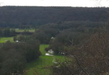
de part et d'autre de la petite rivière sinueuse du Rognon, qui serpente au fond d'une vallée bucolique et verdoyante
ne pas manquer les vestiges de l'ancienne abbaye cistercienne de la Crête
pour une randonnée plus longue, démarrer de la place principale d'Andelot
pour une randonnée plus courte, se rendre d'abord  en voiture au château de Morteau

Elevation profile

Photos

Positioning

Country:
France
Region :
Grand Est
Department/Province :
Haute-Marne
Municipality :
Andelot-Blancheville
Location:
Andelot
Start:(UTM)
671453 ; 5345492 (31U) N.

Trails nearby

Trail Other activity Chantraines - cyclo rail - Photo
Other activity
Nicole SIMONNET

Other activity

Medium
Chantraines, Grand Est, Haute-Marne, France
10.7 km | 12 km-effort
1h 47min
Yes
Trail Walking Andelot-Blancheville - Morteai - Photo
Walking
FRANCKY52

Walking

Medium
Andelot-Blancheville, Grand Est, Haute-Marne, France
12.7 km | 16.4 km-effort
3h 34min
Yes
Trail On foot Bourdons-sur-Rognon - bourdons-sur-rognon (1) - Photo
On foot
irenep52

On foot

Easy
Bourdons-sur-Rognon, Grand Est, Haute-Marne, France
10.2 km | 12.3 km-effort
2h 47min
Yes


Close
My subscriptions