Trail Walking Limoux - Magrie Gours - Photo

Magrie Gours

© OpenStreetMap contributors
Length
Length
21 km
Max alt
Max alt
394 m
Uphill gradient
Uphill gradient
567 m
Km-Effort
Km-Effort  
28 km
Min alt
Min alt
172 m
Downhill gradient
Downhill gradient
568 m
Boucle
Boucle
Yes
Creation date :
2022-01-13 07:52:32.561
Updated on :
2022-01-13 15:57:18.905

(1 Reviews)

Walking
Walking
5h15
Difficulty : Easy

Scan this QR Code to open this trail in the SityTrail application

FREE GPS app for hiking

Logo SityTrail SityTrail

IGN / Geographical institutes

Download SityTrail from the App Store Download SityTrail from Google Play

Logo SityTrail SityTrail World

The world is yours!

Download SityTrail from the App Store Download SityTrail from Google Play Download SityTrail on Huawei AppGallery

About

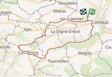
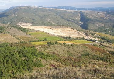
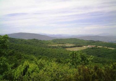
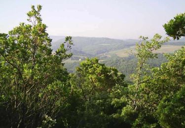
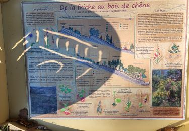
Trail Walking of 21 km to be discovered at Occitania, Aude, Limoux. This trail is proposed by Jean Marie Pons.

Elevation profile

Positioning

Country:
France
Region :
Occitania
Department/Province :
Aude
Municipality :
Limoux
Location:
Unknown
Start:(UTM)
435183 ; 4767420 (31T) N.

Comments

Please log in to post a review or rate the element


randonnée agréable, intéressante en ce jeudi 24-02-22. Le tracé au niveau du château, je ne l'ai pas vu, donc partir vers le lotissement à gauche, puis route. Audier.


Trails nearby

Trail Walking Limoux - Limoux- Ninaute- Mounnet - Photo
Walking
mikaou.t

Walking

Medium
(1)
Limoux, Occitania, Aude, France
10.9 km | 15.7 km-effort
3h 0min
Yes
Trail Walking Cournanel - Magrie-Cournanel Cabanes en fete - Photo
Walking
jopost

Walking

Very easy
(2)
Cournanel, Occitania, Aude, France
7.4 km | 8.6 km-effort
4h 22min
Yes
Trail Mountain bike Limoux - Limoux, toureille, croix st Pierre   - Photo
Mountain bike
schwarzy

Mountain bike

Difficult
Limoux, Occitania, Aude, France
30 km | 42 km-effort
4h 41min
Yes
Trail Mountain bike Pieusse - Los camins de la blanqueta 2006 - Photo
Mountain bike
tracegps

Mountain bike

Very difficult
Pieusse, Occitania, Aude, France
53 km | 71 km-effort
4h 30min
Yes
Trail Mountain bike Pieusse - Los camins de la blanqueta (prox. Limoux) - Photo
Mountain bike
tracegps

Mountain bike

Very difficult
Pieusse, Occitania, Aude, France
53 km | 72 km-effort
6h 0min
Yes
Trail Walking Cournanel - COURNANEL les cabanes porposée par Pascale - Photo
Walking
Mamilaure

Walking

Very easy
Cournanel, Occitania, Aude, France
6.1 km | 7.1 km-effort
1h 29min
Yes
Trail Walking Cournanel - cournanel les cabanes  - Photo
Walking
cappelle

Walking

Easy
Cournanel, Occitania, Aude, France
6.2 km | 7.2 km-effort
1h 56min
Yes
Trail Walking Pauligne - pauligne, Cassagnau, Le Soulié, Pauligne - Photo
Walking
christinetondeur

Walking

Easy
Pauligne, Occitania, Aude, France
9.5 km | 12.1 km-effort
2h 39min
Yes
Trail Walking Pauligne - Pauligne,Malras,La Digne d'Amont, Ajac, Cassagnau - Photo
Walking
christinetondeur

Walking

Medium
(1)
Pauligne, Occitania, Aude, France
17.7 km | 24 km-effort
5h 28min
Yes


Close
My subscriptions