Trail Cycle Auriol - Plan d'aups par le vallon du Peyruis - Photo

Plan d'aups par le vallon du Peyruis

© OpenStreetMap contributors
Length
Length
37 km
Max alt
Max alt
738 m
Uphill gradient
Uphill gradient
777 m
Km-Effort
Km-Effort  
48 km
Min alt
Min alt
205 m
Downhill gradient
Downhill gradient
786 m
Boucle
Boucle
Yes
Creation date :
2014-12-10 00:00:00.0
Updated on :
2014-12-10 00:00:00.0

(0 Reviews)

Cycle
Cycle
2h46
Difficulty : Medium

Scan this QR Code to open this trail in the SityTrail application

FREE GPS app for hiking

Logo SityTrail SityTrail

IGN / Geographical institutes

Download SityTrail from the App Store Download SityTrail from Google Play

Logo SityTrail SityTrail World

The world is yours!

Download SityTrail from the App Store Download SityTrail from Google Play Download SityTrail on Huawei AppGallery

About

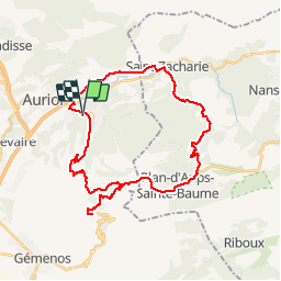
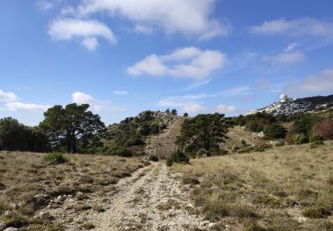
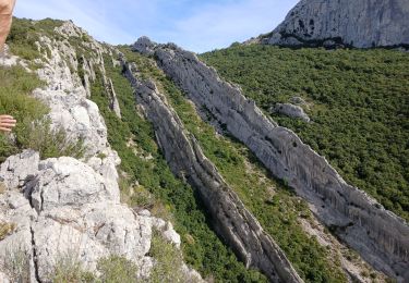
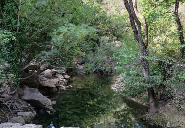
Trail Cycle of 37 km to be discovered at Provence-Alpes-Côte d'Azur, Bouches-du-Rhône, Auriol. This trail is proposed by cyclopat42600.

Description

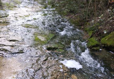
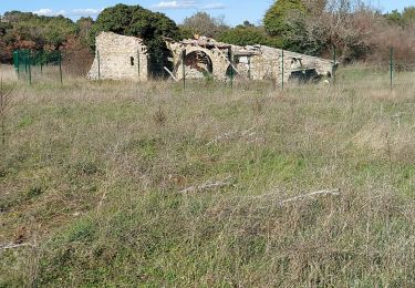
Petite boucle dans le massif de la Sainte Baume avec un crochet par le col de l'Espigoulier

Elevation profile

Positioning

Country:
France
Region :
Provence-Alpes-Côte d'Azur
Department/Province :
Bouches-du-Rhône
Municipality :
Auriol
Location:
Unknown
Start:(UTM)
715195 ; 4804340 (31T) N.

Trails nearby

Trail Walking Auriol - la crete des infernets - Photo
Walking
Coryphene

Walking

Difficult
(1)
Auriol, Provence-Alpes-Côte d'Azur, Bouches-du-Rhône, France
8.6 km | 14 km-effort
3h 22min
Yes
Trail Walking Plan-d'Aups-Sainte-Baume - La Grotte aux oiseaux - Plan d'Aups  - Photo
Walking
tracegps

Walking

Medium
(1)
Plan-d'Aups-Sainte-Baume, Provence-Alpes-Côte d'Azur, Var, France
8.8 km | 12.5 km-effort
2h 30min
Yes
Trail On foot Auriol - Les moulins - Photo
On foot
PRO

On foot

Easy
Auriol, Provence-Alpes-Côte d'Azur, Bouches-du-Rhône, France
3.7 km | 4.2 km-effort
57min
Yes
Trail Walking Auriol - le ravin des Encanaux - Photo
Walking
GUIDE
amiral13

Walking

Difficult
Auriol, Provence-Alpes-Côte d'Azur, Bouches-du-Rhône, France
7.3 km | 12.2 km-effort
3h 10min
Yes
Trail Walking Plan-d'Aups-Sainte-Baume - Pic de Bertagne - Grotte Betton - Le plan d'aups - Photo
Walking
GUIDE
affinetataille

Walking

Medium
Plan-d'Aups-Sainte-Baume, Provence-Alpes-Côte d'Azur, Var, France
9.9 km | 15.7 km-effort
3h 30min
Yes
Trail Walking Auriol - Les Encanaux, Auriol-05-06-24 - Photo
Walking
Christiancordin

Walking

Medium
Auriol, Provence-Alpes-Côte d'Azur, Bouches-du-Rhône, France
15.4 km | 24 km-effort
4h 9min
Yes
Trail Walking Auriol - les Encanaux  - Photo
Walking
cousam

Walking

Difficult
Auriol, Provence-Alpes-Côte d'Azur, Bouches-du-Rhône, France
7.1 km | 11 km-effort
2h 14min
Yes
Trail Walking Plan-d'Aups-Sainte-Baume - Plan f’aups - Photo
Walking
gaggiroland

Walking

Difficult
Plan-d'Aups-Sainte-Baume, Provence-Alpes-Côte d'Azur, Var, France
10 km | 14.3 km-effort
4h 48min
Yes
Trail Walking Auriol - Ravin des Infernets -Tête de chien - Photo
Walking
cousam

Walking

Very difficult
Auriol, Provence-Alpes-Côte d'Azur, Bouches-du-Rhône, France
13.7 km | 22 km-effort
9h 33min
Yes


Close
My subscriptions