


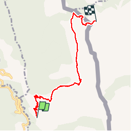


8.1 km | 14.4 km-effort


User


FREE GPS app for hiking
 SityTrail
IGN / Geographical institutes
SityTrail World
The world is yours!
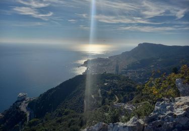
Trail Walking of 7.2 km to be discovered at Provence-Alpes-Côte d'Azur, Maritime Alps, Castellar. This trail is proposed by PEBREJOSIANE.
Aller simple
Au départ de la route de Castellar (premier embranchement après Monti)
On pourra revenir par le même chemin, ou passer versant Italien


Walking

Walking

On foot

Walking

Walking

Walking

Walking

Walking
Walking