![Trail Running Unknown - Chennai footing - Photo](https://media.geolcdn.com/t/1900/400/35cdeb0e-df7c-47b0-bd88-d043fe4323aa.jpg&format=pjpeg&maxdim=2)
Chennai footing
Fourcroy Christophe
User
![Length](/images/other/stat-length.png)
Length
3.4 km
![Max alt](https://static1.geolcdn.com/siteimages/upload/files/1508320355ic_sort_altitude_max_24dp.png)
Max alt
16 m
![Uphill gradient](https://static1.geolcdn.com/siteimages/upload/files/1508320355ic_sort_den_pos_24dp.png)
Uphill gradient
18 m
![Km-Effort](/images/other/stat-length.png)
Km-Effort
3.6 km
![Min alt](https://static1.geolcdn.com/siteimages/upload/files/1508320355ic_sort_altitude_min_24dp.png)
Min alt
7 m
![Downhill gradient](https://static1.geolcdn.com/siteimages/upload/files/1508320355ic_sort_den_neg_24dp.png)
Downhill gradient
16 m
![Boucle](https://static1.geolcdn.com/siteimages/upload/files/16400158638029165_repeat_loop_refresh_sync_direction_icon.png)
Boucle
Yes
Creation date :
2022-01-06 00:27:08.0
Updated on :
2022-01-06 00:58:30.386
![Running](https://static1.geolcdn.com/sitytour/trail-icons/103.png)
31m
Difficulty : Very easy
![Scan this QR Code to open this trail in the SityTrail application](https://capi.geolives.com/qq0zvz2zws4bq2lad0pu/sitytour/trails/3042761/qr.png?size=200)
FREE GPS app for hiking
About
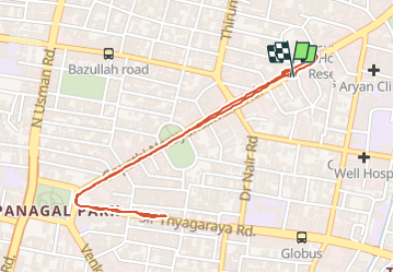
Trail Running of 3.4 km to be discovered at Tamil Nadu, Unknown, Unknown. This trail is proposed by Fourcroy Christophe.
Positioning
Country:
India
Region :
Tamil Nadu
Department/Province :
Unknown
Municipality :
Unknown
Location:
Zone 9 Teynampet
Start:(Dec)
Start:(UTM)
417866 ; 1442366 (44P) N.
Comments
Trails nearby