Trail Walking Méry-sur-Seine - entre Méry sur Seine et Saint-Oulph - Photo

entre Méry sur Seine et Saint-Oulph

© OpenStreetMap contributors
Length
Length
6.4 km
Max alt
Max alt
88 m
Uphill gradient
Uphill gradient
33 m
Km-Effort
Km-Effort  
6.9 km
Min alt
Min alt
74 m
Downhill gradient
Downhill gradient
30 m
Boucle
Boucle
Yes
Creation date :
2021-12-31 13:55:20.412
Updated on :
2022-01-19 14:33:23.857

(0 Reviews)

Walking
Walking
1h37
Difficulty : Very easy

Scan this QR Code to open this trail in the SityTrail application

FREE GPS app for hiking

Logo SityTrail SityTrail

IGN / Geographical institutes

Download SityTrail from the App Store Download SityTrail from Google Play

Logo SityTrail SityTrail World

The world is yours!

Download SityTrail from the App Store Download SityTrail from Google Play Download SityTrail on Huawei AppGallery

About

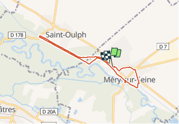
Trail Walking of 6.4 km to be discovered at Grand Est, Aube, Méry-sur-Seine. This trail is proposed by jeannine grandjean.

Description

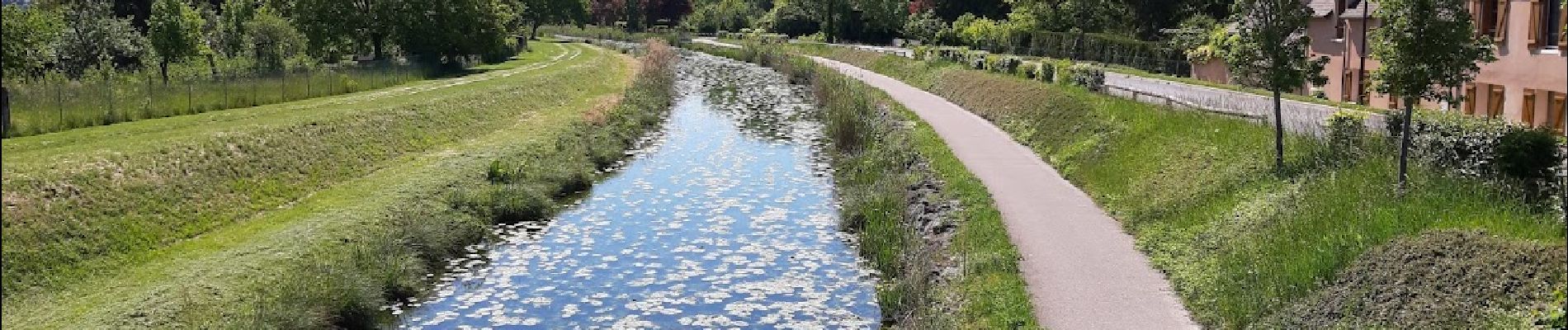
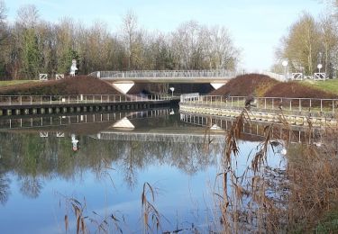
départ sur le parking face au camping, route de Soissons ; suivre le chemin qui mène au pont de Saint-Oulph en suivant le Canal de la Haute-Seine ; retour sur l'autre rive du canal par la Voie Verte (la quitter un moment pour passer à travers bois) ; à l'arrivée à Méry, quitter la piste cyclable et se diriger vers l'église ; suivre la Seine (chemin des Retranchements) et rejoindre le canal que l'on traverse sur la passerelle ; passe devant la maison de retraite, traverser le pont et reprendre la vélovoie jusqu'au point de départ

Elevation profile

Photos

Positioning

Country:
France
Region :
Grand Est
Department/Province :
Aube
Municipality :
Méry-sur-Seine
Location:
Unknown
Start:(UTM)
565319 ; 5373562 (31U) N.

Trails nearby

Trail Walking Méry-sur-Seine - de MÉRY SUR SEINE aux ÉTANGS de BRUN - Photo
Walking
jeannine grandjean

Walking

Very easy
Méry-sur-Seine, Grand Est, Aube, France
9.4 km | 9.9 km-effort
2h 25min
Yes
Trail Walking Méry-sur-Seine - Boucle Mery sur Seine - Droupt-Saint-Basle  - Photo
Walking
NANE51

Walking

Easy
Méry-sur-Seine, Grand Est, Aube, France
11.6 km | 12.2 km-effort
2h 17min
Yes
Trail Walking Droupt-Saint-Basle - Droupt, Rilly, écluse 8  - Photo
Walking
NANE51

Walking

Easy
Droupt-Saint-Basle, Grand Est, Aube, France
17.8 km | 19.8 km-effort
4h 9min
Yes
Trail Walking Vallant-Saint-Georges - Boucle entre canal et champs - Photo
Walking
NANE51

Walking

Easy
Vallant-Saint-Georges, Grand Est, Aube, France
18.1 km | 0 m-effort
4h 7min
Yes
Trail Mountain bike Châtres - 221922 - Photo
Mountain bike
joeljoseph

Mountain bike

Difficult
Châtres, Grand Est, Aube, France
31 km | 32 km-effort
2h 33min
Yes
Trail Road bike Méry-sur-Seine - ouf du soleil - Photo
Road bike
joeljoseph

Road bike

Very difficult
Méry-sur-Seine, Grand Est, Aube, France
53 km | 56 km-effort
2h 59min
Yes
Trail Road bike Méry-sur-Seine - renard - Photo
Road bike
joeljoseph

Road bike

Very difficult
Méry-sur-Seine, Grand Est, Aube, France
51 km | 55 km-effort
3h 12min
Yes
Trail Walking Vallant-Saint-Georges - Vallant-Saint-Georges.(10) - Circuit à la découverte des 3 saints - Photo
Walking
temmichel

Walking

Difficult
Vallant-Saint-Georges, Grand Est, Aube, France
15.8 km | 16.9 km-effort
3h 50min
Yes
Trail Mountain bike Châtres - flotte oulph - Photo
Mountain bike
joeljoseph

Mountain bike

Easy
Châtres, Grand Est, Aube, France
3.7 km | 3.9 km-effort
5min
No


Close
My subscriptions