![](/images/other/stat-length.png)
![Trail Walking Antoing - Circuit du grand large - Photo](https://media.geolcdn.com/t/1900/400/2ef909e2-3ef3-4ef4-8bff-cd8336ecd9f7.jpg&format=pjpeg&maxdim=2)
Circuit du grand large
Au fil de nos découvertes
« L’heure de la fin des découvertes ne sonne jamais. » Colette GUIDE+
![Length](/images/other/stat-length.png)
![Max alt](https://static1.geolcdn.com/siteimages/upload/files/1508320355ic_sort_altitude_max_24dp.png)
![Uphill gradient](https://static1.geolcdn.com/siteimages/upload/files/1508320355ic_sort_den_pos_24dp.png)
![Km-Effort](/images/other/stat-length.png)
![Min alt](https://static1.geolcdn.com/siteimages/upload/files/1508320355ic_sort_altitude_min_24dp.png)
![Downhill gradient](https://static1.geolcdn.com/siteimages/upload/files/1508320355ic_sort_den_neg_24dp.png)
![Boucle](https://static1.geolcdn.com/siteimages/upload/files/16400158638029165_repeat_loop_refresh_sync_direction_icon.png)
![Walking](https://static1.geolcdn.com/sitytour/trail-icons/101.png)
1h40
Difficulty : Medium
![Scan this QR Code to open this trail in the SityTrail application](https://capi.geolives.com/qq0zvz2zws4bq2lad0pu/sitytour/trails/3036478/qr.png?size=200)
FREE GPS app for hiking
About
Trail Walking of 6.8 km to be discovered at Wallonia, Hainaut, Antoing. This trail is proposed by Au fil de nos découvertes.
Description
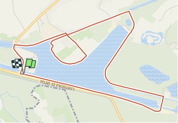
🅿️ Départ et Parking :
Écluse de Péronnes
Rue d’Hollain
7640 Antoing
🌲🌳
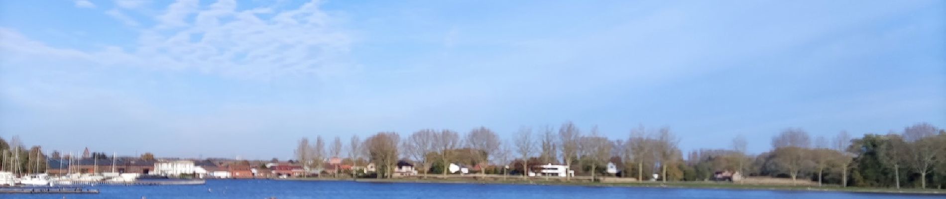
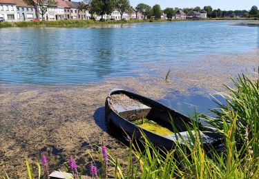
Le départ de la promenade se fait à l’écluse de Péronnes. Vous longerez le grand large jusqu’à l’écluse du Canal.
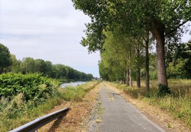
Il faut passer au dessus de la deuxième écluse, ainsi qu’au dessus d’un petit canal et prendre à gauche.
Les paysages sont magnifiques et changeants au fil des kilomètres. 😍
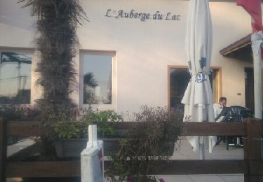
Possibilités de pique-niquer. 🥪🍴
Chiens autorisés en laisse. 🐩🐶🐕
Convient pour les enfants . 👱👱♂️
Convient vraiment pour les poussettes et personnes à mobilité réduite. 👨🦽👩🦽👶
Positioning
Comments
Trails nearby
![Trail Walking Antoing - grand large- penonnes lez antoing - Photo](https://media.geolcdn.com/t/375/260/ext.jpg?maxdim=2&url=https%3A%2F%2Fservices.sitytrail.com%2FGeolivesWS%2FDownloadMedia.ashx%3FTrailID%3D653025%26Media%3Dfix__20161029165326.jpg)
![Walking Walking](https://static1.geolcdn.com/sitytour/trail-icons/101.png)
Walking
![](/images/other/stat-length.png)
![](https://static1.geolcdn.com/siteimages/upload/files/16400158638029165_repeat_loop_refresh_sync_direction_icon.png)
![Trail Walking Brunehaut - Circuit de la coupure de Bléharies - Photo](https://media.geolcdn.com/t/375/260/c388fd6c-a6df-4e66-add0-50e55c75a52e.jpg&format=jpg&maxdim=2)
![Walking Walking](https://static1.geolcdn.com/sitytour/trail-icons/101.png)
Walking
![](/images/other/stat-length.png)
![](https://static1.geolcdn.com/siteimages/upload/files/16400158638029165_repeat_loop_refresh_sync_direction_icon.png)
![Trail Walking Antoing - Balade au coeur de Péronnes - Photo](https://media.geolcdn.com/t/375/260/d7561409-c7bf-436c-aa67-e1ca13223359.jpg&format=jpg&maxdim=2)
![Walking Walking](https://static1.geolcdn.com/sitytour/trail-icons/101.png)
Walking
![](/images/other/stat-length.png)
![](https://static1.geolcdn.com/siteimages/upload/files/16400158638029165_repeat_loop_refresh_sync_direction_icon.png)
![Trail On foot Brunehaut - A tour of the plant and tree nurseries at Lesdain - Photo](https://media.geolcdn.com/t/375/260/ext.jpg?maxdim=2&url=https%3A%2F%2Fpivotmedia.tourismewallonie.be%2FANX-02-04JM-0024%2FANX-02-04JM-0024.jpg)
![On foot On foot](https://static1.geolcdn.com/sitytour/trail-icons/100.png)
On foot
![](/images/other/stat-length.png)
![](https://static1.geolcdn.com/siteimages/upload/files/16400158638029165_repeat_loop_refresh_sync_direction_icon.png)
![Trail On foot Antoing - 'Pays Blanc' circuit - Photo](https://media.geolcdn.com/t/375/260/ext.jpg?maxdim=2&url=https%3A%2F%2Fpivotmedia.tourismewallonie.be%2FANX-02-04JV-0001%2FANX-02-04JV-0001.jpg)
![On foot On foot](https://static1.geolcdn.com/sitytour/trail-icons/100.png)
On foot
![](/images/other/stat-length.png)
![](https://static1.geolcdn.com/siteimages/upload/files/16400158638029165_repeat_loop_refresh_sync_direction_icon.png)
![Trail On foot Brunehaut - Bléharies severed meander bird watching walking tour - 3,5km - Photo](https://media.geolcdn.com/t/375/260/ext.jpg?maxdim=2&url=https%3A%2F%2Fpivotmedia.tourismewallonie.be%2FANX-02-04JP-002T%2FANX-02-04JP-002T.jpg)
![On foot On foot](https://static1.geolcdn.com/sitytour/trail-icons/100.png)
On foot
![](/images/other/stat-length.png)
![](https://static1.geolcdn.com/siteimages/upload/files/16400158638029165_repeat_loop_refresh_sync_direction_icon.png)
![Trail Walking Mortagne-du-Nord - Mortagne-du-Nord 18,6 km - Photo](https://media.geolcdn.com/t/375/260/fd97f041-03e8-458c-b32d-9e5c0c535a41.jpg&format=jpg&maxdim=2)
![Walking Walking](https://static1.geolcdn.com/sitytour/trail-icons/101.png)
Walking
![](/images/other/stat-length.png)
![](https://static1.geolcdn.com/siteimages/upload/files/16400158638029165_repeat_loop_refresh_sync_direction_icon.png)
![Trail Road bike Tournai - Brau vélo Ravel Antoing - Photo](https://media.geolcdn.com/t/375/260/ext.jpg?maxdim=2&url=https%3A%2F%2Fstatic1.geolcdn.com%2Fsiteimages%2Fupload%2Ffiles%2F1524743154velo.jpg)
![Road bike Road bike](https://static1.geolcdn.com/sitytour/trail-icons/201.png)
Road bike
![](/images/other/stat-length.png)
![](https://static1.geolcdn.com/siteimages/upload/files/16400158638029165_repeat_loop_refresh_sync_direction_icon.png)
![Trail Walking Brunehaut - RB - H - 15 Lesdain - Photo](https://media.geolcdn.com/t/375/260/ext.jpg?maxdim=2&url=https%3A%2F%2Fservices.sitytrail.com%2FGeolivesWS%2FDownloadMedia.ashx%3FTrailID%3D617918%26Media%3Dfix__20160820190940.jpg)
![Walking Walking](https://static1.geolcdn.com/sitytour/trail-icons/101.png)
Walking
![](/images/other/stat-length.png)
![](https://static1.geolcdn.com/siteimages/upload/files/16400158638029165_repeat_loop_refresh_sync_direction_icon.png)