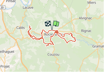
![](/images/other/stat-length.png)
![Trail Mountain bike Rocamadour - VTT Rocamad. Magalie 43km 920D+ 13 SEPT 2021 - Photo](https://media.geolcdn.com/t/1900/400/ext.pjpeg?maxdim=2&url=https%3A%2F%2Fstatic1.geolcdn.com%2Fsiteimages%2Fupload%2Ffiles%2F1524743154velo.jpg)
VTT Rocamad. Magalie 43km 920D+ 13 SEPT 2021
Levillefranchois
User
![Length](/images/other/stat-length.png)
![Max alt](https://static1.geolcdn.com/siteimages/upload/files/1508320355ic_sort_altitude_max_24dp.png)
![Uphill gradient](https://static1.geolcdn.com/siteimages/upload/files/1508320355ic_sort_den_pos_24dp.png)
![Km-Effort](/images/other/stat-length.png)
![Min alt](https://static1.geolcdn.com/siteimages/upload/files/1508320355ic_sort_altitude_min_24dp.png)
![Downhill gradient](https://static1.geolcdn.com/siteimages/upload/files/1508320355ic_sort_den_neg_24dp.png)
![Boucle](https://static1.geolcdn.com/siteimages/upload/files/16400158638029165_repeat_loop_refresh_sync_direction_icon.png)
![Mountain bike](https://static1.geolcdn.com/sitytour/trail-icons/202.png)
3h49
Difficulty : Difficult
![Scan this QR Code to open this trail in the SityTrail application](https://capi.geolives.com/qq0zvz2zws4bq2lad0pu/sitytour/trails/3032591/qr.png?size=200)
FREE GPS app for hiking
About
Trail Mountain bike of 43 km to be discovered at Occitania, Lot, Rocamadour. This trail is proposed by Levillefranchois.
Description
Pour éviter les parkings payants ou encombrés, on peut se garer à Marcayou.
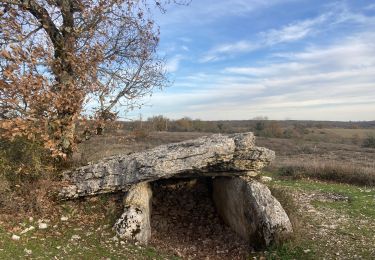
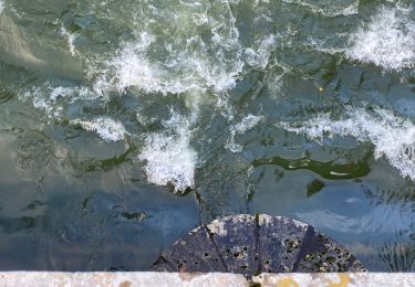
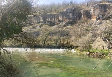
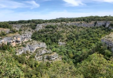
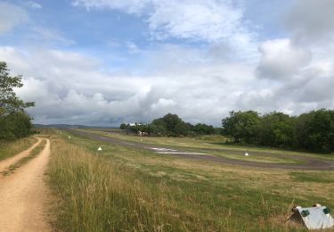
De beaux passages et points de vue!
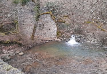
La montée apres le moulin de Tournefeuille est éprouvante et pour cette raison il serait plus facile de faire le circuit dans l'autre sens. Difficile en électrique sur cette section et très physique en musculaire.
Positioning
Comments
Trails nearby
![Trail Walking Rocamadour - Col de mages Lafage Rocamadour La Panonie - Photo](https://media.geolcdn.com/t/375/260/9f4a7e91-ac8d-4857-be4f-8e26f11cf7f3.jpg&format=jpg&maxdim=2)
![Walking Walking](https://static1.geolcdn.com/sitytour/trail-icons/101.png)
Walking
![](/images/other/stat-length.png)
![](https://static1.geolcdn.com/siteimages/upload/files/16400158638029165_repeat_loop_refresh_sync_direction_icon.png)
![Trail Walking Calès - Cougnaguet Rocamadour - Photo](https://media.geolcdn.com/t/375/260/add75687-554b-4d45-a34f-d79f204e2b9d.jpg&format=jpg&maxdim=2)
![Walking Walking](https://static1.geolcdn.com/sitytour/trail-icons/101.png)
Walking
![](/images/other/stat-length.png)
![](https://static1.geolcdn.com/siteimages/upload/files/16400158638029165_repeat_loop_refresh_sync_direction_icon.png)
![Trail Walking Calès - Cales lacave cougnaguet - Photo](https://media.geolcdn.com/t/375/260/79e6908b-86b7-4f2f-b896-312926c7edab.jpg&format=jpg&maxdim=2)
![Walking Walking](https://static1.geolcdn.com/sitytour/trail-icons/101.png)
Walking
![](/images/other/stat-length.png)
![](https://static1.geolcdn.com/siteimages/upload/files/16400158638029165_repeat_loop_refresh_sync_direction_icon.png)
![Trail On foot Rocamadour - Boucle de randonnée entre Rocamadour et le Gouffre de Padirac - Photo](https://media.geolcdn.com/t/375/260/80b0432d-439e-456c-9615-ea85758f11af.jpeg&format=jpg&maxdim=2)
![On foot On foot](https://static1.geolcdn.com/sitytour/trail-icons/100.png)
On foot
![](/images/other/stat-length.png)
![](https://static1.geolcdn.com/siteimages/upload/files/16400158638029165_repeat_loop_refresh_sync_direction_icon.png)
![Walking Walking](https://static1.geolcdn.com/sitytour/trail-icons/101.png)
Walking
![](/images/other/stat-length.png)
![](https://static1.geolcdn.com/siteimages/upload/files/16400158638029165_repeat_loop_refresh_sync_direction_icon.png)
![Trail Walking Gramat - alzou gorges - Photo](https://media.geolcdn.com/t/375/260/fa7c3de3-dc73-4d5f-86fc-1696475a59ed.jpg&format=jpg&maxdim=2)
![Walking Walking](https://static1.geolcdn.com/sitytour/trail-icons/101.png)
![Trail Walking Rocamadour - Rocamadour cougnaguet calouet - Photo](https://media.geolcdn.com/t/375/260/d5650960-8085-450c-a78d-c7c16a2ada0f.jpg&format=jpg&maxdim=2)
![Walking Walking](https://static1.geolcdn.com/sitytour/trail-icons/101.png)
Walking
![](/images/other/stat-length.png)
![](https://static1.geolcdn.com/siteimages/upload/files/16400158638029165_repeat_loop_refresh_sync_direction_icon.png)
![Trail Walking Rocamadour - Rocamadour , magés , moulins du saut - Photo](https://media.geolcdn.com/t/375/260/51833c9c-a710-4054-bb36-7a2bcfc341c1.jpg&format=jpg&maxdim=2)
![Walking Walking](https://static1.geolcdn.com/sitytour/trail-icons/101.png)
Walking
![](/images/other/stat-length.png)
![](https://static1.geolcdn.com/siteimages/upload/files/16400158638029165_repeat_loop_refresh_sync_direction_icon.png)
![Trail Mountain bike Rocamadour - Rocamadour–Lacave 16/06/20 - Photo](https://media.geolcdn.com/t/375/260/2aa447b3-7876-4197-9b34-ce0761bc08d3.jpg&format=jpg&maxdim=2)
![Mountain bike Mountain bike](https://static1.geolcdn.com/sitytour/trail-icons/202.png)
Mountain bike
![](/images/other/stat-length.png)
![](https://static1.geolcdn.com/siteimages/upload/files/16400158638029165_repeat_loop_refresh_sync_direction_icon.png)