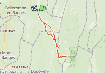
![](/images/other/stat-length.png)
![Trail Touring skiing Bellecombe-en-Bauges - la dent des portes et sous le Trelod - Photo](https://media.geolcdn.com/t/1900/400/5df2df97-f7db-4fea-9d78-8be71e3fb466.jpg&format=pjpeg&maxdim=2)
la dent des portes et sous le Trelod
nadd73
User GUIDE
![Length](/images/other/stat-length.png)
![Max alt](https://static1.geolcdn.com/siteimages/upload/files/1508320355ic_sort_altitude_max_24dp.png)
![Uphill gradient](https://static1.geolcdn.com/siteimages/upload/files/1508320355ic_sort_den_pos_24dp.png)
![Km-Effort](/images/other/stat-length.png)
![Min alt](https://static1.geolcdn.com/siteimages/upload/files/1508320355ic_sort_altitude_min_24dp.png)
![Downhill gradient](https://static1.geolcdn.com/siteimages/upload/files/1508320355ic_sort_den_neg_24dp.png)
![Boucle](https://static1.geolcdn.com/siteimages/upload/files/16400158638029165_repeat_loop_refresh_sync_direction_icon.png)
![Touring skiing](https://static1.geolcdn.com/sitytour/trail-icons/503.png)
3h52
Difficulty : Medium
![Scan this QR Code to open this trail in the SityTrail application](https://capi.geolives.com/qq0zvz2zws4bq2lad0pu/sitytour/trails/3028665/qr.png?size=200)
FREE GPS app for hiking
About
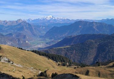
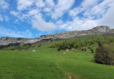
Trail Touring skiing of 12.9 km to be discovered at Auvergne-Rhône-Alpes, Savoy, Bellecombe-en-Bauges. This trail is proposed by nadd73.
Description
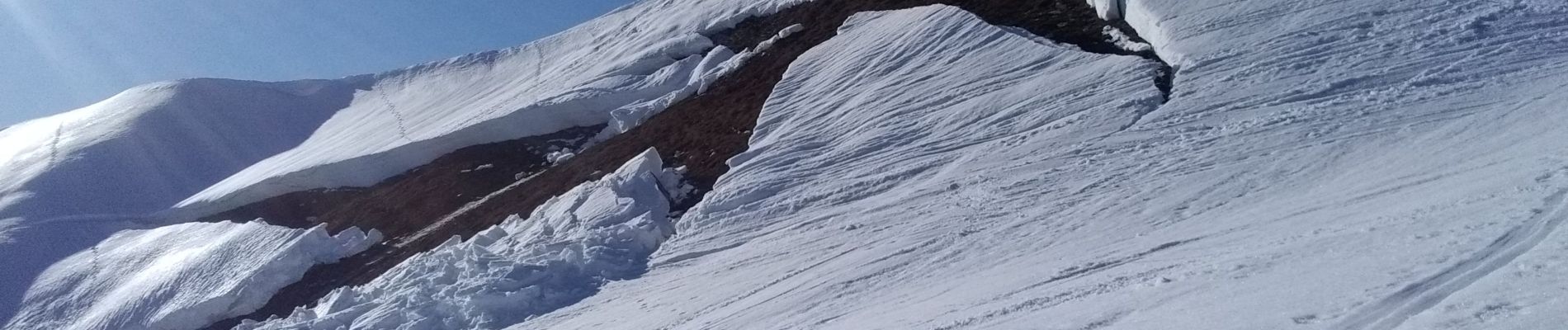
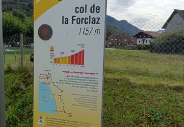
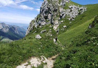
Départ de Montdevant vers 11h. Le passage sous la dent était gelé à la montée, donc couteaux, et à la descente c'était juste bon. Sinon de la poudreuse.
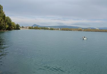
Beaucoup de monde mais qui s'arrête avant le passage gelé.
Ensuite toute seule avec les chamois et les choucas.
Positioning
Comments
Trails nearby
![Trail Walking Bellecombe-en-Bauges - Pointe de Banc Plat en boucle - Photo](https://media.geolcdn.com/t/375/260/80b75f38-16b0-40b8-9a99-ebc551fd27ff.jpg&format=jpg&maxdim=2)
![Walking Walking](https://static1.geolcdn.com/sitytour/trail-icons/101.png)
Walking
![](/images/other/stat-length.png)
![](https://static1.geolcdn.com/siteimages/upload/files/16400158638029165_repeat_loop_refresh_sync_direction_icon.png)
![Trail Walking Bellecombe-en-Bauges - Banc plat boucle - Photo](https://media.geolcdn.com/t/375/260/a2db89fd-d92b-448f-a4ef-41a90ffed31c.jpg&format=jpg&maxdim=2)
![Walking Walking](https://static1.geolcdn.com/sitytour/trail-icons/101.png)
Walking
![](/images/other/stat-length.png)
![](https://static1.geolcdn.com/siteimages/upload/files/16400158638029165_repeat_loop_refresh_sync_direction_icon.png)
![Trail Walking Doucy-en-Bauges - 2015-09-11 Marche Mont Trelod - Photo](https://media.geolcdn.com/t/375/260/ext.jpg?maxdim=2&url=https%3A%2F%2Fstatic1.geolcdn.com%2Fsiteimages%2Fupload%2Ffiles%2F1553511878bg_sport_marche.png)
![Walking Walking](https://static1.geolcdn.com/sitytour/trail-icons/101.png)
Walking
![](/images/other/stat-length.png)
![](https://static1.geolcdn.com/siteimages/upload/files/16400158638029165_repeat_loop_refresh_sync_direction_icon.png)
![Trail Walking Bellecombe-en-Bauges - BAUGES: BANC PLAT via REPOSOIR - BORNETTE - REFUGE COMBE - Photo](https://media.geolcdn.com/t/375/260/e352fcdc-17f0-46fd-b7a7-5ac4f4bb5365.jpg&format=jpg&maxdim=2)
![Walking Walking](https://static1.geolcdn.com/sitytour/trail-icons/101.png)
Walking
![](/images/other/stat-length.png)
![](https://static1.geolcdn.com/siteimages/upload/files/16400158638029165_repeat_loop_refresh_sync_direction_icon.png)
![Trail Electric bike Doussard - col de Forclas tour du lac d Annecy - Photo](https://media.geolcdn.com/t/375/260/af7b4962-9417-4f5f-9c8e-56fed7afe560.jpg&format=jpg&maxdim=2)
![Electric bike Electric bike](https://static1.geolcdn.com/sitytour/trail-icons/205.png)
Electric bike
![](/images/other/stat-length.png)
![](https://static1.geolcdn.com/siteimages/upload/files/16400158638029165_repeat_loop_refresh_sync_direction_icon.png)
![Trail Electric bike Doussard - tour du lac d Annecy - Photo](https://media.geolcdn.com/t/375/260/2e57f541-488e-4913-8986-cca52229ef69.jpg&format=jpg&maxdim=2)
![Electric bike Electric bike](https://static1.geolcdn.com/sitytour/trail-icons/205.png)
Electric bike
![](/images/other/stat-length.png)
![](https://static1.geolcdn.com/siteimages/upload/files/16400158638029165_repeat_loop_refresh_sync_direction_icon.png)
![Trail Walking Bellecombe-en-Bauges - Dent des portes e Mont Trelod - Photo](https://media.geolcdn.com/t/375/260/b0c4b228-1140-4be2-bd7d-dd2d9637b851.jpg&format=jpg&maxdim=2)
![Walking Walking](https://static1.geolcdn.com/sitytour/trail-icons/101.png)
Walking
![](/images/other/stat-length.png)
![](https://static1.geolcdn.com/siteimages/upload/files/16400158638029165_repeat_loop_refresh_sync_direction_icon.png)
![Trail Walking Doucy-en-Bauges - 250524 Le Trelod et la Dents des Portes - Photo](https://media.geolcdn.com/t/375/260/4afdb455-3922-47f1-8f79-e9d92dd0333d.jpg&format=jpg&maxdim=2)
![Walking Walking](https://static1.geolcdn.com/sitytour/trail-icons/101.png)
Walking
![](/images/other/stat-length.png)
![](https://static1.geolcdn.com/siteimages/upload/files/16400158638029165_repeat_loop_refresh_sync_direction_icon.png)
![Trail Walking Bellecombe-en-Bauges - La croix du Roy - Photo](https://media.geolcdn.com/t/375/260/f0613759-db59-4826-869f-3a31d0a833ec.jpg&format=jpg&maxdim=2)
![Walking Walking](https://static1.geolcdn.com/sitytour/trail-icons/101.png)
Walking
![](/images/other/stat-length.png)
![](https://static1.geolcdn.com/siteimages/upload/files/16400158638029165_repeat_loop_refresh_sync_direction_icon.png)