

Cornillon - Saint Gély

GOIOLIRIBES
User

Length
11.1 km

Max alt
307 m

Uphill gradient
333 m

Km-Effort
15.6 km

Min alt
77 m

Downhill gradient
328 m
Boucle
Yes
Creation date :
2021-12-16 08:10:46.561
Updated on :
2023-06-02 13:25:15.614
3h35
Difficulty : Difficult

FREE GPS app for hiking
About
Trail Walking of 11.1 km to be discovered at Occitania, Gard, Cornillon. This trail is proposed by GOIOLIRIBES.
Description
Petite randonnée à Saint Gély de 11 kms - Sans trop de difficultés -
Groupe de 17 - dernière rando avant les fêtes - Repas pris à la brasserie de Saint Gély - Très bonne ambiance - stationnement devant la cave coopérative.
Positioning
Country:
France
Region :
Occitania
Department/Province :
Gard
Municipality :
Cornillon
Location:
Unknown
Start:(Dec)
Start:(UTM)
619353 ; 4896025 (31T) N.
Comments
Trails nearby
Montclus - St André de Roquepertuis


Walking
Difficult
(1)
Saint-André-de-Roquepertuis,
Occitania,
Gard,
France

17.4 km | 24 km-effort
5h 0min
Yes
Valbonne botaniques


Walking
Easy
(1)
Saint-Paulet-de-Caisson,
Occitania,
Gard,
France

3.3 km | 4.4 km-effort
56min
Yes
PF-Chartreuse de Valbonne


Walking
Medium
(1)
Saint-Paulet-de-Caisson,
Occitania,
Gard,
France

14.9 km | 21 km-effort
4h 24min
Yes
Verfeuil - Les Concluses


Walking
Medium
(3)
Verfeuil,
Occitania,
Gard,
France

13.9 km | 19.2 km-effort
3h 40min
No
Autour de Cornillon


Walking
Medium
Cornillon,
Occitania,
Gard,
France

19.3 km | 28 km-effort
5h 51min
Yes
Verfeuil


Walking
Very difficult
Verfeuil,
Occitania,
Gard,
France

19.9 km | 25 km-effort
5h 38min
Yes
Village La Roque sur Cèze


Walking
Medium
La Roque-sur-Cèze,
Occitania,
Gard,
France

3.1 km | 4.7 km-effort
56min
Yes
Autour de Goudargues / Goussargues


Walking
Medium
Goudargues,
Occitania,
Gard,
France

16.3 km | 21 km-effort
4h 8min
Yes
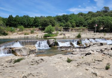
les cascades du Sautadet


Walking
Easy
La Roque-sur-Cèze,
Occitania,
Gard,
France

8.6 km | 12.3 km-effort
2h 39min
Yes


 SityTrail


