


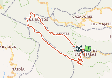


17.6 km | 29 km-effort


User GUIDE


FREE GPS app for hiking
 SityTrail
IGN / Geographical institutes
SityTrail World
The world is yours!
Trail Walking of 11.5 km to be discovered at Canary Islands, Las Palmas, Agüimes. This trail is proposed by blechanteur.
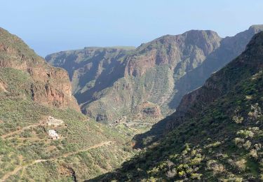
superbe randonnée qui alterne un départ escarpé avec un plateau très agréable, une forêt aérée la caldéra originale, le retour en descente constante en mode "roue llibre"
Walking

On foot

Walking
Walking
Walking