![](/images/other/stat-length.png)
![Trail Walking Villedômer - Villedomer - Étang de l'Arche - Photo](https://media.geolcdn.com/t/1900/400/cc6a816a-f3f4-48e1-b54d-93d3dbb3b0cd.jpg&format=pjpeg&maxdim=2)
Villedomer - Étang de l'Arche
guydu41
User
![Length](/images/other/stat-length.png)
![Max alt](https://static1.geolcdn.com/siteimages/upload/files/1508320355ic_sort_altitude_max_24dp.png)
![Uphill gradient](https://static1.geolcdn.com/siteimages/upload/files/1508320355ic_sort_den_pos_24dp.png)
![Km-Effort](/images/other/stat-length.png)
![Min alt](https://static1.geolcdn.com/siteimages/upload/files/1508320355ic_sort_altitude_min_24dp.png)
![Downhill gradient](https://static1.geolcdn.com/siteimages/upload/files/1508320355ic_sort_den_neg_24dp.png)
![Boucle](https://static1.geolcdn.com/siteimages/upload/files/16400158638029165_repeat_loop_refresh_sync_direction_icon.png)
![Walking](https://static1.geolcdn.com/sitytour/trail-icons/101.png)
2h34
Difficulty : Very easy
![Scan this QR Code to open this trail in the SityTrail application](https://capi.geolives.com/qq0zvz2zws4bq2lad0pu/sitytour/trails/3023586/qr.png?size=200)
FREE GPS app for hiking
About
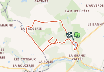
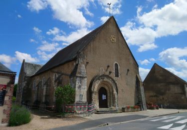
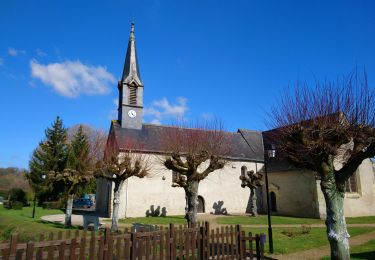
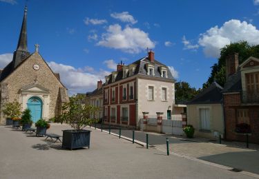
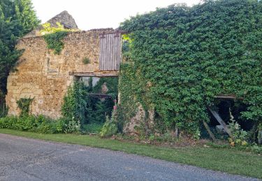
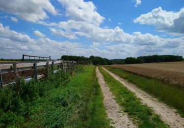
Trail Walking of 8.7 km to be discovered at Centre-Loire Valley, Indre-et-Loire, Villedômer. This trail is proposed by guydu41.
Description
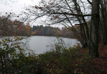
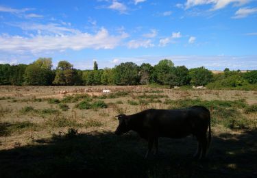
Petite randonnée depuis le parking au bord de l'étang de l'Arche sur la commune de Villedômer.
Traversée d'un ruisseau sur une mini passerelle au milieu d'un bois puis marche au milieu de champs et prairies avant de découvrir les caves Margolines.
Fin du parcours en empruntant des sentiers et chemins montants et descendants autour du très bel étang de l'Arche.
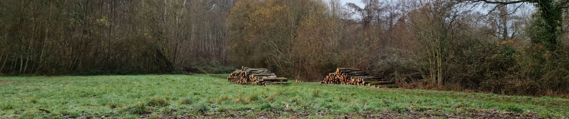
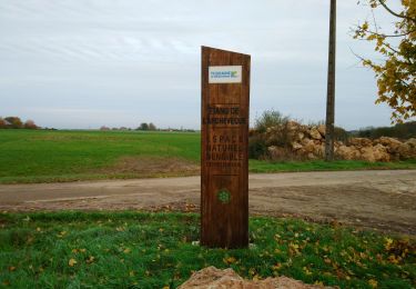
Positioning
Comments
Trails nearby
![Trail Walking Villedômer - la Grand'Vallée - Saint-Laurent-en-Gâtines via PRs - 26.8km 225m 5h35 (35mn) - 2022 12 03 - Photo](https://media.geolcdn.com/t/375/260/8b7d114e-fe4f-44eb-8278-b583e99468bd.jpg&format=jpg&maxdim=2)
![Walking Walking](https://static1.geolcdn.com/sitytour/trail-icons/101.png)
Walking
![](/images/other/stat-length.png)
![](https://static1.geolcdn.com/siteimages/upload/files/16400158638029165_repeat_loop_refresh_sync_direction_icon.png)
![Trail Walking Villedômer - Étang de l'Archevêque - Crotelles la Grand' Vallée - 20.3km 215m 4h25 (35mn) - 2022 11 26 - Photo](https://media.geolcdn.com/t/375/260/8eae5aaa-0c3c-4826-a622-21410b89935e.jpg&format=jpg&maxdim=2)
![Walking Walking](https://static1.geolcdn.com/sitytour/trail-icons/101.png)
Walking
![](/images/other/stat-length.png)
![](https://static1.geolcdn.com/siteimages/upload/files/16400158638029165_repeat_loop_refresh_sync_direction_icon.png)
![Trail Walking Auzouer-en-Touraine - Auzouer-en-Touraine - Circuit Bec Sec variante - 18.4km 220m 4h10 (30mn) - 2022 09 06 - Photo](https://media.geolcdn.com/t/375/260/38a4be1b-598c-4a27-bdce-82573aabedf8.jpg&format=jpg&maxdim=2)
![Walking Walking](https://static1.geolcdn.com/sitytour/trail-icons/101.png)
Walking
![](/images/other/stat-length.png)
![](https://static1.geolcdn.com/siteimages/upload/files/16400158638029165_repeat_loop_refresh_sync_direction_icon.png)
![Trail Walking Château-Renault - Château-Renault - GR655ouest Villechauve - 21.9km 235m 4h55 (30mn) - 2021 10 23 - Photo](https://media.geolcdn.com/t/375/260/f56af21b-37d8-43a1-8e30-6f94c58a9a00.jpg&format=jpg&maxdim=2)
![Walking Walking](https://static1.geolcdn.com/sitytour/trail-icons/101.png)
Walking
![](/images/other/stat-length.png)
![](https://static1.geolcdn.com/siteimages/upload/files/16400158638029165_repeat_loop_refresh_sync_direction_icon.png)
![Trail Walking Auzouer-en-Touraine - Auzouer-en-Touraine - circuit de la Quintaine - 12.7km 150m 2h40 - 2021 07 06 - Photo](https://media.geolcdn.com/t/375/260/3b343954-d302-40ba-b336-fb9df6b89cbf.jpg&format=jpg&maxdim=2)
![Walking Walking](https://static1.geolcdn.com/sitytour/trail-icons/101.png)
Walking
![](/images/other/stat-length.png)
![](https://static1.geolcdn.com/siteimages/upload/files/16400158638029165_repeat_loop_refresh_sync_direction_icon.png)
![Trail Walking Crotelles - Crotelles - PR avec variante - 21.4km 285m 4h35 (30mn) - 2021 03 20 - Photo](https://media.geolcdn.com/t/375/260/bceaf6e3-80b3-4324-91c6-ae12af2bbf7f.jpg&format=jpg&maxdim=2)
![Walking Walking](https://static1.geolcdn.com/sitytour/trail-icons/101.png)
Walking
![](/images/other/stat-length.png)
![](https://static1.geolcdn.com/siteimages/upload/files/16400158638029165_repeat_loop_refresh_sync_direction_icon.png)
![Trail Walking Villedômer - Villedômer - Le sentier des Bois - 22.4km 265m 5h05 (25mn) - 2019 08 10 - Photo](https://media.geolcdn.com/t/375/260/bf722cc0-91b1-46aa-bfeb-b4446fdcac70.jpg&format=jpg&maxdim=2)
![Walking Walking](https://static1.geolcdn.com/sitytour/trail-icons/101.png)
Walking
![](/images/other/stat-length.png)
![](https://static1.geolcdn.com/siteimages/upload/files/16400158638029165_repeat_loop_refresh_sync_direction_icon.png)
![Trail Walking Villedômer - Villedômer - Photo](https://media.geolcdn.com/t/375/260/01205bfa-a16a-4b1b-9536-49c99ad5bf3a.jpg&format=jpg&maxdim=2)
![Walking Walking](https://static1.geolcdn.com/sitytour/trail-icons/101.png)
Walking
![](/images/other/stat-length.png)
![](https://static1.geolcdn.com/siteimages/upload/files/16400158638029165_repeat_loop_refresh_sync_direction_icon.png)
![Trail Walking Neuillé-le-Lierre - Neuillé-le-Lierre - Château-Renault - 25.4km 300m 5h00 (30mn) - 2019 02 16 - Photo](https://media.geolcdn.com/t/375/260/1825a49e-9bcd-4895-83ba-af7468c33b8b.jpg&format=jpg&maxdim=2)
![Walking Walking](https://static1.geolcdn.com/sitytour/trail-icons/101.png)
Walking
![](/images/other/stat-length.png)
![](https://static1.geolcdn.com/siteimages/upload/files/16400158638029165_repeat_loop_refresh_sync_direction_icon.png)