![](/images/other/stat-length.png)
![Trail Walking Ornans - Bonnevaux du bas - Photo](https://media.geolcdn.com/t/1900/400/f1a73fb1-33ec-44c3-99b5-796ebfd85180.jpg&format=pjpeg&maxdim=2)
Bonnevaux du bas
eltonnermou
User
![Length](/images/other/stat-length.png)
![Max alt](https://static1.geolcdn.com/siteimages/upload/files/1508320355ic_sort_altitude_max_24dp.png)
![Uphill gradient](https://static1.geolcdn.com/siteimages/upload/files/1508320355ic_sort_den_pos_24dp.png)
![Km-Effort](/images/other/stat-length.png)
![Min alt](https://static1.geolcdn.com/siteimages/upload/files/1508320355ic_sort_altitude_min_24dp.png)
![Downhill gradient](https://static1.geolcdn.com/siteimages/upload/files/1508320355ic_sort_den_neg_24dp.png)
![Boucle](https://static1.geolcdn.com/siteimages/upload/files/16400158638029165_repeat_loop_refresh_sync_direction_icon.png)
![Walking](https://static1.geolcdn.com/sitytour/trail-icons/101.png)
4h30
Difficulty : Medium
![Scan this QR Code to open this trail in the SityTrail application](https://capi.geolives.com/qq0zvz2zws4bq2lad0pu/sitytour/trails/3022261/qr.png?size=200)
FREE GPS app for hiking
About
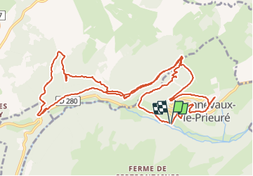
Trail Walking of 14.4 km to be discovered at Bourgogne-Franche-Comté, Doubs, Ornans. This trail is proposed by eltonnermou.
Description
parking proximité du cimetière près des vestiges de l'église (proche du poteau balise).
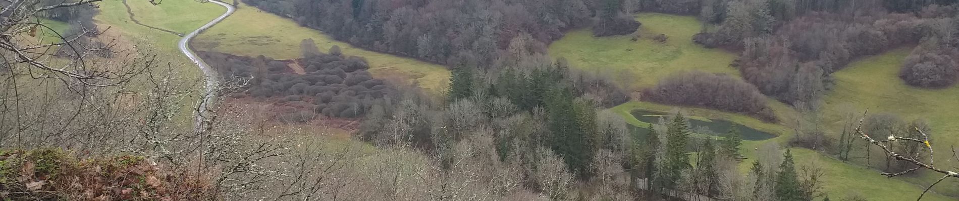
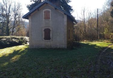
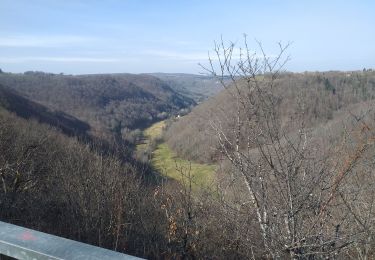
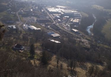
Cette très belle randonnée pédestre vous entrainera à travers différents paysages. De beaux points de vues sur le plateau et la vallée. 2 montées engageantes pas trop longues, des passages, non sécurisés en corniches = bâtons et bonnes chaussures conseillés ; une grande variété de milieux traversés. Vous emprunterez l'ancienne voie du tacot et traverserez un tunnel (180m de long) éclairé. A partir du km 7 (environ) quand vous quitterez la D280 à main droite, suivre cette sente à la montée très, très raide (bâtons obligatoires) pour rejoindre un sentier plus confortable que vous prendrez en partant à droite, et le suivre jusqu'à atteindre un croisement (sur le plat) et prendrez à droite pour rejoindre les prés ( la trace est aléatoire sur cet itinéraire, la cause n'en n'est pas identifiée). Vous repasserez au dessus du tunnel et suivrez la crête sur plusieurs km.
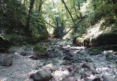
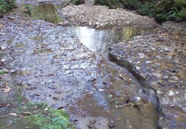
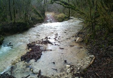
Puis, de la grotte de plaisir fontaine jusqu'à la départementale, vous longez le ruisseau, avec sa pisciculture (les produits : filets de truite, terrine, ... y sont excellents) et le bar/restaurant.
Avec un peu de chance, vous surprendrez des chamois sur les pentes escarpées du secteur (j'en ai admiré en 2 groupes une petite dizaine). Vous pourrez apprécier la diversité de la flore et profiter d'un parcours ombragé et très agréable.
Positioning
Comments
Trails nearby
![Trail Walking Ornans - Votre-dame du chêne - Photo](https://media.geolcdn.com/t/375/260/c7bb9265-b47a-4388-88e0-f95f4287d390.jpg&format=jpg&maxdim=2)
![Walking Walking](https://static1.geolcdn.com/sitytour/trail-icons/101.png)
Walking
![](/images/other/stat-length.png)
![](https://static1.geolcdn.com/siteimages/upload/files/16400158638029165_repeat_loop_refresh_sync_direction_icon.png)
![Trail Walking Ornans - ornans belvédère château - Photo](https://media.geolcdn.com/t/375/260/ext.jpg?maxdim=2&url=https%3A%2F%2Fstatic1.geolcdn.com%2Fsiteimages%2Fupload%2Ffiles%2F1553511878bg_sport_marche.png)
![Walking Walking](https://static1.geolcdn.com/sitytour/trail-icons/101.png)
Walking
![](/images/other/stat-length.png)
![](https://static1.geolcdn.com/siteimages/upload/files/16400158638029165_repeat_loop_refresh_sync_direction_icon.png)
![Trail Mountain bike Ornans - xtrem'loue 2017 - 15kms - Photo](https://media.geolcdn.com/t/375/260/ext.jpg?maxdim=2&url=https%3A%2F%2Fstatic1.geolcdn.com%2Fsiteimages%2Fupload%2Ffiles%2F1524743154velo.jpg)
![Mountain bike Mountain bike](https://static1.geolcdn.com/sitytour/trail-icons/202.png)
Mountain bike
![](/images/other/stat-length.png)
![](https://static1.geolcdn.com/siteimages/upload/files/16400158638029165_repeat_loop_refresh_sync_direction_icon.png)
![Trail Walking Ornans - ravin du puits noir - Photo](https://media.geolcdn.com/t/375/260/ext.jpg?maxdim=2&url=https%3A%2F%2Fstatic1.geolcdn.com%2Fsiteimages%2Fupload%2Ffiles%2F1553511878bg_sport_marche.png)
![Walking Walking](https://static1.geolcdn.com/sitytour/trail-icons/101.png)
Walking
![](/images/other/stat-length.png)
![](https://static1.geolcdn.com/siteimages/upload/files/16400158638029165_repeat_loop_refresh_sync_direction_icon.png)
![Trail Walking Ornans - bonnevaux le bas - Photo](https://media.geolcdn.com/t/375/260/5ff62682-efb8-483f-8256-a13a182673fd.jpg&format=jpg&maxdim=2)
![Walking Walking](https://static1.geolcdn.com/sitytour/trail-icons/101.png)
Walking
![](/images/other/stat-length.png)
![](https://static1.geolcdn.com/siteimages/upload/files/16400158638029165_repeat_loop_refresh_sync_direction_icon.png)
![Trail Walking Guyans-Durnes - Saules](https://media.geolcdn.com/t/375/260/9d871206-a2dc-4e09-959e-edcf9f164d61.jpg&format=jpg&maxdim=2)
![Walking Walking](https://static1.geolcdn.com/sitytour/trail-icons/101.png)
Walking
![](/images/other/stat-length.png)
![](https://static1.geolcdn.com/siteimages/upload/files/16400158638029165_repeat_loop_refresh_sync_direction_icon.png)
![Trail Walking Ornans - la brème-ornans - Photo](https://media.geolcdn.com/t/375/260/81308a17-509d-403e-8794-e1193f7b651d.jpg&format=jpg&maxdim=2)
![Walking Walking](https://static1.geolcdn.com/sitytour/trail-icons/101.png)
Walking
![](/images/other/stat-length.png)
![](https://static1.geolcdn.com/siteimages/upload/files/16400158638029165_repeat_loop_refresh_sync_direction_icon.png)
![Trail Walking Ornans - Ornans cascade Boneille - Photo](https://media.geolcdn.com/t/375/260/e2490db9-f934-49ee-a993-2eb22588987f.jpg&format=jpg&maxdim=2)
![Walking Walking](https://static1.geolcdn.com/sitytour/trail-icons/101.png)
Walking
![](/images/other/stat-length.png)
![](https://static1.geolcdn.com/siteimages/upload/files/16400158638029165_repeat_loop_refresh_sync_direction_icon.png)
![Trail Walking Ornans - Ornans - Cascades Baume Bourla de la tuffière- Source Bleue 29 déc 2020 CAF - Photo](https://media.geolcdn.com/t/375/260/df218930-367b-4b62-a490-26c81ba12f19.jpg&format=jpg&maxdim=2)
![Walking Walking](https://static1.geolcdn.com/sitytour/trail-icons/101.png)
Walking
![](/images/other/stat-length.png)
![](https://static1.geolcdn.com/siteimages/upload/files/16400158638029165_repeat_loop_refresh_sync_direction_icon.png)