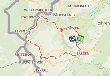
![](/images/other/stat-length.png)
![Trail Walking Monschau - 2021-12-08_18h51m27_791 - Photo](https://media.geolcdn.com/t/1900/400/ext.pjpeg?maxdim=2&url=https%3A%2F%2Fstatic1.geolcdn.com%2Fsiteimages%2Fupload%2Ffiles%2F1553511878bg_sport_marche.png)
2021-12-08_18h51m27_791
mumu.larandonneuse
User GUIDE
![Length](/images/other/stat-length.png)
![Max alt](https://static1.geolcdn.com/siteimages/upload/files/1508320355ic_sort_altitude_max_24dp.png)
![Uphill gradient](https://static1.geolcdn.com/siteimages/upload/files/1508320355ic_sort_den_pos_24dp.png)
![Km-Effort](/images/other/stat-length.png)
![Min alt](https://static1.geolcdn.com/siteimages/upload/files/1508320355ic_sort_altitude_min_24dp.png)
![Downhill gradient](https://static1.geolcdn.com/siteimages/upload/files/1508320355ic_sort_den_neg_24dp.png)
![Boucle](https://static1.geolcdn.com/siteimages/upload/files/16400158638029165_repeat_loop_refresh_sync_direction_icon.png)
![Walking](https://static1.geolcdn.com/sitytour/trail-icons/101.png)
4h36
Difficulty : Difficult
![Scan this QR Code to open this trail in the SityTrail application](https://capi.geolives.com/qq0zvz2zws4bq2lad0pu/sitytour/trails/3021834/qr.png?size=200)
FREE GPS app for hiking
About
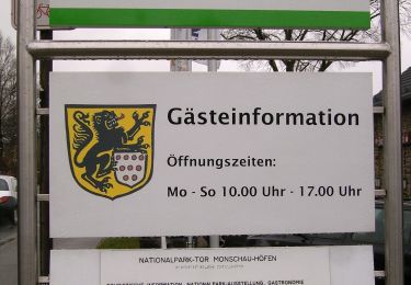
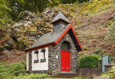
Trail Walking of 15.9 km to be discovered at North Rhine-Westphalia, Städteregion Aachen, Monschau. This trail is proposed by mumu.larandonneuse.
Description
ℹ Gpx pris sur www.wandelgidszuidlimburg.com n° 791.
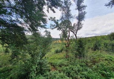
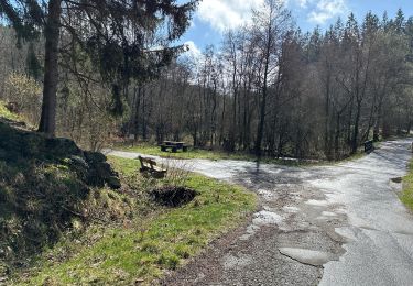
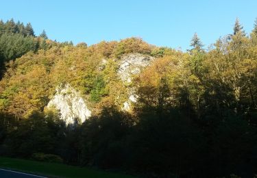
Ce véritable tour de l'Eifel se compose de 2 parties différentes. Pendant la première partie, vous marchez à travers la vallée du Perlenbach, puis vous suivez un sentier aventureux le long de la Rur pendant longtemps. Vous pouvez également monter ici jusqu'au Gipfelkreuz avec un beau panorama. Il peut être marécageux à la Rur après la pluie, alors portez des chaussures de marche hautes. La deuxième partie vous emmène sur une route panoramique avec de belles vues jusqu'au village de Kaltenherberg où vous pourrez faire une pause au restaurant Hirsch. Ensuite, vous redescendez vers le Perlenbach. Le diable est à nouveau dans la queue, car il y a ensuite une autre montée jusqu'au village où vous êtes les bienvenus à l'hôtel-café. Vous devez avoir une bonne mobilité pour cette promenade, prévoyez donc un bâton pour les descentes raides.
.
Positioning
Comments
Trails nearby
![Trail Walking Monschau - 2024-03-28_17h00m40_partnerweg-des-eifelsteigs-narzissenroute (1) - Photo](https://media.geolcdn.com/t/375/260/f78b6422-c27b-477b-b695-82eecbd61b40.jpg&format=jpg&maxdim=2)
![Walking Walking](https://static1.geolcdn.com/sitytour/trail-icons/101.png)
Walking
![](/images/other/stat-length.png)
![](https://static1.geolcdn.com/siteimages/upload/files/16400158638029165_repeat_loop_refresh_sync_direction_icon.png)
![Trail Walking Monschau - Montjoie - Ternell en ligne - Photo](https://media.geolcdn.com/t/375/260/d0229e76-e80b-4ee0-af20-8e96d215cea3.jpg&format=jpg&maxdim=2)
![Walking Walking](https://static1.geolcdn.com/sitytour/trail-icons/101.png)
Walking
![](/images/other/stat-length.png)
![](https://static1.geolcdn.com/siteimages/upload/files/16400158638029165_repeat_loop_refresh_sync_direction_icon.png)
![Trail Walking Bütgenbach - 2021-08-07_23h49m19_kalterherberg - Photo](https://media.geolcdn.com/t/375/260/f30f3eaf-c1e4-41d4-bcfb-42e5cbece161.jpg&format=jpg&maxdim=2)
![Walking Walking](https://static1.geolcdn.com/sitytour/trail-icons/101.png)
Walking
![](/images/other/stat-length.png)
![](https://static1.geolcdn.com/siteimages/upload/files/16400158638029165_repeat_loop_refresh_sync_direction_icon.png)
![Trail Walking Monschau - rando kalterherberg-rocher bieley 11/08/2021 - Photo](https://media.geolcdn.com/t/375/260/b8400c0e-5378-474d-9c63-b53205ca548b.jpg&format=jpg&maxdim=2)
![Walking Walking](https://static1.geolcdn.com/sitytour/trail-icons/101.png)
Walking
![](/images/other/stat-length.png)
![](https://static1.geolcdn.com/siteimages/upload/files/16400158638029165_repeat_loop_refresh_sync_direction_icon.png)
![Trail Walking Monschau - Rando Eifel des jonquilles narcisses 18,3 - Photo](https://media.geolcdn.com/t/375/260/29cf751c-7851-449b-b365-4b88ea56faf3.jpg&format=jpg&maxdim=2)
![Walking Walking](https://static1.geolcdn.com/sitytour/trail-icons/101.png)
Walking
![](/images/other/stat-length.png)
![](https://static1.geolcdn.com/siteimages/upload/files/16400158638029165_repeat_loop_refresh_sync_direction_icon.png)
![Trail On foot Monschau - Eifelverein Rohren - Weg 57 - Photo](https://media.geolcdn.com/t/375/260/a620ba14-736e-46ad-b0d4-965dfc1d4df3.jpeg&format=jpg&maxdim=2)
![On foot On foot](https://static1.geolcdn.com/sitytour/trail-icons/100.png)
On foot
![](/images/other/stat-length.png)
![](https://static1.geolcdn.com/siteimages/upload/files/16400158638029165_repeat_loop_refresh_sync_direction_icon.png)
![Trail On foot Simmerath - Heckenlandroute - Photo](https://media.geolcdn.com/t/375/260/6d3ab88b-1108-44d4-b0fa-bf155c1861af.jpeg&format=jpg&maxdim=2)
![On foot On foot](https://static1.geolcdn.com/sitytour/trail-icons/100.png)
On foot
![](/images/other/stat-length.png)
![](https://static1.geolcdn.com/siteimages/upload/files/16400158638029165_repeat_loop_refresh_sync_direction_icon.png)
![Trail On foot Monschau - Monschauer Nationalpark-Wanderweg](https://media.geolcdn.com/t/375/260/6ecae744-a5e1-4d67-8c65-d4bc2433654d.jpeg&format=jpg&maxdim=2)
![On foot On foot](https://static1.geolcdn.com/sitytour/trail-icons/100.png)
On foot
![](/images/other/stat-length.png)
![](https://static1.geolcdn.com/siteimages/upload/files/16400158638029165_repeat_loop_refresh_sync_direction_icon.png)
![Trail On foot Monschau - Narzissenroute Höfen (Eifel) - Photo](https://media.geolcdn.com/t/375/260/4209bd6d-0e5a-4c94-aa91-ecdefe50dbb3.jpeg&format=jpg&maxdim=2)
![On foot On foot](https://static1.geolcdn.com/sitytour/trail-icons/100.png)
On foot
![](/images/other/stat-length.png)
![](https://static1.geolcdn.com/siteimages/upload/files/16400158638029165_repeat_loop_refresh_sync_direction_icon.png)