![](/images/other/stat-length.png)
![Trail Walking Ousté - SAINT CRÉAC le soum de Trémou reco - Photo](https://media.geolcdn.com/t/1900/400/a98a900a-30ee-4911-939d-ee970c5781d5.jpg&format=pjpeg&maxdim=2)
SAINT CRÉAC le soum de Trémou reco
marmotte65
User GUIDE
![Length](/images/other/stat-length.png)
![Max alt](https://static1.geolcdn.com/siteimages/upload/files/1508320355ic_sort_altitude_max_24dp.png)
![Uphill gradient](https://static1.geolcdn.com/siteimages/upload/files/1508320355ic_sort_den_pos_24dp.png)
![Km-Effort](/images/other/stat-length.png)
![Min alt](https://static1.geolcdn.com/siteimages/upload/files/1508320355ic_sort_altitude_min_24dp.png)
![Downhill gradient](https://static1.geolcdn.com/siteimages/upload/files/1508320355ic_sort_den_neg_24dp.png)
![Boucle](https://static1.geolcdn.com/siteimages/upload/files/16400158638029165_repeat_loop_refresh_sync_direction_icon.png)
![Walking](https://static1.geolcdn.com/sitytour/trail-icons/101.png)
3h41
Difficulty : Difficult
![Scan this QR Code to open this trail in the SityTrail application](https://capi.geolives.com/qq0zvz2zws4bq2lad0pu/sitytour/trails/3021785/qr.png?size=200)
FREE GPS app for hiking
About
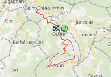
Trail Walking of 11.2 km to be discovered at Occitania, Hautespyrenees, Ousté. This trail is proposed by marmotte65.
Description
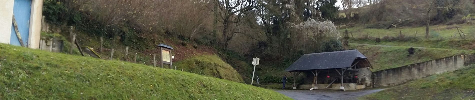
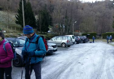
Compte tenu des rigueurs météo nous avons opté pour un départ de OUSTE en boucle par OURDON et le soum de Tremou.
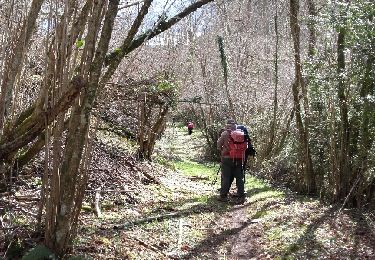
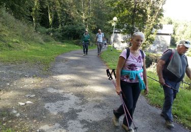
et puisque la pluie n'a pas voulue de nous nous avons fait un A/R OUSTE / SAINT-CREAC / OUSTE.
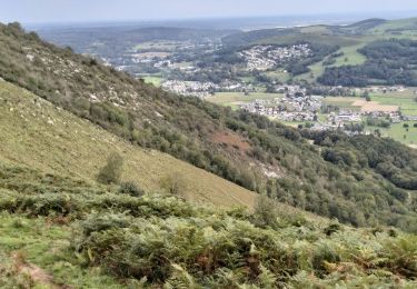
ceci n'était qu'une reco la rando G3 est prévue le 17/12/2021 dernière rando de l'année avant les festivités en comité restreins.
bonne fin d'année à tout le monde.
Le départ se fera de SAINT-CREAC / OUSTE / OURDON / OUSTE / SAINT-CREAC
Positioning
Comments
Trails nearby
![Trail Walking Ourdis-Cotdoussan - OURDIS Cotdoussan le pic de la clique-fait 933294 (fait le 30/03/2018)](https://media.geolcdn.com/t/375/260/ext.jpg?maxdim=2&url=https%3A%2F%2Fservices.sitytrail.com%2FGeolivesWS%2FDownloadMedia.ashx%3FTrailID%3D933294%26Media%3Dfix__20180330154214.jpg)
![Walking Walking](https://static1.geolcdn.com/sitytour/trail-icons/101.png)
Walking
![](/images/other/stat-length.png)
![](https://static1.geolcdn.com/siteimages/upload/files/16400158638029165_repeat_loop_refresh_sync_direction_icon.png)
![Trail Equestrian Lourdes - GERMS SUR L'OUSSOUET - Photo](https://media.geolcdn.com/t/375/260/ext.jpg?maxdim=2&url=https%3A%2F%2Fstatic1.geolcdn.com%2Fsiteimages%2Fupload%2Ffiles%2F1524743154cheval.jpg)
![Equestrian Equestrian](https://static1.geolcdn.com/sitytour/trail-icons/300.png)
Equestrian
![](/images/other/stat-length.png)
![](https://static1.geolcdn.com/siteimages/upload/files/16400158638029165_repeat_loop_refresh_sync_direction_icon.png)
![Trail Walking Lourdes - 65-lourdes-pic-jer-via-AYNE-14km-450m - Photo](https://media.geolcdn.com/t/375/260/edfe9827-bfa7-45cb-8900-3f3f61682c3a.jpg&format=jpg&maxdim=2)
![Walking Walking](https://static1.geolcdn.com/sitytour/trail-icons/101.png)
Walking
![](/images/other/stat-length.png)
![](https://static1.geolcdn.com/siteimages/upload/files/16400158638029165_repeat_loop_refresh_sync_direction_icon.png)
![Trail Walking Saint-Créac - SAINT CRÉAC soum de Tremou BF de Guy G3 - Photo](https://media.geolcdn.com/t/375/260/9d594086-7588-47fe-9248-f3484a1a71e9.jpg&format=jpg&maxdim=2)
![Walking Walking](https://static1.geolcdn.com/sitytour/trail-icons/101.png)
Walking
![](/images/other/stat-length.png)
![](https://static1.geolcdn.com/siteimages/upload/files/16400158638029165_repeat_loop_refresh_sync_direction_icon.png)
![Trail Walking Lourdes - Pic du Jer - Photo](https://media.geolcdn.com/t/375/260/2ec92ca4-bc0f-4457-b492-963919b92b1f.jpg&format=jpg&maxdim=2)
![Walking Walking](https://static1.geolcdn.com/sitytour/trail-icons/101.png)
Walking
![](/images/other/stat-length.png)
![](https://static1.geolcdn.com/siteimages/upload/files/16400158638029165_repeat_loop_refresh_sync_direction_icon.png)
![Trail Walking Lourdes - LOURDES le Beout autrement 2955824 - Photo](https://media.geolcdn.com/t/375/260/988997aa-10d6-47b9-8be8-5078e4de55b9.jpg&format=jpg&maxdim=2)
![Walking Walking](https://static1.geolcdn.com/sitytour/trail-icons/101.png)
Walking
![](/images/other/stat-length.png)
![](https://static1.geolcdn.com/siteimages/upload/files/16400158638029165_repeat_loop_refresh_sync_direction_icon.png)
![Trail Walking Jarret - Ayné Tucoulet G3 fait - Photo](https://media.geolcdn.com/t/375/260/43c76f91-9f44-4523-ab6a-7e7ca17239e5.jpg&format=jpg&maxdim=2)
![Walking Walking](https://static1.geolcdn.com/sitytour/trail-icons/101.png)
Walking
![](/images/other/stat-length.png)
![](https://static1.geolcdn.com/siteimages/upload/files/16400158638029165_repeat_loop_refresh_sync_direction_icon.png)
![Trail Walking Saint-Créac - sous de très G3 FAIT - Photo](https://media.geolcdn.com/t/375/260/daa3fd33-d145-4433-a673-26c6e5ebdf86.jpg&format=jpg&maxdim=2)
![Walking Walking](https://static1.geolcdn.com/sitytour/trail-icons/101.png)
Walking
![](/images/other/stat-length.png)
![](https://static1.geolcdn.com/siteimages/upload/files/16400158638029165_repeat_loop_refresh_sync_direction_icon.png)
![Trail Walking Geu - De Geu à Lias - Photo](https://media.geolcdn.com/t/375/260/ext.jpg?maxdim=2&url=https%3A%2F%2Fservices.sitytrail.com%2FGeolivesWS%2FDownloadMedia.ashx%3FTrailID%3D317825%26Media%3D17175_6.jpg)
![Walking Walking](https://static1.geolcdn.com/sitytour/trail-icons/101.png)
Walking
![](/images/other/stat-length.png)
![](https://static1.geolcdn.com/siteimages/upload/files/16400158638029165_repeat_loop_refresh_sync_direction_icon.png)