Trail Walking Monétay-sur-Loire - Monetay sur Loire  - Photo
© OpenStreetMap contributors
Length
Length
16.3 km
Max alt
Max alt
293 m
Uphill gradient
Uphill gradient
218 m
Km-Effort
Km-Effort  
19.2 km
Min alt
Min alt
237 m
Downhill gradient
Downhill gradient
218 m
Boucle
Boucle
Yes
Creation date :
2021-12-07 07:57:03.55
Updated on :
2021-12-08 12:29:30.578

(0 Reviews)

Walking
Walking
5h08
Difficulty : Medium

Scan this QR Code to open this trail in the SityTrail application

FREE GPS app for hiking

Logo SityTrail SityTrail

IGN / Geographical institutes

Download SityTrail from the App Store Download SityTrail from Google Play

Logo SityTrail SityTrail World

The world is yours!

Download SityTrail from the App Store Download SityTrail from Google Play Download SityTrail on Huawei AppGallery

About

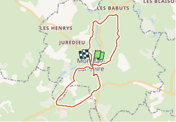
Trail Walking of 16.3 km to be discovered at Auvergne-Rhône-Alpes, Allier, Monétay-sur-Loire. This trail is proposed by Praticrando.

Description

Randonnée par monts et par vaux autour de Monetay sur Loire.  Peut être partagée en deux Randonnée de 8 kms environ

Elevation profile

Positioning

Country:
France
Region :
Auvergne-Rhône-Alpes
Department/Province :
Allier
Municipality :
Monétay-sur-Loire
Location:
Unknown
Start:(UTM)
562829 ; 5142107 (31T) N.

Trails nearby

Trail Walking Monétay-sur-Loire - Monétay Sur Loire - Photo
Walking
jfdeligementon

Walking

Easy
Monétay-sur-Loire, Auvergne-Rhône-Alpes, Allier, France
8.7 km | 10.5 km-effort
2h 15min
Yes


Close
My subscriptions