


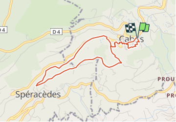

7.3 km | 10.3 km-effort


User


FREE GPS app for hiking
 SityTrail
IGN / Geographical institutes
SityTrail World
The world is yours!
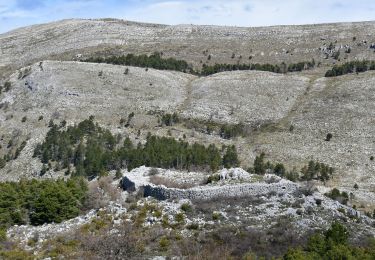
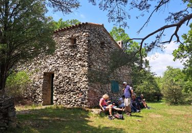
Trail Walking of 4.6 km to be discovered at Provence-Alpes-Côte d'Azur, Maritime Alps, Cabris. This trail is proposed by santaflor.
Depuis le pré, traverser le joli village de Cabris pour découvrir ses contreforts ,au milieu de la campagne méditerranéenne, orientés vers Spéracèdes et Peymeinade .
On foot

Walking

On foot
On foot

Mountain bike
Walking
Walking
Walking
Walking