![](/images/other/stat-length.png)
La Plaine de Caille
jlrayon
User
![Length](/images/other/stat-length.png)
Length
11 km
![Max alt](https://static1.geolcdn.com/siteimages/upload/files/1508320355ic_sort_altitude_max_24dp.png)
Max alt
1222 m
![Uphill gradient](https://static1.geolcdn.com/siteimages/upload/files/1508320355ic_sort_den_pos_24dp.png)
Uphill gradient
225 m
![Km-Effort](/images/other/stat-length.png)
Km-Effort
14 km
![Min alt](https://static1.geolcdn.com/siteimages/upload/files/1508320355ic_sort_altitude_min_24dp.png)
Min alt
1121 m
![Downhill gradient](https://static1.geolcdn.com/siteimages/upload/files/1508320355ic_sort_den_neg_24dp.png)
Downhill gradient
228 m
![Boucle](https://static1.geolcdn.com/siteimages/upload/files/16400158638029165_repeat_loop_refresh_sync_direction_icon.png)
Boucle
Yes
Creation date :
2021-11-26 08:36:23.076
Updated on :
2021-11-27 15:25:18.67
![Walking](https://static1.geolcdn.com/sitytour/trail-icons/101.png)
5h43
Difficulty : Easy
![Scan this QR Code to open this trail in the SityTrail application](https://capi.geolives.com/qq0zvz2zws4bq2lad0pu/sitytour/trails/3013135/qr.png?size=200)
FREE GPS app for hiking
About
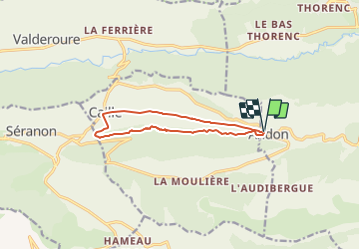
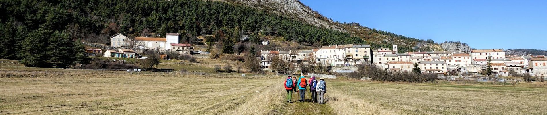
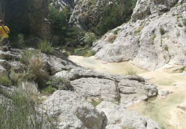
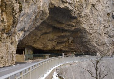
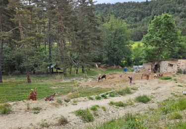
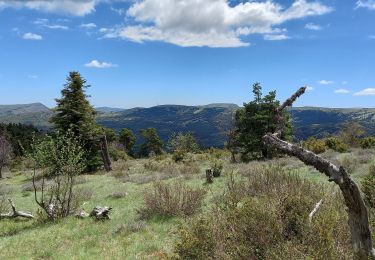
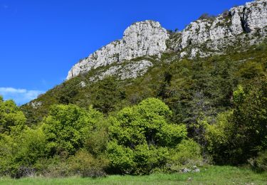
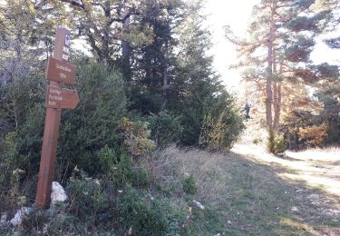
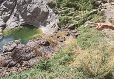
Trail Walking of 11 km to be discovered at Provence-Alpes-Côte d'Azur, Maritime Alps, Andon. This trail is proposed by jlrayon.
Description
Tour du poljé (=dépression karstique à fond plat) de la plaine de Caille au départ d'Andon.
Allée par la forêt de "La Faourée" retour par le bois de "Le Serre".
Positioning
Country:
France
Region :
Provence-Alpes-Côte d'Azur
Department/Province :
Maritime Alps
Municipality :
Andon
Location:
Unknown
Start:(Dec)
Start:(UTM)
321693 ; 4849161 (32T) N.
Comments
Trails nearby
![Trail Walking Escragnolles - Casade du Ray (Clars) depuis les Gallants - Photo](https://media.geolcdn.com/t/375/260/a42f38d6-7773-4eff-b635-6c5634fe1592.jpg&format=jpg&maxdim=2)
![Walking Walking](https://static1.geolcdn.com/sitytour/trail-icons/101.png)
Casade du Ray (Clars) depuis les Gallants
Walking
Very easy
(1)
Escragnolles,
Provence-Alpes-Côte d'Azur,
Maritime Alps,
France
![](/images/other/stat-length.png)
938 m | 1.3 km-effort
20min
![](https://static1.geolcdn.com/siteimages/upload/files/16400158638029165_repeat_loop_refresh_sync_direction_icon.png)
No
![Trail Walking Escragnolles - escragnolles mourine - Photo](https://media.geolcdn.com/t/375/260/6cf5f747-cefb-423b-ae55-31ddf95937fc.jpg&format=jpg&maxdim=2)
![Walking Walking](https://static1.geolcdn.com/sitytour/trail-icons/101.png)
escragnolles mourine
Walking
Difficult
Escragnolles,
Provence-Alpes-Côte d'Azur,
Maritime Alps,
France
![](/images/other/stat-length.png)
10.9 km | 17.7 km-effort
5h 54min
![](https://static1.geolcdn.com/siteimages/upload/files/16400158638029165_repeat_loop_refresh_sync_direction_icon.png)
Yes
![Trail On foot Caille - Grand tour du haut Estéron - Etape 5 - Photo](https://media.geolcdn.com/t/375/260/e0be63bf-1b07-4796-9aef-aaad8742cfa1.jpeg&format=jpg&maxdim=2)
![On foot On foot](https://static1.geolcdn.com/sitytour/trail-icons/100.png)
Grand tour du haut Estéron - Etape 5
On foot
Difficult
Caille,
Provence-Alpes-Côte d'Azur,
Maritime Alps,
France
![](/images/other/stat-length.png)
19.3 km | 32 km-effort
7h 13min
![](https://static1.geolcdn.com/siteimages/upload/files/16400158638029165_repeat_loop_refresh_sync_direction_icon.png)
No
![Trail On foot Escragnolles - Plateau de Briasq - Photo](https://media.geolcdn.com/t/375/260/3318d519-9f3b-4858-a9ae-b470b623f859.jpeg&format=jpg&maxdim=2)
![On foot On foot](https://static1.geolcdn.com/sitytour/trail-icons/100.png)
Plateau de Briasq
On foot
Medium
Escragnolles,
Provence-Alpes-Côte d'Azur,
Maritime Alps,
France
![](/images/other/stat-length.png)
14.1 km | 22 km-effort
4h 56min
![](https://static1.geolcdn.com/siteimages/upload/files/16400158638029165_repeat_loop_refresh_sync_direction_icon.png)
Yes
![Trail Walking Andon - L'Audibergue du Pont du Loup - Photo](https://media.geolcdn.com/t/375/260/461a541c-f76c-4a15-9b4e-2811bf184191.jpg&format=jpg&maxdim=2)
![Walking Walking](https://static1.geolcdn.com/sitytour/trail-icons/101.png)
L'Audibergue du Pont du Loup
Walking
Easy
Andon,
Provence-Alpes-Côte d'Azur,
Maritime Alps,
France
![](/images/other/stat-length.png)
10 km | 16.2 km-effort
5h 21min
![](https://static1.geolcdn.com/siteimages/upload/files/16400158638029165_repeat_loop_refresh_sync_direction_icon.png)
Yes
![Trail Walking Andon - Lac de Thorenc - Photo](https://media.geolcdn.com/t/375/260/10cee014-c536-450b-95b9-87eb20ea089c.jpg&format=jpg&maxdim=2)
![Walking Walking](https://static1.geolcdn.com/sitytour/trail-icons/101.png)
Lac de Thorenc
Walking
Difficult
Andon,
Provence-Alpes-Côte d'Azur,
Maritime Alps,
France
![](/images/other/stat-length.png)
11.5 km | 17.7 km-effort
6h 12min
![](https://static1.geolcdn.com/siteimages/upload/files/16400158638029165_repeat_loop_refresh_sync_direction_icon.png)
Yes
![Walking Walking](https://static1.geolcdn.com/sitytour/trail-icons/101.png)
Andon - Pk Pont du Loup - Le Castellaras - Château des 4 Tours
Walking
Medium
Andon,
Provence-Alpes-Côte d'Azur,
Maritime Alps,
France
![](/images/other/stat-length.png)
15.6 km | 25 km-effort
5h 37min
![](https://static1.geolcdn.com/siteimages/upload/files/16400158638029165_repeat_loop_refresh_sync_direction_icon.png)
Yes
![Trail Walking Andon - Pont du loup, Andon Castellaras - Photo](https://media.geolcdn.com/t/375/260/49da9b68-a5af-4ed4-8d88-1d60f2a5514d.jpg&format=jpg&maxdim=2)
![Walking Walking](https://static1.geolcdn.com/sitytour/trail-icons/101.png)
Pont du loup, Andon Castellaras
Walking
Medium
Andon,
Provence-Alpes-Côte d'Azur,
Maritime Alps,
France
![](/images/other/stat-length.png)
12.5 km | 21 km-effort
4h 44min
![](https://static1.geolcdn.com/siteimages/upload/files/16400158638029165_repeat_loop_refresh_sync_direction_icon.png)
Yes
![Trail Walking Escragnolles - Cascade de Clars Les Galans Escragnolle - Photo](https://media.geolcdn.com/t/375/260/aa611d93-3044-456d-a50b-82d77faee19e.jpg&format=jpg&maxdim=2)
![Walking Walking](https://static1.geolcdn.com/sitytour/trail-icons/101.png)
Cascade de Clars Les Galans Escragnolle
Walking
Medium
(1)
Escragnolles,
Provence-Alpes-Côte d'Azur,
Maritime Alps,
France
![](/images/other/stat-length.png)
8.9 km | 13.3 km-effort
4h 20min
![](https://static1.geolcdn.com/siteimages/upload/files/16400158638029165_repeat_loop_refresh_sync_direction_icon.png)
Yes