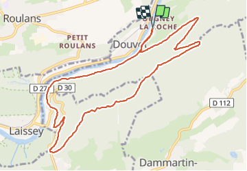
![](/images/other/stat-length.png)
![Trail Walking Ougney-Douvot - ougney la Roche (douvot) - Photo](https://media.geolcdn.com/t/1900/400/532e6234-3db8-43f6-834f-754785112099.jpg&format=pjpeg&maxdim=2)
ougney la Roche (douvot)
eltonnermou
User
![Length](/images/other/stat-length.png)
![Max alt](https://static1.geolcdn.com/siteimages/upload/files/1508320355ic_sort_altitude_max_24dp.png)
![Uphill gradient](https://static1.geolcdn.com/siteimages/upload/files/1508320355ic_sort_den_pos_24dp.png)
![Km-Effort](/images/other/stat-length.png)
![Min alt](https://static1.geolcdn.com/siteimages/upload/files/1508320355ic_sort_altitude_min_24dp.png)
![Downhill gradient](https://static1.geolcdn.com/siteimages/upload/files/1508320355ic_sort_den_neg_24dp.png)
![Boucle](https://static1.geolcdn.com/siteimages/upload/files/16400158638029165_repeat_loop_refresh_sync_direction_icon.png)
![Walking](https://static1.geolcdn.com/sitytour/trail-icons/101.png)
1h54
Difficulty : Easy
![Scan this QR Code to open this trail in the SityTrail application](https://capi.geolives.com/qq0zvz2zws4bq2lad0pu/sitytour/trails/3011372/qr.png?size=200)
FREE GPS app for hiking
About
Trail Walking of 11.7 km to be discovered at Bourgogne-Franche-Comté, Doubs, Ougney-Douvot. This trail is proposed by eltonnermou.
Description
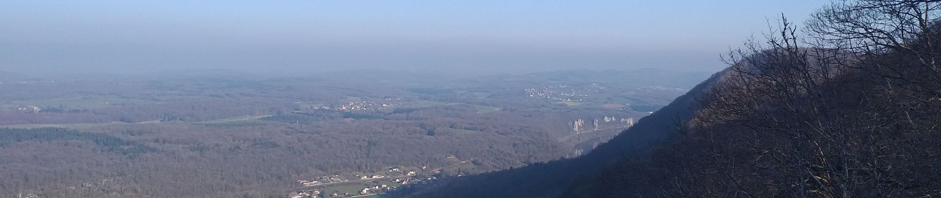
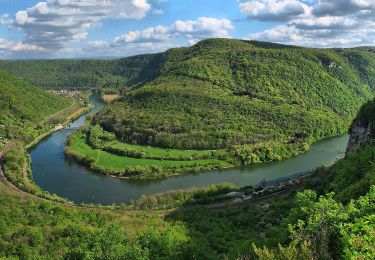
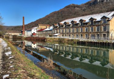
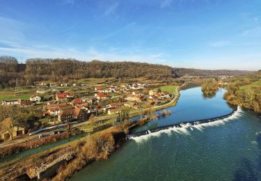
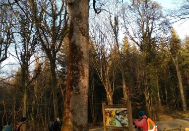
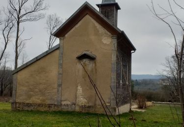
Cette très belle randonnée pédestre vous entrainera à travers différents paysages. Beaucoup de beaux points de vues sur la vallée du Doubs (de Baume les dames à Besançon), sur le mont Souvence et sur le mont notre dame d'Aigremont, puis sur des éoliennes. A l'aller et au retour vous longez le doubs avec ses hérons cendrés, cormorans et autres canards. Un petit défilé entre roches, fort sympathique. Une vue du château de Roulans peu habituelle.
Avec un peu de chance, vous surprendrez des chamois sur les pentes escarpées du secteur. Vous pourrez apprécier la diversité de la flore et profiter (suivant la saison) d'un parcours ombragé et très agréable au bord de l'eau.
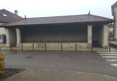
Positioning
Comments
Trails nearby
![Trail Walking Dammartin-les-Templiers - dammartin les templiers - Photo](https://media.geolcdn.com/t/375/260/c2bd0938-453f-48b0-b513-762bbdd613a3.jpg&format=jpg&maxdim=2)
![Walking Walking](https://static1.geolcdn.com/sitytour/trail-icons/101.png)
Walking
![](/images/other/stat-length.png)
![](https://static1.geolcdn.com/siteimages/upload/files/16400158638029165_repeat_loop_refresh_sync_direction_icon.png)
![Trail On foot Deluz - Sentier du Château Loriot - Photo](https://media.geolcdn.com/t/375/260/a6c0a960-bcfb-4e05-ab1e-cb250b6d6d40.jpeg&format=jpg&maxdim=2)
![On foot On foot](https://static1.geolcdn.com/sitytour/trail-icons/100.png)
On foot
![](/images/other/stat-length.png)
![](https://static1.geolcdn.com/siteimages/upload/files/16400158638029165_repeat_loop_refresh_sync_direction_icon.png)
![Trail On foot Deluz - Sentier du Patrimoine - Photo](https://media.geolcdn.com/t/375/260/3858c5b3-abf9-4504-8767-bbab2b7352b8.jpeg&format=jpg&maxdim=2)
![On foot On foot](https://static1.geolcdn.com/sitytour/trail-icons/100.png)
On foot
![](/images/other/stat-length.png)
![](https://static1.geolcdn.com/siteimages/upload/files/16400158638029165_repeat_loop_refresh_sync_direction_icon.png)
![Trail Walking Silley-Bléfond - Silley Blėfond - Photo](https://media.geolcdn.com/t/375/260/72cba853-944f-4e71-a6a4-e1015b10675c.jpg&format=jpg&maxdim=2)
![Walking Walking](https://static1.geolcdn.com/sitytour/trail-icons/101.png)
Walking
![](/images/other/stat-length.png)
![](https://static1.geolcdn.com/siteimages/upload/files/16400158638029165_repeat_loop_refresh_sync_direction_icon.png)
![Trail On foot Champlive - Sentier des Crêtes - Photo](https://media.geolcdn.com/t/375/260/7c732505-4f0b-4f56-a014-1317e06c73a8.jpeg&format=jpg&maxdim=2)
![On foot On foot](https://static1.geolcdn.com/sitytour/trail-icons/100.png)
On foot
![](/images/other/stat-length.png)
![](https://static1.geolcdn.com/siteimages/upload/files/16400158638029165_repeat_loop_refresh_sync_direction_icon.png)
![Trail On foot Bretigney-Notre-Dame - Les Gorges de l'Audeux - Photo](https://media.geolcdn.com/t/375/260/3c4f074e-3673-45a1-aa6d-0738dd54ea67.jpeg&format=jpg&maxdim=2)
![On foot On foot](https://static1.geolcdn.com/sitytour/trail-icons/100.png)
On foot
![](/images/other/stat-length.png)
![](https://static1.geolcdn.com/siteimages/upload/files/16400158638029165_repeat_loop_refresh_sync_direction_icon.png)
![Trail Walking Roulans - Roulans - Photo](https://media.geolcdn.com/t/375/260/2cbbd98c-ccf8-4bac-a479-dbed0aefef86.jpg&format=jpg&maxdim=2)
![Walking Walking](https://static1.geolcdn.com/sitytour/trail-icons/101.png)
Walking
![](/images/other/stat-length.png)
![](https://static1.geolcdn.com/siteimages/upload/files/16400158638029165_repeat_loop_refresh_sync_direction_icon.png)
![Trail Walking Séchin - Sechin 23 janvier 2020 CAF - Photo](https://media.geolcdn.com/t/375/260/9bdc166d-03a0-478f-a63a-eb5267e40a66.jpg&format=jpg&maxdim=2)
![Walking Walking](https://static1.geolcdn.com/sitytour/trail-icons/101.png)
Walking
![](/images/other/stat-length.png)
![](https://static1.geolcdn.com/siteimages/upload/files/16400158638029165_repeat_loop_refresh_sync_direction_icon.png)
![Trail Walking Le Puy - Le Puy - Photo](https://media.geolcdn.com/t/375/260/258f3f3c-c50b-405c-bd68-a6ac42ea325f.jpg&format=jpg&maxdim=2)
![Walking Walking](https://static1.geolcdn.com/sitytour/trail-icons/101.png)
Walking
![](/images/other/stat-length.png)
![](https://static1.geolcdn.com/siteimages/upload/files/16400158638029165_repeat_loop_refresh_sync_direction_icon.png)