![](/images/other/stat-length.png)
![Trail Walking Raeren - Raeren 22,5 - Photo](https://media.geolcdn.com/t/1900/400/aaf7b650-0732-421c-8d78-16d42a94da60.jpg&format=pjpeg&maxdim=2)
Raeren 22,5
rvapeldo
User GUIDE
![Length](/images/other/stat-length.png)
![Max alt](https://static1.geolcdn.com/siteimages/upload/files/1508320355ic_sort_altitude_max_24dp.png)
![Uphill gradient](https://static1.geolcdn.com/siteimages/upload/files/1508320355ic_sort_den_pos_24dp.png)
![Km-Effort](/images/other/stat-length.png)
![Min alt](https://static1.geolcdn.com/siteimages/upload/files/1508320355ic_sort_altitude_min_24dp.png)
![Downhill gradient](https://static1.geolcdn.com/siteimages/upload/files/1508320355ic_sort_den_neg_24dp.png)
![Boucle](https://static1.geolcdn.com/siteimages/upload/files/16400158638029165_repeat_loop_refresh_sync_direction_icon.png)
![Walking](https://static1.geolcdn.com/sitytour/trail-icons/101.png)
5h31
Difficulty : Medium
![Scan this QR Code to open this trail in the SityTrail application](https://capi.geolives.com/qq0zvz2zws4bq2lad0pu/sitytour/trails/3007956/qr.png?size=200)
FREE GPS app for hiking
About
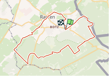
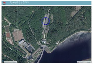
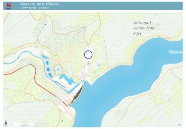
Trail Walking of 22 km to be discovered at Wallonia, Liège, Raeren. This trail is proposed by rvapeldo.
Description
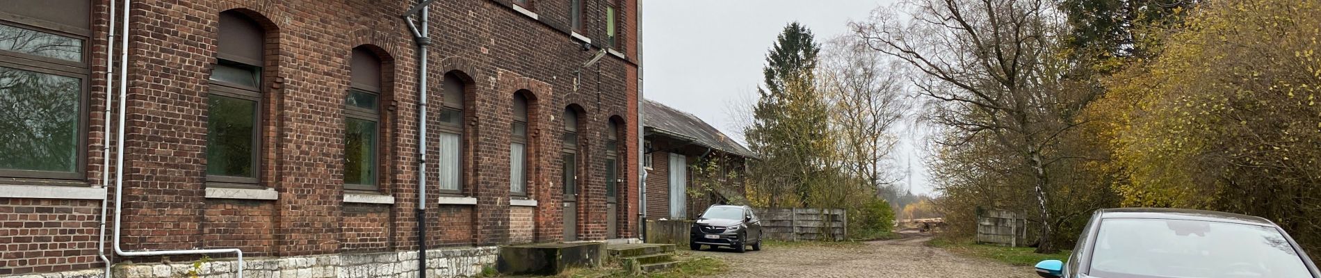
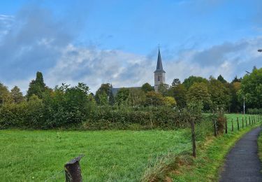
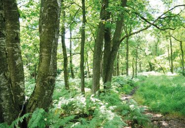
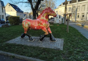
Un joli tour au départ de l’ancienne gare de Raeren. Le passage qui longe la frontière allemande est fort joli, le long d’une rivière serpentante au nom exotique, l’Inde, suivent ensuite des chemins dans des bois, en général assez aisés. L’approche de Raeren se fait d’un échalier à l’autre, dans des prés, avant de passer par le village, et en particulier son château.
Positioning
Comments
Trails nearby
![Trail Walking Raeren - 2021-08-07_23h28m55_raeren - Photo](https://media.geolcdn.com/t/375/260/423c8447-b257-4538-8bf5-b82f7fde1439.jpg&format=jpg&maxdim=2)
![Walking Walking](https://static1.geolcdn.com/sitytour/trail-icons/101.png)
Walking
![](/images/other/stat-length.png)
![](https://static1.geolcdn.com/siteimages/upload/files/16400158638029165_repeat_loop_refresh_sync_direction_icon.png)
![Trail Walking Raeren - 2021-04-02_18h39m41_975 - Photo](https://media.geolcdn.com/t/375/260/4dbde2fb-33e3-4e75-84b3-1404a45e04cc.jpg&format=jpg&maxdim=2)
![Walking Walking](https://static1.geolcdn.com/sitytour/trail-icons/101.png)
Walking
![](/images/other/stat-length.png)
![](https://static1.geolcdn.com/siteimages/upload/files/16400158638029165_repeat_loop_refresh_sync_direction_icon.png)
![Trail Walking Raeren - Petergensfeld - Natura 2000, des sites qui valent le détour - Lg21 - Photo](https://media.geolcdn.com/t/375/260/ext.jpg?maxdim=2&url=https%3A%2F%2Fservices.sitytrail.com%2FGeolivesWS%2FDownloadMedia.ashx%3FTrailID%3D612568%26Media%3D681f47ef-4b07-41b4-ba43-227c6775122c.JPG)
![Walking Walking](https://static1.geolcdn.com/sitytour/trail-icons/101.png)
Walking
![](/images/other/stat-length.png)
![](https://static1.geolcdn.com/siteimages/upload/files/16400158638029165_repeat_loop_refresh_sync_direction_icon.png)
![Trail Walking Raeren - Venn trilogie (2eme étape) - Photo](https://media.geolcdn.com/t/375/260/27f84523-0a25-4d22-8ea7-8cee03cc185d.jpg&format=jpg&maxdim=2)
![Walking Walking](https://static1.geolcdn.com/sitytour/trail-icons/101.png)
Walking
![](/images/other/stat-length.png)
![](https://static1.geolcdn.com/siteimages/upload/files/16400158638029165_repeat_loop_refresh_sync_direction_icon.png)
![Trail Walking Raeren - RB-Lg-30_Hauset_via-racc-2 - Photo](https://media.geolcdn.com/t/375/260/ext.jpg?maxdim=2&url=https%3A%2F%2Fservices.sitytrail.com%2FGeolivesWS%2FDownloadMedia.ashx%3FTrailID%3D402105%26Media%3Df4d2b2db-afd2-4d70-8342-c9642a40cdea.jpg)
![Walking Walking](https://static1.geolcdn.com/sitytour/trail-icons/101.png)
Walking
![](/images/other/stat-length.png)
![](https://static1.geolcdn.com/siteimages/upload/files/16400158638029165_repeat_loop_refresh_sync_direction_icon.png)
![Trail Walking Raeren - RB-Lg-30_Hauset - Photo](https://media.geolcdn.com/t/375/260/ext.jpg?maxdim=2&url=https%3A%2F%2Fservices.sitytrail.com%2FGeolivesWS%2FDownloadMedia.ashx%3FTrailID%3D402103%26Media%3Df4d2b2db-afd2-4d70-8342-c9642a40cdea.jpg)
![Walking Walking](https://static1.geolcdn.com/sitytour/trail-icons/101.png)
![Trail Walking Eupen - Eupen, par bois, prairies et chemins - Photo](https://media.geolcdn.com/t/375/260/ext.jpg?maxdim=2&url=https%3A%2F%2Fservices.sitytrail.com%2FGeolivesWS%2FDownloadMedia.ashx%3FTrailID%3D757615%26Media%3D20170521143224.jpg)
![Walking Walking](https://static1.geolcdn.com/sitytour/trail-icons/101.png)
Walking
![](/images/other/stat-length.png)
![](https://static1.geolcdn.com/siteimages/upload/files/16400158638029165_repeat_loop_refresh_sync_direction_icon.png)
![Trail Walking Eupen - 20250120 - Barrage Eupen 6.4 Km - Photo](https://media.geolcdn.com/t/375/260/e1fc0c94-0101-453e-bad2-8f407786fbf8.jpeg&format=jpg&maxdim=2)
![Walking Walking](https://static1.geolcdn.com/sitytour/trail-icons/101.png)
Walking
![](/images/other/stat-length.png)
![](https://static1.geolcdn.com/siteimages/upload/files/16400158638029165_repeat_loop_refresh_sync_direction_icon.png)
![Trail Walking Eupen - 20240422 - Barrage EUPEN 7.1 Km - Photo](https://media.geolcdn.com/t/375/260/b48e31dc-9cbc-4b5b-a385-6c757c9b552f.jpeg&format=jpg&maxdim=2)
![Walking Walking](https://static1.geolcdn.com/sitytour/trail-icons/101.png)
Walking
![](/images/other/stat-length.png)
![](https://static1.geolcdn.com/siteimages/upload/files/16400158638029165_repeat_loop_refresh_sync_direction_icon.png)