Trail Walking Seillans - Seillans Circuit des Pignes  - Photo

Seillans Circuit des Pignes

 domi06
domi06

User

© OpenStreetMap contributors
Length
Length
19 km
Max alt
Max alt
773 m
Uphill gradient
Uphill gradient
598 m
Km-Effort
Km-Effort  
27 km
Min alt
Min alt
370 m
Downhill gradient
Downhill gradient
599 m
Boucle
Boucle
Yes
Creation date :
2021-11-20 08:02:29.529
Updated on :
2024-07-19 15:33:55.255

(0 Reviews)

Walking
Walking
6h20
Difficulty : Medium

Scan this QR Code to open this trail in the SityTrail application

FREE GPS app for hiking

Logo SityTrail SityTrail

IGN / Geographical institutes

Download SityTrail from the App Store Download SityTrail from Google Play

Logo SityTrail SityTrail World

The world is yours!

Download SityTrail from the App Store Download SityTrail from Google Play Download SityTrail on Huawei AppGallery

About

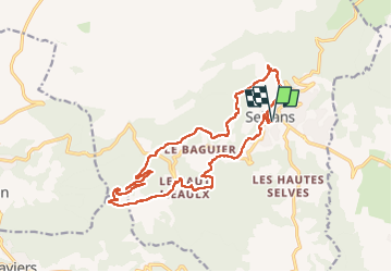
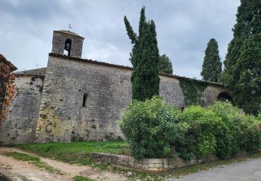
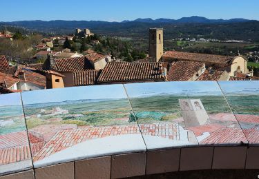
Trail Walking of 19 km to be discovered at Provence-Alpes-Côte d'Azur, Var, Seillans. This trail is proposed by domi06.

Description

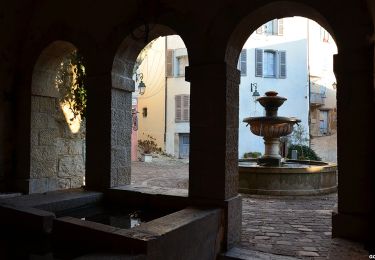
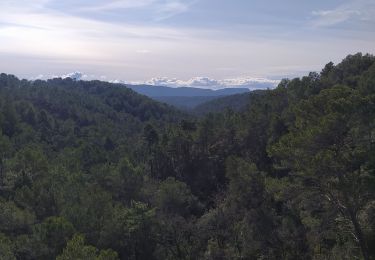
De la porte Sarrasine, repérer les marques jaunes. Celles-ci permettent de sortir du village par une route qui descend vers la rivière : La franchir par un pont et prendre la route du Moulin et continuer tout droit en direction du vallon des Combes Longues. Remonter ce vallon par un sentier qui monte sur la gauche. Celui-ci amène à une large piste sur laquelle on bifurque à gauche.  On suit celle-ci jusqu'au col de St Arnoux (voir la chapelle St Arnoux sur la droite). Traverser la RD19 et prendre la piste qui s'élève sur la droite. Du sommet de la Pigne, on arrive à un beau panorama qui permet de voir la plaine de Fayence, l'Estérel et la mer. On redescend ensuite progressivement vers Seillans par une piste puis des petites routes. On croise la RD19 que l'on quitte immédiatement pour emprunter une ruelle moins passagère. On arrive sans difficulté à Seillans.

Elevation profile

Photos

Positioning

Country:
France
Region :
Provence-Alpes-Côte d'Azur
Department/Province :
Var
Municipality :
Seillans
Location:
Unknown
Start:(UTM)
310065 ; 4834057 (32T) N.

Trails nearby

Trail Walking Seillans - z seillans 03-10-23 - Photo
Walking
cb8310

Walking

Easy
Seillans, Provence-Alpes-Côte d'Azur, Var, France
3.7 km | 4.6 km-effort
1h 36min
Yes
Trail Walking Fayence - FAYENCE - TOUR DES CHAPELLES  - Photo
Walking
jean-marie.parachini

Walking

Easy
Fayence, Provence-Alpes-Côte d'Azur, Var, France
16.2 km | 21 km-effort
8h 3min
Yes
Trail Walking Seillans - La Pigne - Photo
Walking
avdem

Walking

Easy
Seillans, Provence-Alpes-Côte d'Azur, Var, France
16.3 km | 23 km-effort
5h 51min
Yes
Trail Walking Seillans - Seillans - Fayence - Tourrettes - Callian - Photo
Walking
LtZIP

Walking

Easy
Seillans, Provence-Alpes-Côte d'Azur, Var, France
17.3 km | 23 km-effort
4h 35min
No
Trail Walking Seillans - Bories de Seillans,  la Camandre, vallon des combes longues  - Photo
Walking
domi06

Walking

Easy
Seillans, Provence-Alpes-Côte d'Azur, Var, France
16.4 km | 22 km-effort
5h 30min
Yes
Trail Walking Fayence - Fayence - ND des Cyprès - ND des Selves - Photo
Walking
LtZIP

Walking

Easy
Fayence, Provence-Alpes-Côte d'Azur, Var, France
16.9 km | 22 km-effort
4h 27min
Yes
Trail Walking Seillans - 20190327 rando réelle Seillans - Photo
Walking
Sugg

Walking

Medium
Seillans, Provence-Alpes-Côte d'Azur, Var, France
14.1 km | 19.2 km-effort
5h 37min
No
Trail Walking Fayence - Fayence le circuit des chapelles - Photo
Walking
jean-marie.parachini

Walking

Medium
Fayence, Provence-Alpes-Côte d'Azur, Var, France
16.2 km | 21 km-effort
7h 28min
Yes
Trail Walking Seillans - 20190323 Seillans reco partielle  - Photo
Walking
Sugg

Walking

Medium
Seillans, Provence-Alpes-Côte d'Azur, Var, France
10.6 km | 15.7 km-effort
2h 15min
No


Close
My subscriptions