Trail Walking Chorges - circuit n0 10 Bois Garret départ Chorges - Photo

circuit n0 10 Bois Garret départ Chorges

 damlou
damlou

User

© OpenStreetMap contributors
Length
Length
5.5 km
Max alt
Max alt
1526 m
Uphill gradient
Uphill gradient
377 m
Km-Effort
Km-Effort  
10.5 km
Min alt
Min alt
1145 m
Downhill gradient
Downhill gradient
374 m
Boucle
Boucle
Yes
Creation date :
2021-11-19 08:36:35.104
Updated on :
2021-11-19 11:22:44.885

(0 Reviews)

Walking
Walking
1h55
Difficulty : Difficult

Scan this QR Code to open this trail in the SityTrail application

FREE GPS app for hiking

Logo SityTrail SityTrail

IGN / Geographical institutes

Download SityTrail from the App Store Download SityTrail from Google Play

Logo SityTrail SityTrail World

The world is yours!

Download SityTrail from the App Store Download SityTrail from Google Play Download SityTrail on Huawei AppGallery

About

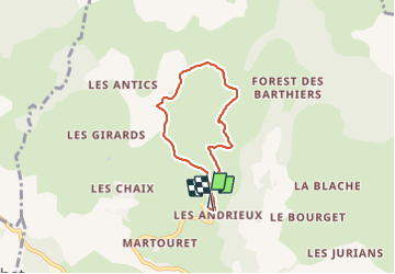
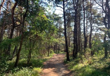
Trail Walking of 5.5 km to be discovered at Provence-Alpes-Côte d'Azur, Hautes-Alpes, Chorges. This trail is proposed by damlou.

Description

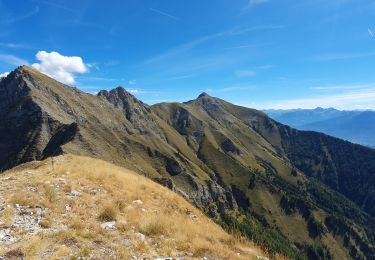
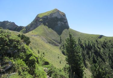
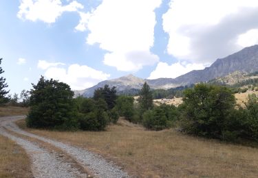
Difficile montée raide 400 m dénivellé 3H00
Au pied Piolit magnifique sans envers plus facile

Elevation profile

Positioning

Country:
France
Region :
Provence-Alpes-Côte d'Azur
Department/Province :
Hautes-Alpes
Municipality :
Chorges
Location:
Unknown
Start:(UTM)
284153 ; 4938049 (32T) N.

Comments

Please log in to post a review or rate the element


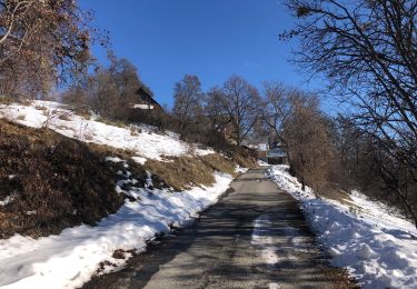
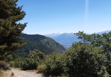
Raquette ok attention plein sud peut partir du hameau Naune Raze parking les Chirouzes plus facile.Direction Martonnet, Andrieux puis col de la Gardette


Trails nearby

Trail Walking Ancelle - L'arche et L'aiguille 01/09/23 - Photo
Walking
GUIDE
R@ph

Walking

Very difficult
Ancelle, Provence-Alpes-Côte d'Azur, Hautes-Alpes, France
8.6 km | 19.6 km-effort
4h 27min
Yes
Trail Walking Ancelle - Piolit - Photo
Walking
GUIDE
Marco05

Walking

Difficult
Ancelle, Provence-Alpes-Côte d'Azur, Hautes-Alpes, France
8.9 km | 19.4 km-effort
4h 24min
Yes
Trail Walking Ancelle - Arche - Photo
Walking
GUIDE
Marco05

Walking

Medium
Ancelle, Provence-Alpes-Côte d'Azur, Hautes-Alpes, France
6.9 km | 16 km-effort
3h 37min
No
Trail Walking Chorges - Les Parias et la Pousterle par le col de Chorges - Photo
Walking
GUIDE
David25400

Walking

Medium
Chorges, Provence-Alpes-Côte d'Azur, Hautes-Alpes, France
15.4 km | 32 km-effort
6h 18min
Yes
Trail Horseback riding Prunières - Le pomeyret avec Ziton  - Photo
Horseback riding
GUIDE
orsel

Horseback riding

Easy
Prunières, Provence-Alpes-Côte d'Azur, Hautes-Alpes, France
6.6 km | 10 km-effort
3h 3min
Yes
Trail Walking Chorges - CHORGES camping clé des champs Cantheloube retour par le nord - Photo
Walking
jll7513

Walking

Easy
Chorges, Provence-Alpes-Côte d'Azur, Hautes-Alpes, France
8.7 km | 12.1 km-effort
2h 44min
Yes
Trail Walking Chorges - au dessus de Chorges : Naume Raze . les Drayes . parking des Gardes . Forest Barthiers . Naume Raze - Photo
Walking
GUIDE
stef789

Walking

Medium
Chorges, Provence-Alpes-Côte d'Azur, Hautes-Alpes, France
9.3 km | 14.9 km-effort
4h 13min
Yes
Trail Walking Ancelle - crêtes d´Auréous : col de la Moissière . Chatégré . St Philippe . lac de Faudon  - Photo
Walking
GUIDE
stef789

Walking

Easy
Ancelle, Provence-Alpes-Côte d'Azur, Hautes-Alpes, France
6.9 km | 9.8 km-effort
2h 39min
Yes
Trail Walking Chorges - Col de la Gardette - l'Esillon 12.6.22 - Photo
Walking
GUIDE
fredetpascale

Walking

Easy
Chorges, Provence-Alpes-Côte d'Azur, Hautes-Alpes, France
8.4 km | 16.7 km-effort
3h 40min
Yes


Close
My subscriptions