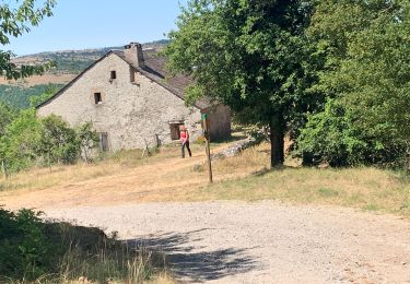
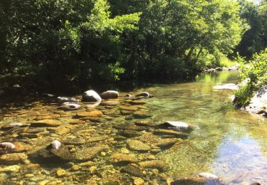
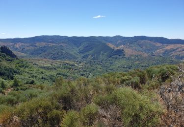
Trail Equestrian Lanuéjols - SityTrail - Boucle Chevauchée Cévenole MAJ 21 Juin 2020 - Photo

SityTrail - Boucle Chevauchée Cévenole MAJ 21 Juin 2020

© OpenStreetMap contributors
Length
Length
208 km
Max alt
Max alt
1699 m
Uphill gradient
Uphill gradient
5749 m
Km-Effort
Km-Effort  
285 km
Min alt
Min alt
503 m
Downhill gradient
Downhill gradient
5749 m
Boucle
Boucle
Yes
Creation date :
2021-11-14 07:34:59.255
Updated on :
2021-11-14 07:53:47.499

(0 Reviews)

Equestrian
Equestrian
--
Difficulty : Very easy

Scan this QR Code to open this trail in the SityTrail application

FREE GPS app for hiking

Logo SityTrail SityTrail

IGN / Geographical institutes

Download SityTrail from the App Store Download SityTrail from Google Play

Logo SityTrail SityTrail World

The world is yours!

Download SityTrail from the App Store Download SityTrail from Google Play Download SityTrail on Huawei AppGallery

About

Trail Equestrian of 208 km to be discovered at Occitania, Gard, Lanuéjols. This trail is proposed by Lozère Cheval.

Description

Modif suite au mail de Mossé

Elevation profile

Points of interest

Point of interest Pont de Montvert - Sud Mont Lozère - Camping du Ventalon - Photo
Lozère Cheval
PONT DE MONTVERT - SUD MONT LOZÈRE 
Point of interest Saint-André-de-Lancize - Ferme des Mourènes  - Photo
Lozère Cheval
SAINT-ANDRÉ-DE-LANCIZE 
Point of interest Molezon - La Roquette G'Rando d'Anes - Photo
Lozère Cheval
Point of interest Barre-des-Cévennes - Croisette Combes - Photo
Lozère Cheval
BARRE-DES-CÉVENNES 
Point of interest Lanuéjols - Aiguebonne - Photo
Lozère Cheval
LANUÉJOLS 
Point of interest Meyrueis - Ecurie Méjean - Photo
Lozère Cheval
MEYRUEIS 
Point of interest Hures-la-Parade - Auberge Chanet  - Photo
Lozère Cheval
HURES-LA-PARADE 
Point of interest Ispagnac - Anes du  Vigos  - Photo
Lozère Cheval
ISPAGNAC 
Point of interest Ispagnac - Amatuzzi - Photo
Lozère Cheval
ISPAGNAC 
Point of interest Ispagnac - Camping Cerisier - Photo
Lozère Cheval
Point of interest Ispagnac - Hotel le Vallon  - Photo
Lozère Cheval
Point of interest Saint-Étienne-du-Valdonnez - Auberge de Monmirat - Photo
Lozère Cheval
SAINT-ÉTIENNE-DU-VALDONNEZ 
Point of interest Mont Lozère et Goulet - Hôtel le Refuge - Photo
Lozère Cheval
MONT LOZÈRE ET GOULET 
Point of interest Vialas - Mas de la Barque - Photo
Lozère Cheval
Point of interest Dourbies - Hotel du Parc l'Esperou - Photo
Lozère Cheval
Point of interest Florac Trois Rivières - Camping Val Cévennes - Photo
Lozère Cheval
FLORAC TROIS RIVIÈRES 

Positioning

Country:
France
Region :
Occitania
Department/Province :
Gard
Municipality :
Lanuéjols
Location:
Unknown
Start:(UTM)
532931 ; 4884776 (31T) N.

Trails nearby

Trail Walking Saint-Sauveur-Camprieu - Dourbies Camprieu boucle - Photo
Walking
GUIDE
Roger Philippe Wallez

Walking

Very difficult
Saint-Sauveur-Camprieu, Occitania, Gard, France
21 km | 29 km-effort
7h 34min
No
Trail Walking Trèves - rando 2 jours  - Photo
Walking
GUIDE
nadinebondoux

Walking

Medium
Trèves, Occitania, Gard, France
8.9 km | 15.6 km-effort
2h 56min
No
Trail Walking Trèves - st firmin - Photo
Walking
aldeu

Walking

Medium
(1)
Trèves, Occitania, Gard, France
6.9 km | 11.9 km-effort
2h 38min
Yes
Trail Walking Trèves - Trêves via Dourbies - Photo
Walking
GUIDE
Roger Philippe Wallez

Walking

Very difficult
Trèves, Occitania, Gard, France
163 km | 205 km-effort
10h 6min
No
Trail Walking Lanuéjols - Boucle Lanuejols - Pont de Claperousse - Photo
Walking
LBarel

Walking

Very easy
Lanuéjols, Occitania, Gard, France
7.4 km | 9.2 km-effort
2h 0min
Yes
Trail Walking Lanuéjols - Commeiras - Photo
Walking
boudpn

Walking

Lanuéjols, Occitania, Gard, France
16.3 km | 24 km-effort
6h 23min
Yes
Trail On foot Lanuéjols - gorges du Trevezel Gard GPS - Photo
On foot
silvestreclaudine

On foot

Medium
Lanuéjols, Occitania, Gard, France
18.7 km | 30 km-effort
Unknown
Yes
Trail Walking Trèves - trevezel in live - Photo
Walking
CASSISFRAMBOISE

Walking

Very difficult
Trèves, Occitania, Gard, France
17.6 km | 30 km-effort
4h 51min
Yes
Trail On foot Saint-Sauveur-Camprieu - GR 66A - Photo
On foot
GUIDE+

On foot

Easy
Saint-Sauveur-Camprieu, Occitania, Gard, France
10.6 km | 14.3 km-effort
3h 14min
No


Close
My subscriptions