![](/images/other/stat-length.png)
![Trail Walking Senez - boucle autour du village de poil depuis le parking de chabrejas - Photo](https://media.geolcdn.com/t/1900/400/ef910f25-8d23-46f9-b65c-5d4f7b28c0b3.jpg&format=pjpeg&maxdim=2)
boucle autour du village de poil depuis le parking de chabrejas
famillerudent
User
![Length](/images/other/stat-length.png)
![Max alt](https://static1.geolcdn.com/siteimages/upload/files/1508320355ic_sort_altitude_max_24dp.png)
![Uphill gradient](https://static1.geolcdn.com/siteimages/upload/files/1508320355ic_sort_den_pos_24dp.png)
![Km-Effort](/images/other/stat-length.png)
![Min alt](https://static1.geolcdn.com/siteimages/upload/files/1508320355ic_sort_altitude_min_24dp.png)
![Downhill gradient](https://static1.geolcdn.com/siteimages/upload/files/1508320355ic_sort_den_neg_24dp.png)
![Boucle](https://static1.geolcdn.com/siteimages/upload/files/16400158638029165_repeat_loop_refresh_sync_direction_icon.png)
![Walking](https://static1.geolcdn.com/sitytour/trail-icons/101.png)
5h54
Difficulty : Easy
![Scan this QR Code to open this trail in the SityTrail application](https://capi.geolives.com/qq0zvz2zws4bq2lad0pu/sitytour/trails/3001783/qr.png?size=200)
FREE GPS app for hiking
About
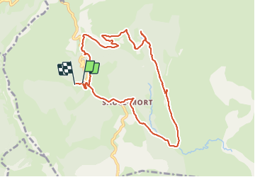
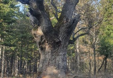
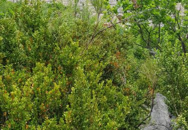
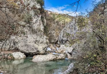
Trail Walking of 10.4 km to be discovered at Provence-Alpes-Côte d'Azur, Alpes-de-Haute-Provence, Senez. This trail is proposed by famillerudent.
Description
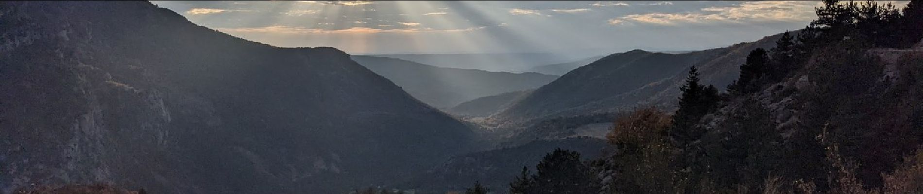
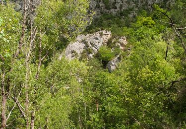
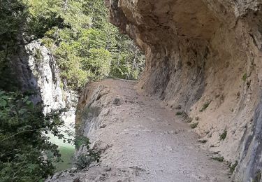
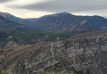
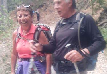
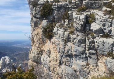
Une randonnée superbe avec de beaux points de vue dans un environnement sauvage pour découvrir l'ancien village
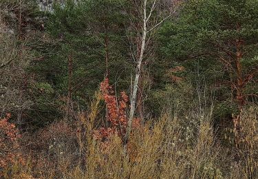
Le Poil (au XIXème siècle la commune comptait 350 habitants dont plus d'une centaine dans le village) nous avons fait cette rando dans le sens inverse du sens clasique pour avoir le soleil avec nous pour les photos.(cf faite en automne)
pas de difficultés particulieres
Positioning
Comments
Trails nearby
![Trail Walking Estoublon - Gorges de Trévans - Estoublon - Photo](https://media.geolcdn.com/t/375/260/ext.jpg?maxdim=2&url=https%3A%2F%2Fservices.sitytrail.com%2FGeolivesWS%2FDownloadMedia.ashx%3FTrailID%3D106721%26Media%3D11374_5.jpg)
![Walking Walking](https://static1.geolcdn.com/sitytour/trail-icons/101.png)
Walking
![](/images/other/stat-length.png)
![](https://static1.geolcdn.com/siteimages/upload/files/16400158638029165_repeat_loop_refresh_sync_direction_icon.png)
![Trail Walking Estoublon - TREVANS, Chateau de Trevans, les Beluguettes. Cotes Chaudes , Belvédère des Gorges , Turquet ,o quet - Photo](https://media.geolcdn.com/t/375/260/488d605b-c812-4edd-a2c1-2f4802305dc3.jpg&format=jpg&maxdim=2)
![Walking Walking](https://static1.geolcdn.com/sitytour/trail-icons/101.png)
Walking
![](/images/other/stat-length.png)
![](https://static1.geolcdn.com/siteimages/upload/files/16400158638029165_repeat_loop_refresh_sync_direction_icon.png)
![Trail Walking Beynes - Montagne de Beynes 11kms 720m - Photo](https://media.geolcdn.com/t/375/260/0924528c-4d8c-48ab-ad20-f85077c2766f.jpg&format=jpg&maxdim=2)
![Walking Walking](https://static1.geolcdn.com/sitytour/trail-icons/101.png)
Walking
![](/images/other/stat-length.png)
![](https://static1.geolcdn.com/siteimages/upload/files/16400158638029165_repeat_loop_refresh_sync_direction_icon.png)
![Trail Walking Estoublon - Trevans les gorges - Photo](https://media.geolcdn.com/t/375/260/2cbe37e7-5ddf-4213-89bc-0a9ca520d8c1.jpg&format=jpg&maxdim=2)
![Walking Walking](https://static1.geolcdn.com/sitytour/trail-icons/101.png)
Walking
![](/images/other/stat-length.png)
![](https://static1.geolcdn.com/siteimages/upload/files/16400158638029165_repeat_loop_refresh_sync_direction_icon.png)
![Trail Walking Beynes - 2023-03-17 Montagne de Beyne - Photo](https://media.geolcdn.com/t/375/260/a2f9f9ce-2317-441f-8351-fbd6bbd22b1f.jpg&format=jpg&maxdim=2)
![Walking Walking](https://static1.geolcdn.com/sitytour/trail-icons/101.png)
Walking
![](/images/other/stat-length.png)
![](https://static1.geolcdn.com/siteimages/upload/files/16400158638029165_repeat_loop_refresh_sync_direction_icon.png)
![Trail Walking Estoublon - Gorges de Trevans par Valbonnette - Photo](https://media.geolcdn.com/t/375/260/10517f6a-6ec3-4f7b-85a2-34d58762c642.jpg&format=jpg&maxdim=2)
![Walking Walking](https://static1.geolcdn.com/sitytour/trail-icons/101.png)
Walking
![](/images/other/stat-length.png)
![](https://static1.geolcdn.com/siteimages/upload/files/16400158638029165_repeat_loop_refresh_sync_direction_icon.png)
![Trail Walking Estoublon - 2023-02-21 Gorges de Trévans - Passerelle de la Délasse - Photo](https://media.geolcdn.com/t/375/260/0eeaaad3-f154-4199-b0d4-f7114f5176f6.jpg&format=jpg&maxdim=2)
![Walking Walking](https://static1.geolcdn.com/sitytour/trail-icons/101.png)
Walking
![](/images/other/stat-length.png)
![](https://static1.geolcdn.com/siteimages/upload/files/16400158638029165_repeat_loop_refresh_sync_direction_icon.png)
![Trail Walking Beynes - 04 La montagne de Beynes (Variante 05/2022) - Photo](https://media.geolcdn.com/t/375/260/00ffcda8-2af0-4879-a93e-d3abe306c026.jpg&format=jpg&maxdim=2)
![Walking Walking](https://static1.geolcdn.com/sitytour/trail-icons/101.png)
Walking
![](/images/other/stat-length.png)
![](https://static1.geolcdn.com/siteimages/upload/files/16400158638029165_repeat_loop_refresh_sync_direction_icon.png)
![Trail Walking Estoublon - gorges de trevans sentier de valbonette - Photo](https://media.geolcdn.com/t/375/260/e95b5ac0-ca3e-4559-bbd5-f5d21be426a1.jpg&format=jpg&maxdim=2)
![Walking Walking](https://static1.geolcdn.com/sitytour/trail-icons/101.png)
Walking
![](/images/other/stat-length.png)
![](https://static1.geolcdn.com/siteimages/upload/files/16400158638029165_repeat_loop_refresh_sync_direction_icon.png)