![](/images/other/stat-length.png)
![Trail Walking Sigchos - Sigchos - Quilotoa - Day 1 (Sigchos - Isinvili) - Photo](https://media.geolcdn.com/t/1900/400/78673e5f-ec9a-4bce-8d62-bf42e9c396b1.jpg&format=pjpeg&maxdim=2)
Sigchos - Quilotoa - Day 1 (Sigchos - Isinvili)
gildascb
User
![Length](/images/other/stat-length.png)
![Max alt](https://static1.geolcdn.com/siteimages/upload/files/1508320355ic_sort_altitude_max_24dp.png)
![Uphill gradient](https://static1.geolcdn.com/siteimages/upload/files/1508320355ic_sort_den_pos_24dp.png)
![Km-Effort](/images/other/stat-length.png)
![Min alt](https://static1.geolcdn.com/siteimages/upload/files/1508320355ic_sort_altitude_min_24dp.png)
![Downhill gradient](https://static1.geolcdn.com/siteimages/upload/files/1508320355ic_sort_den_neg_24dp.png)
![Boucle](https://static1.geolcdn.com/siteimages/upload/files/16400158638029165_repeat_loop_refresh_sync_direction_icon.png)
![Walking](https://static1.geolcdn.com/sitytour/trail-icons/101.png)
4h24
Difficulty : Medium
![Scan this QR Code to open this trail in the SityTrail application](https://capi.geolives.com/qq0zvz2zws4bq2lad0pu/sitytour/trails/2987846/qr.png?size=200)
FREE GPS app for hiking
About
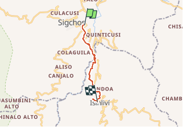
Trail Walking of 10.5 km to be discovered at Cotopaxi, Sigchos, Sigchos. This trail is proposed by gildascb.
Description
Caminata de 3 días desde Sigchos hasta la Laguna del Quilotoa pasando por Isinvili y Chugchilan.
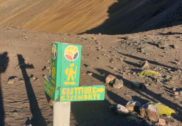
La laguna del Quilotoa es sin duda una de las más bellas de Ecuador. Situado a 4.000 metros sobre el nivel del mar, el Quilotoa es un antiguo volcán, en cuyo centro se encuentra una laguna de 9 km de ancho y 250 metros de profundidad. El color del agua cambia de verde oscuro a verde claro. La vista desde el borde de la laguna es magnífica.
En cada etapa se pueden encontrar hoteles que van desde el confort rústico hasta hoteles de mayor categoría (recomiendo especialmente el Llullama en Isinvili: inmejorable relación calidad-precio).
Caminata para caminante en buena condición física (especialmente la ultima etapa con mas de 1000 m. de diferencia de altura y llegada a 4000 m de altitud).
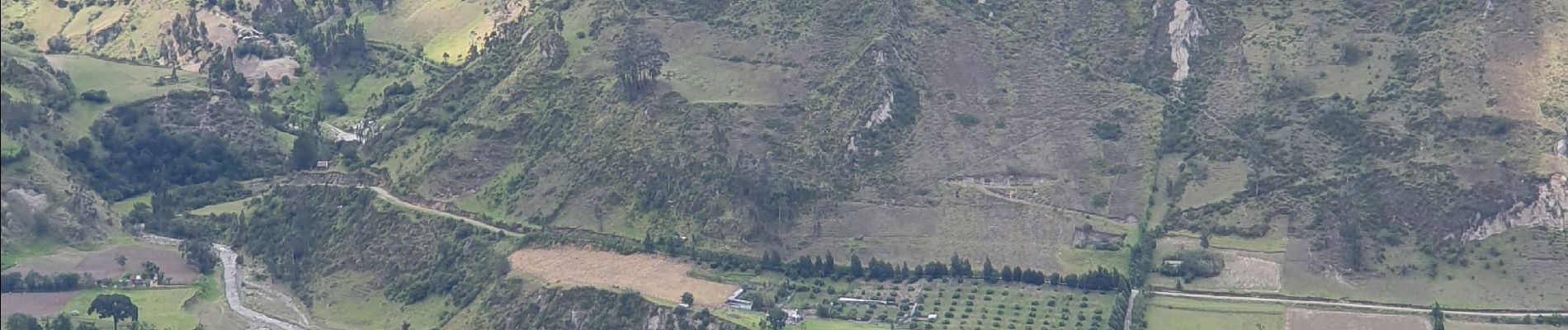
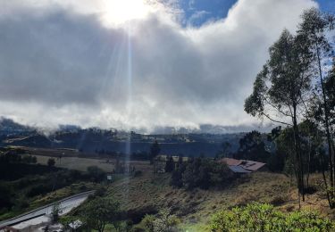
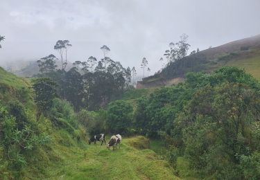
Positioning
Comments
Trails nearby
![Trail Walking Chugchillan - Sigchos - Quilotoa - Day 3 (chugchilan - Quilotoa) - Photo](https://media.geolcdn.com/t/375/260/8b4e96d6-0bc3-4c2a-b5bd-42fc0eb4dbd2.jpg&format=jpg&maxdim=2)
![Walking Walking](https://static1.geolcdn.com/sitytour/trail-icons/101.png)
Walking
![](/images/other/stat-length.png)
![](https://static1.geolcdn.com/siteimages/upload/files/16400158638029165_repeat_loop_refresh_sync_direction_icon.png)
![Trail Walking Isinlivi - Sigchos - Quilotoa - Day 2 - Isinvili - Chugchilan - Photo](https://media.geolcdn.com/t/375/260/37892984-9b02-4c1c-b87c-1bc86e935479.jpg&format=jpg&maxdim=2)
![Walking Walking](https://static1.geolcdn.com/sitytour/trail-icons/101.png)
Walking
![](/images/other/stat-length.png)
![](https://static1.geolcdn.com/siteimages/upload/files/16400158638029165_repeat_loop_refresh_sync_direction_icon.png)
![Trail Walking Parroquia El Chaupi - Ascension Illiniza Norte - Photo](https://media.geolcdn.com/t/375/260/d3587fbf-bd1e-48e5-986b-a59e33ba22ae.jpg&format=jpg&maxdim=2)
![Walking Walking](https://static1.geolcdn.com/sitytour/trail-icons/101.png)
Walking
![](/images/other/stat-length.png)
![](https://static1.geolcdn.com/siteimages/upload/files/16400158638029165_repeat_loop_refresh_sync_direction_icon.png)
![Trail Other activity Parroquia El Chaupi - Illiniza Nord - Photo](https://media.geolcdn.com/t/375/260/ext.jpg?maxdim=2&url=https%3A%2F%2Fstatic1.geolcdn.com%2Fsiteimages%2Fupload%2Ffiles%2F1545311037marcheuse_200dpi.jpg)
![Other activity Other activity](https://static1.geolcdn.com/sitytour/trail-icons/900.png)
Other activity
![](/images/other/stat-length.png)
![](https://static1.geolcdn.com/siteimages/upload/files/16400158638029165_repeat_loop_refresh_sync_direction_icon.png)
![Trail Walking Chugchillan - Chugchillan - Quilotoa - Photo](https://media.geolcdn.com/t/375/260/ext.jpg?maxdim=2&url=https%3A%2F%2Fstatic1.geolcdn.com%2Fsiteimages%2Fupload%2Ffiles%2F1553511878bg_sport_marche.png)
![Walking Walking](https://static1.geolcdn.com/sitytour/trail-icons/101.png)
Walking
![](/images/other/stat-length.png)
![](https://static1.geolcdn.com/siteimages/upload/files/16400158638029165_repeat_loop_refresh_sync_direction_icon.png)
![Trail Walking Zumbahua - Quilotoa - Chugchillan - Photo](https://media.geolcdn.com/t/375/260/ext.jpg?maxdim=2&url=https%3A%2F%2Fstatic1.geolcdn.com%2Fsiteimages%2Fupload%2Ffiles%2F1553511878bg_sport_marche.png)
![Walking Walking](https://static1.geolcdn.com/sitytour/trail-icons/101.png)
Walking
![](/images/other/stat-length.png)
![](https://static1.geolcdn.com/siteimages/upload/files/16400158638029165_repeat_loop_refresh_sync_direction_icon.png)
![Trail Walking Zumbahua - Quilotoa Shalala lodge - Photo](https://media.geolcdn.com/t/375/260/ext.jpg?maxdim=2&url=https%3A%2F%2Fstatic1.geolcdn.com%2Fsiteimages%2Fupload%2Ffiles%2F1553511878bg_sport_marche.png)
![Walking Walking](https://static1.geolcdn.com/sitytour/trail-icons/101.png)
Walking
![](/images/other/stat-length.png)
![](https://static1.geolcdn.com/siteimages/upload/files/16400158638029165_repeat_loop_refresh_sync_direction_icon.png)
![Trail Walking Zumbahua - Descente à la lagune, mirador Shalala - Photo](https://media.geolcdn.com/t/375/260/ext.jpg?maxdim=2&url=https%3A%2F%2Fstatic1.geolcdn.com%2Fsiteimages%2Fupload%2Ffiles%2F1553511878bg_sport_marche.png)
![Walking Walking](https://static1.geolcdn.com/sitytour/trail-icons/101.png)
Walking
![](/images/other/stat-length.png)
![](https://static1.geolcdn.com/siteimages/upload/files/16400158638029165_repeat_loop_refresh_sync_direction_icon.png)