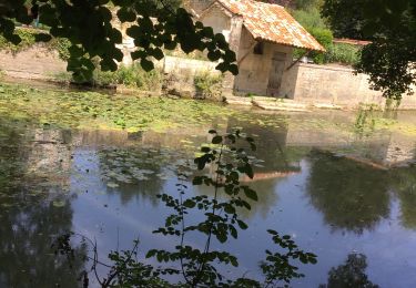
Trail Walking Clion - La Chapelle Saint-Paul à Clion-sur-Seugne - Photo

La Chapelle Saint-Paul à Clion-sur-Seugne

© OpenStreetMap contributors
Length
Length
4.8 km
Max alt
Max alt
37 m
Uphill gradient
Uphill gradient
25 m
Km-Effort
Km-Effort  
5.2 km
Min alt
Min alt
27 m
Downhill gradient
Downhill gradient
25 m
Boucle
Boucle
Yes
Creation date :
2021-10-25 09:50:55.232
Updated on :
2021-10-25 09:51:50.33

(0 Reviews)

Walking
Walking
1h10
Difficulty : Easy

Scan this QR Code to open this trail in the SityTrail application

FREE GPS app for hiking

Logo SityTrail SityTrail

IGN / Geographical institutes

Download SityTrail from the App Store Download SityTrail from Google Play

Logo SityTrail SityTrail World

The world is yours!

Download SityTrail from the App Store Download SityTrail from Google Play Download SityTrail on Huawei AppGallery

About

Trail Walking of 4.8 km to be discovered at New Aquitaine, Charente-Maritime, Clion. This trail is proposed by neoroll44.

Description

Départ salle des fêtes de Clion-sur-Seugne.

(D/A) Dos au parking, se diriger à droite dans la Rue des Oiseaux. Au carrefour, suivre le balisage GR®360 Rouge et Blanc vers la droite, continuer sur la Route de la Varaze sur 700m environ.

(1) A l'embranchement tourner à droite, toujours en suivant le GR®360. Après 350m environ, emprunter le chemin de Fontaine vers la gauche et parvenir jusqu'à un pont sur la Seugne.

(2) Ne pas le traverser et longer le ruisseau jusqu'aux sources de Saint-Paul (les pèlerins de Compostelle y prenaient halte).

(3) Aller jusqu'à la chapelle, repartir à droite vers l'Ouest pour retrouver la Rue des Sources : vous quittez le GR® et suivez désormais le seul balisage Jaune. Dans le virage de la Rue des Fontaines, prendre en face et suivre la rue qui fait un virage à gauche. Laisser la rue de droite et poursuivre tout droit, couper la rue suivante vers la voie ferrée.

(4) Traverser avec prudence la voie ferrée et prendre un chemin qui part aussitôt à droite le long de celle-ci. Le chemin s'écarte un peu et rejoint un croisement.

(5) Au calvaire, continuer tout droit, puis au stade, prendre à droite sur la Rue du Stade. Traverser à nouveau la voie ferrée et poursuivre en face dans l'Avenue Saint-André. Tourner à droite Rue de Saint-Onge et à gauche pour retrouver le parking (D/A).

Elevation profile

Points of interest

Point of interest Clion - Carrefour - Photo
neoroll44
CLION 
Point of interest Clion - Sources de Saint-Paul - Photo
neoroll44
Point of interest Clion - Croisement du calvaire - Photo
neoroll44

Positioning

Country:
France
Region :
New Aquitaine
Department/Province :
Charente-Maritime
Municipality :
Clion
Location:
Unknown
Start:(UTM)
695384 ; 5039202 (30T) N.

Trails nearby

Trail Walking Marignac - Marignac - Photo
Walking
towednack

Walking

Very easy
(1)
Marignac, New Aquitaine, Charente-Maritime, France
18.1 km | 21 km-effort
4h 47min
Yes
Trail Walking Jonzac - Mail de Seugne-parcours pêche - Photo
Walking
papajp

Walking

Jonzac, New Aquitaine, Charente-Maritime, France
7.2 km | 7.9 km-effort
2h 28min
No
Trail Walking Clam - CLAM J Rando - Photo
Walking
jpland17800

Walking

Difficult
Clam, New Aquitaine, Charente-Maritime, France
13.3 km | 14.8 km-effort
3h 25min
Yes
Trail Walking Saint-Georges-Antignac - St Georges Patricia  - Photo
Walking
jpland17800

Walking

Difficult
Saint-Georges-Antignac, New Aquitaine, Charente-Maritime, France
13.3 km | 15 km-effort
2h 37min
No
Trail Quad Saint-Georges-Antignac - estuaire - Photo
Quad
Fabrice Billonnet

Quad

Very easy
Saint-Georges-Antignac, New Aquitaine, Charente-Maritime, France
163 km | 191 km-effort
9h 16min
No
Trail Walking Clion - Du Pont des Ânes à la Chapelle de Saint-Paul autour de Clion - Photo
Walking
neoroll44

Walking

Medium
Clion, New Aquitaine, Charente-Maritime, France
9.6 km | 10.4 km-effort
2h 20min
Yes
Trail Walking Clion - Du Pont des Ânes à la Chapelle de Saint-Paul autour de Clion - Photo
Walking
neoroll44

Walking

Medium
Clion, New Aquitaine, Charente-Maritime, France
9.6 km | 10.4 km-effort
2h 30min
Yes
Trail Walking Saint-Germain-de-Lusignan - Les moulins du côté de Saint-Germain-de-Lusignan - Photo
Walking
neoroll44

Walking

Medium
Saint-Germain-de-Lusignan, New Aquitaine, Charente-Maritime, France
10.8 km | 11.9 km-effort
3h 0min
Yes
Trail Car Guitinières - La Martinière - Photo
Car
Onillon

Car

Guitinières, New Aquitaine, Charente-Maritime, France
8.6 km | 9.7 km-effort
13min
No


Close
My subscriptions