![](/images/other/stat-length.png)
![Trail Walking Saint-Nazaire-le-Désert - Le Parquet version courte - Photo](https://media.geolcdn.com/t/1900/400/01629ad3-af64-4f33-80bf-8c0eb7b8df5a.jpg&format=pjpeg&maxdim=2)
Le Parquet version courte
ajd26
User
![Length](/images/other/stat-length.png)
Length
14.3 km
![Max alt](https://static1.geolcdn.com/siteimages/upload/files/1508320355ic_sort_altitude_max_24dp.png)
Max alt
1088 m
![Uphill gradient](https://static1.geolcdn.com/siteimages/upload/files/1508320355ic_sort_den_pos_24dp.png)
Uphill gradient
764 m
![Km-Effort](/images/other/stat-length.png)
Km-Effort
24 km
![Min alt](https://static1.geolcdn.com/siteimages/upload/files/1508320355ic_sort_altitude_min_24dp.png)
Min alt
559 m
![Downhill gradient](https://static1.geolcdn.com/siteimages/upload/files/1508320355ic_sort_den_neg_24dp.png)
Downhill gradient
764 m
![Boucle](https://static1.geolcdn.com/siteimages/upload/files/16400158638029165_repeat_loop_refresh_sync_direction_icon.png)
Boucle
Yes
Creation date :
2021-10-24 08:28:08.0
Updated on :
2021-10-25 07:15:51.245
![Walking](https://static1.geolcdn.com/sitytour/trail-icons/101.png)
4h16
Difficulty : Medium
![Scan this QR Code to open this trail in the SityTrail application](https://capi.geolives.com/qq0zvz2zws4bq2lad0pu/sitytour/trails/2981553/qr.png?size=200)
FREE GPS app for hiking
About
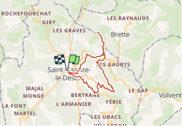
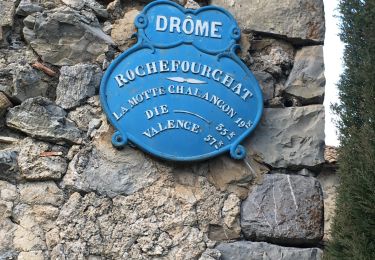
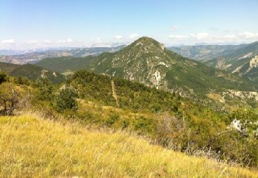
Trail Walking of 14.3 km to be discovered at Auvergne-Rhône-Alpes, Drôme, Saint-Nazaire-le-Désert. This trail is proposed by ajd26.
Description
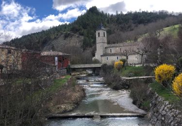
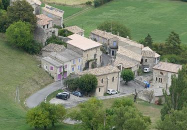
départ de St Nazaire le Désert
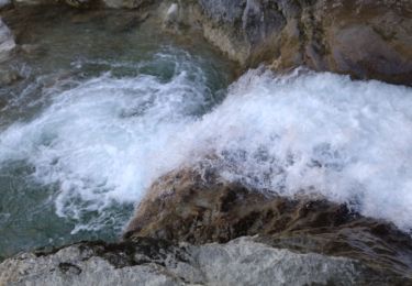
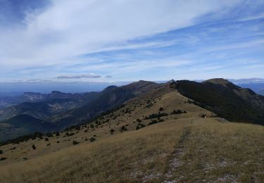
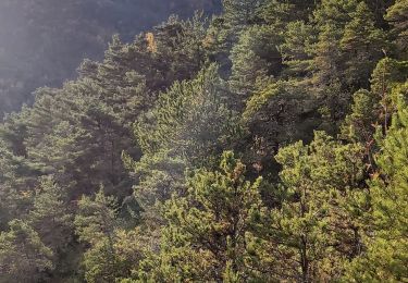
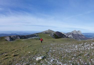
jolie rando avec des beaux panoramas en continu, pas de difficultés sauf le montée au parquet qui est soutenue
Positioning
Country:
France
Region :
Auvergne-Rhône-Alpes
Department/Province :
Drôme
Municipality :
Saint-Nazaire-le-Désert
Location:
Unknown
Start:(Dec)
Start:(UTM)
680655 ; 4937752 (31T) N.
Comments
Trails nearby
![Trail Walking Saint-Nazaire-le-Désert - 26 st Nazaire le desert - Photo](https://media.geolcdn.com/t/375/260/800f793b-c8e6-438c-bf52-c0a833bbf3e1.jpg&format=jpg&maxdim=2)
![Walking Walking](https://static1.geolcdn.com/sitytour/trail-icons/101.png)
26 st Nazaire le desert
Walking
Very difficult
Saint-Nazaire-le-Désert,
Auvergne-Rhône-Alpes,
Drôme,
France
![](/images/other/stat-length.png)
8.5 km | 16 km-effort
5h 17min
![](https://static1.geolcdn.com/siteimages/upload/files/16400158638029165_repeat_loop_refresh_sync_direction_icon.png)
No
![Trail Walking Saint-Nazaire-le-Désert - Bergerie du Pradaux - Photo](https://media.geolcdn.com/t/375/260/ext.jpg?maxdim=2&url=https%3A%2F%2Fstatic1.geolcdn.com%2Fsiteimages%2Fupload%2Ffiles%2F1553511878bg_sport_marche.png)
![Walking Walking](https://static1.geolcdn.com/sitytour/trail-icons/101.png)
Bergerie du Pradaux
Walking
Medium
(1)
Saint-Nazaire-le-Désert,
Auvergne-Rhône-Alpes,
Drôme,
France
![](/images/other/stat-length.png)
12.5 km | 22 km-effort
4h 42min
![](https://static1.geolcdn.com/siteimages/upload/files/16400158638029165_repeat_loop_refresh_sync_direction_icon.png)
Yes
![Trail Walking Rochefourchat - Serre Délégué depuis Rochefourchat 15 10 23 - Photo](https://media.geolcdn.com/t/375/260/dd32defb-f16e-4dda-98b5-10da95afa891.jpg&format=jpg&maxdim=2)
![Walking Walking](https://static1.geolcdn.com/sitytour/trail-icons/101.png)
Serre Délégué depuis Rochefourchat 15 10 23
Walking
Medium
Rochefourchat,
Auvergne-Rhône-Alpes,
Drôme,
France
![](/images/other/stat-length.png)
14.3 km | 25 km-effort
4h 29min
![](https://static1.geolcdn.com/siteimages/upload/files/16400158638029165_repeat_loop_refresh_sync_direction_icon.png)
Yes
![Trail Walking Saint-Nazaire-le-Désert - Saint Nazaire le Désert - Photo](https://media.geolcdn.com/t/375/260/727e7242-c051-4080-9ece-fd964be15596.jpg&format=jpg&maxdim=2)
![Walking Walking](https://static1.geolcdn.com/sitytour/trail-icons/101.png)
Saint Nazaire le Désert
Walking
Easy
Saint-Nazaire-le-Désert,
Auvergne-Rhône-Alpes,
Drôme,
France
![](/images/other/stat-length.png)
12.4 km | 21 km-effort
3h 44min
![](https://static1.geolcdn.com/siteimages/upload/files/16400158638029165_repeat_loop_refresh_sync_direction_icon.png)
Yes
![Trail Walking Rochefourchat - Grand Delmas depuis Rochefourchat - Photo](https://media.geolcdn.com/t/375/260/d54b38a2-4988-4640-bf17-e0e6b4ff0960.jpg&format=jpg&maxdim=2)
![Walking Walking](https://static1.geolcdn.com/sitytour/trail-icons/101.png)
Grand Delmas depuis Rochefourchat
Walking
Medium
Rochefourchat,
Auvergne-Rhône-Alpes,
Drôme,
France
![](/images/other/stat-length.png)
16.6 km | 28 km-effort
5h 25min
![](https://static1.geolcdn.com/siteimages/upload/files/16400158638029165_repeat_loop_refresh_sync_direction_icon.png)
Yes
![Trail Walking Saint-Nazaire-le-Désert - St Nazaire le Désert Bergerie des Pradaux - Photo](https://media.geolcdn.com/t/375/260/6e1323bf-526c-4599-aac0-2d5d88ff4402.jpg&format=jpg&maxdim=2)
![Walking Walking](https://static1.geolcdn.com/sitytour/trail-icons/101.png)
St Nazaire le Désert Bergerie des Pradaux
Walking
Medium
Saint-Nazaire-le-Désert,
Auvergne-Rhône-Alpes,
Drôme,
France
![](/images/other/stat-length.png)
10.1 km | 17.7 km-effort
4h 0min
![](https://static1.geolcdn.com/siteimages/upload/files/16400158638029165_repeat_loop_refresh_sync_direction_icon.png)
Yes
![Trail Walking Rochefourchat - Rochefourchat (ASPTT) - Photo](https://media.geolcdn.com/t/375/260/1fdac6b0-e9dc-4a61-aa39-771c68602c4b.jpg&format=jpg&maxdim=2)
![Walking Walking](https://static1.geolcdn.com/sitytour/trail-icons/101.png)
Rochefourchat (ASPTT)
Walking
Medium
Rochefourchat,
Auvergne-Rhône-Alpes,
Drôme,
France
![](/images/other/stat-length.png)
14 km | 25 km-effort
5h 42min
![](https://static1.geolcdn.com/siteimages/upload/files/16400158638029165_repeat_loop_refresh_sync_direction_icon.png)
Yes
![Walking Walking](https://static1.geolcdn.com/sitytour/trail-icons/101.png)
Pradelle - Vallée de la Roanne
Walking
Medium
Pradelle,
Auvergne-Rhône-Alpes,
Drôme,
France
![](/images/other/stat-length.png)
14.7 km | 24 km-effort
4h 0min
![](https://static1.geolcdn.com/siteimages/upload/files/16400158638029165_repeat_loop_refresh_sync_direction_icon.png)
Yes
![Trail Walking Saint-Nazaire-le-Désert - st nazaire le desert-les pradaux - Photo](https://media.geolcdn.com/t/375/260/ext.jpg?maxdim=2&url=https%3A%2F%2Fservices.sitytrail.com%2FGeolivesWS%2FDownloadMedia.ashx%3FTrailID%3D214064%26Media%3D20130815152924.jpg)
![Walking Walking](https://static1.geolcdn.com/sitytour/trail-icons/101.png)
st nazaire le desert-les pradaux
Walking
Difficult
Saint-Nazaire-le-Désert,
Auvergne-Rhône-Alpes,
Drôme,
France
![](/images/other/stat-length.png)
13.1 km | 21 km-effort
5h 0min
![](https://static1.geolcdn.com/siteimages/upload/files/16400158638029165_repeat_loop_refresh_sync_direction_icon.png)
Yes