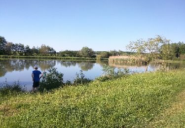
17.6 km | 21 km-effort
Embermenil (Boucles des Entonnoirs) 21 040m +252m
DanielROLLET
User
Length
21 km
Max alt
304 m
Uphill gradient
254 m
Km-Effort
24 km
Min alt
240 m
Downhill gradient
253 m
Boucle
Yes
Creation date :
2021-10-24 07:09:28.485
Updated on :
2021-10-24 16:05:37.664
6h45
Difficulty : Difficult
FREE GPS app for hiking
About
Trail Walking of 21 km to be discovered at Grand Est, Meurthe-et-Moselle, Emberménil. This trail is proposed by DanielROLLET.
Description
2021 10 24 Reco balisage avec Marie - 09h10 à 16h50
Grand beau temps (-2° le matin)
Positioning
Country:
France
Region :
Grand Est
Department/Province :
Meurthe-et-Moselle
Municipality :
Emberménil
Location:
Unknown
Start:(Dec)
Start:(UTM)
330198 ; 5388842 (32U) N.
Comments
Trails nearby
Reillon, les Entonnoirs
Walking
Easy
Reillon,
Grand Est,
Meurthe-et-Moselle,
France
8.1 km | 9.7 km-effort
1h 58min
Yes
emberménil bénaménil
Horseback riding
Easy
Emberménil,
Grand Est,
Meurthe-et-Moselle,
France
12.5 km | 14.3 km-effort
1h 52min
No
Embermenil 6 470m +97m
Walking
Medium
Emberménil,
Grand Est,
Meurthe-et-Moselle,
France
6.5 km | 7.8 km-effort
1h 45min
Yes
vaucourt
Walking
Difficult
Vaucourt,
Grand Est,
Meurthe-et-Moselle,
France
10 km | 12.1 km-effort
2h 2min
Yes
LES EVRIEUX
Walking
Easy
Emberménil,
Grand Est,
Meurthe-et-Moselle,
France
6.5 km | 7.7 km-effort
2h 0min
Yes
Emberménil (Boucle Evrieux) 6 360m +96m
Walking
Medium
Emberménil,
Grand Est,
Meurthe-et-Moselle,
France
6.4 km | 7.6 km-effort
1h 44min
Yes
entonnoir veho
Walking
Medium
Emberménil,
Grand Est,
Meurthe-et-Moselle,
France
9.3 km | 11 km-effort
2h 3min
Yes
Emberménil (Les Boucles des Entonnoirs) 20 920m +253m
Walking
Medium
Emberménil,
Grand Est,
Meurthe-et-Moselle,
France
21 km | 24 km-effort
5h 30min
Yes