![](/images/other/stat-length.png)
![Trail Walking Cesson - Cesson-la-Forêt - Boissise-la-Bertrand - Photo](https://media.geolcdn.com/t/1900/400/74306158-9d38-43d8-bd7b-80eb237db38f.jpg&format=pjpeg&maxdim=2)
Cesson-la-Forêt - Boissise-la-Bertrand
guydu41
User
![Length](/images/other/stat-length.png)
![Max alt](https://static1.geolcdn.com/siteimages/upload/files/1508320355ic_sort_altitude_max_24dp.png)
![Uphill gradient](https://static1.geolcdn.com/siteimages/upload/files/1508320355ic_sort_den_pos_24dp.png)
![Km-Effort](/images/other/stat-length.png)
![Min alt](https://static1.geolcdn.com/siteimages/upload/files/1508320355ic_sort_altitude_min_24dp.png)
![Downhill gradient](https://static1.geolcdn.com/siteimages/upload/files/1508320355ic_sort_den_neg_24dp.png)
![Boucle](https://static1.geolcdn.com/siteimages/upload/files/16400158638029165_repeat_loop_refresh_sync_direction_icon.png)
![Walking](https://static1.geolcdn.com/sitytour/trail-icons/101.png)
3h01
Difficulty : Very easy
![Scan this QR Code to open this trail in the SityTrail application](https://capi.geolives.com/qq0zvz2zws4bq2lad0pu/sitytour/trails/2979667/qr.png?size=200)
FREE GPS app for hiking
About
Trail Walking of 11.7 km to be discovered at Ile-de-France, Seine-et-Marne, Cesson. This trail is proposed by guydu41.
Description
Circuit très agréable de 12 km dans la Forêt Régionale de Bréviande.
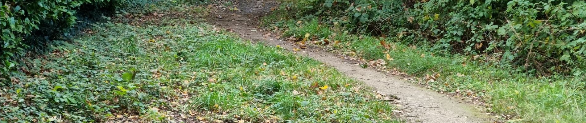
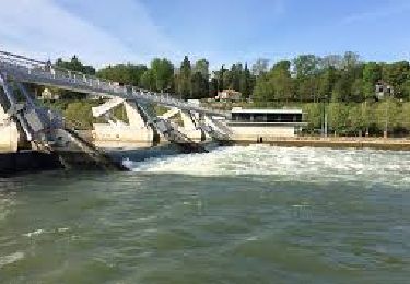
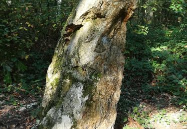
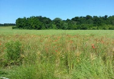
Beau parcours essentiellement sur des allées, chemins et sentiers à travers une jolie petite zone marécageuse aménagée, dans plusieurs bois, au milieu des champs, à côté de prés occupés par des animaux de ferme, en bord de Seine avec l'impressionnant barrage de Vives-Eaux sur lequel on peut déambuler, sur un tout petit sentier dont l'entrée dans le Bois de Bel Air est à peine visible et qui mène vers le Menhir du Grand Berger, etc.
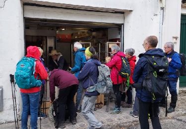
Départ/Arrivée : Parking le long de l'Avenue de la Zibeline, 77240 Cesson-la-Forêt
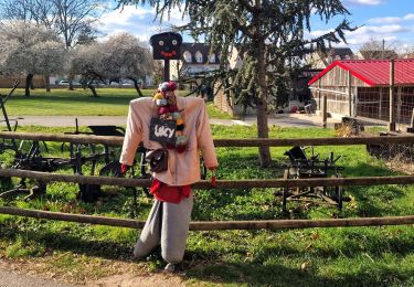
Positioning
Comments
Trails nearby
![Trail Walking Savigny-le-Temple - Entre Savigny-le-Temple et Seine-Port - Photo](https://media.geolcdn.com/t/375/260/bf4e2a57-0e1f-461a-a57c-e80897282f7a.jpg&format=jpg&maxdim=2)
![Walking Walking](https://static1.geolcdn.com/sitytour/trail-icons/101.png)
Walking
![](/images/other/stat-length.png)
![](https://static1.geolcdn.com/siteimages/upload/files/16400158638029165_repeat_loop_refresh_sync_direction_icon.png)
![Trail Walking Nandy - La Forêt de Rougeau - Photo](https://media.geolcdn.com/t/375/260/080e44a1-3383-464c-9323-aaa25c1e4163.jpg&format=jpg&maxdim=2)
![Walking Walking](https://static1.geolcdn.com/sitytour/trail-icons/101.png)
Walking
![](/images/other/stat-length.png)
![](https://static1.geolcdn.com/siteimages/upload/files/16400158638029165_repeat_loop_refresh_sync_direction_icon.png)
![Trail Walking Cesson - JC 20 19.50 km - Cesson la Forêt, forêt de Bréviande - Photo](https://media.geolcdn.com/t/375/260/a57f3f1c-b363-4986-b848-ebc6a7416d96.jpg&format=jpg&maxdim=2)
![Walking Walking](https://static1.geolcdn.com/sitytour/trail-icons/101.png)
Walking
![](/images/other/stat-length.png)
![](https://static1.geolcdn.com/siteimages/upload/files/16400158638029165_repeat_loop_refresh_sync_direction_icon.png)
![Trail Walking Cesson - 2020-09-30_18h09m29_JaINFIZemJ8 - Photo](https://media.geolcdn.com/t/375/260/204fcfa0-de27-435f-8136-b0f0ee7ffa56.jpg&format=jpg&maxdim=2)
![Walking Walking](https://static1.geolcdn.com/sitytour/trail-icons/101.png)
Walking
![](/images/other/stat-length.png)
![](https://static1.geolcdn.com/siteimages/upload/files/16400158638029165_repeat_loop_refresh_sync_direction_icon.png)
![Trail Mountain bike Melun - melun-bas.samois - Photo](https://media.geolcdn.com/t/375/260/ext.jpg?maxdim=2&url=https%3A%2F%2Fservices.sitytrail.com%2FGeolivesWS%2FDownloadMedia.ashx%3FTrailID%3D201635%26Media%3D20130630104925.jpeg)
![Mountain bike Mountain bike](https://static1.geolcdn.com/sitytour/trail-icons/202.png)
Mountain bike
![](/images/other/stat-length.png)
![](https://static1.geolcdn.com/siteimages/upload/files/16400158638029165_repeat_loop_refresh_sync_direction_icon.png)
![Trail Running Seine-Port - Fore?t de Rougeau et bords de Seine - Photo](https://media.geolcdn.com/t/375/260/ext.jpg?maxdim=2&url=https%3A%2F%2Fservices.sitytrail.com%2FGeolivesWS%2FDownloadMedia.ashx%3FTrailID%3D105548%26Media%3D9311_1.jpg)
![Running Running](https://static1.geolcdn.com/sitytour/trail-icons/103.png)
Running
![](/images/other/stat-length.png)
![](https://static1.geolcdn.com/siteimages/upload/files/16400158638029165_repeat_loop_refresh_sync_direction_icon.png)
![Trail Walking Saint-Fargeau-Ponthierry - Boucle 20 km Saint Fargeau - Photo](https://media.geolcdn.com/t/375/260/1121cafc-c79f-4e4a-a841-485665e96120.jpg&format=jpg&maxdim=2)
![Walking Walking](https://static1.geolcdn.com/sitytour/trail-icons/101.png)
Walking
![](/images/other/stat-length.png)
![](https://static1.geolcdn.com/siteimages/upload/files/16400158638029165_repeat_loop_refresh_sync_direction_icon.png)
![Trail On foot Seine-Port - L 52 Les sentes de Seine Port - Photo](https://media.geolcdn.com/t/375/260/ext.jpg?maxdim=2&url=https%3A%2F%2Fstatic1.geolcdn.com%2Fsiteimages%2Fupload%2Ffiles%2F1545311037marcheuse_200dpi.jpg)
![On foot On foot](https://static1.geolcdn.com/sitytour/trail-icons/100.png)
On foot
![](/images/other/stat-length.png)
![](https://static1.geolcdn.com/siteimages/upload/files/16400158638029165_repeat_loop_refresh_sync_direction_icon.png)
![Trail Walking Boissise-la-Bertrand - Boucle Boissise la BERTRAND 30 km - Photo](https://media.geolcdn.com/t/375/260/6730328b-3210-43a6-9f84-f1c044935aa5.jpg&format=jpg&maxdim=2)
![Walking Walking](https://static1.geolcdn.com/sitytour/trail-icons/101.png)
Walking
![](/images/other/stat-length.png)
![](https://static1.geolcdn.com/siteimages/upload/files/16400158638029165_repeat_loop_refresh_sync_direction_icon.png)