


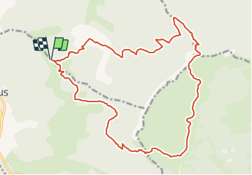

6.4 km | 11.2 km-effort


User


FREE GPS app for hiking
 SityTrail
IGN / Geographical institutes
SityTrail World
The world is yours!
Trail Walking of 12.5 km to be discovered at Auvergne-Rhône-Alpes, Drôme, Peyrus. This trail is proposed by Benjalex.
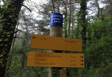
A faire fin octobre, les bois pleins de chasseurs et le plateau sans bétail.
Walking

Walking

Walking

Walking

Walking
Walking
Walking

Walking

Walking