Trail Walking Argelès-sur-Mer - Sallfort - Photo
© OpenStreetMap contributors
Length
Length
12.7 km
Max alt
Max alt
965 m
Uphill gradient
Uphill gradient
563 m
Km-Effort
Km-Effort  
21 km
Min alt
Min alt
364 m
Downhill gradient
Downhill gradient
737 m
Boucle
Boucle
No
Creation date :
2021-10-17 08:20:13.077
Updated on :
2021-10-17 17:26:41.674

(0 Reviews)

Walking
Walking
8h00
Difficulty : Medium

Scan this QR Code to open this trail in the SityTrail application

FREE GPS app for hiking

Logo SityTrail SityTrail

IGN / Geographical institutes

Download SityTrail from the App Store Download SityTrail from Google Play

Logo SityTrail SityTrail World

The world is yours!

Download SityTrail from the App Store Download SityTrail from Google Play Download SityTrail on Huawei AppGallery

About

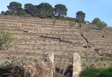
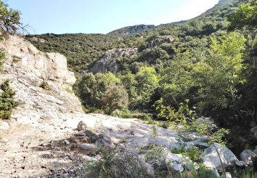
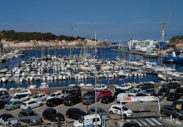
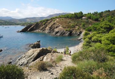
Trail Walking of 12.7 km to be discovered at Occitania, Pyrénées-Orientales, Argelès-sur-Mer. This trail is proposed by Michel Pontie.

Description

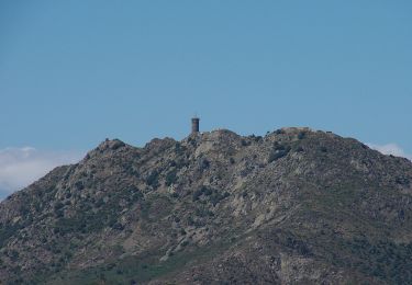
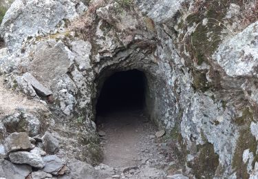
col des Gascons Gr10 Baillaury Sallfort Couloumates col d'en Verderol tunnel Baillaury piste

Elevation profile

Positioning

Country:
France
Region :
Occitania
Department/Province :
Pyrénées-Orientales
Municipality :
Argelès-sur-Mer
Location:
Unknown
Start:(UTM)
504491 ; 4702548 (31T) N.

Trails nearby

Trail Walking Collioure - 66 COLLIOURE - les balcons de Madeloc - circuit de la tour et des fortifications  - Photo
Walking
jeff66

Walking

Difficult
(1)
Collioure, Occitania, Pyrénées-Orientales, France
9.3 km | 14.9 km-effort
2h 4min
Yes
Trail Walking Collioure - COLLIOURE 66 - Ermitage ND de consolation - tour MADELOC - Photo
Walking
jeff66

Walking

Difficult
(4)
Collioure, Occitania, Pyrénées-Orientales, France
14.7 km | 23 km-effort
3h 41min
Yes
Trail Walking Collioure - autour de Collioure a travers les vignes - Photo
Walking
GUIDE
stef789

Walking

Easy
Collioure, Occitania, Pyrénées-Orientales, France
8.8 km | 12.7 km-effort
3h 33min
Yes
Trail On foot Collioure - La Tour Massane par le Chemin de l'Eau - Photo
On foot
GUIDE+

On foot

Medium
Collioure, Occitania, Pyrénées-Orientales, France
15.5 km | 27 km-effort
6h 5min
Yes
Trail Walking Banyuls-sur-Mer - puig de sallfort depuis coll de vallauria - Photo
Walking
GUIDE
stef789

Walking

Medium
Banyuls-sur-Mer, Occitania, Pyrénées-Orientales, France
11.4 km | 19.9 km-effort
5h 7min
Yes
Trail Walking Sorède - Sorède - La Vall - 6.6km 210m 2h00 - 2018 09 08 - Photo
Walking
GUIDE
Orcal37

Walking

Easy
Sorède, Occitania, Pyrénées-Orientales, France
6.6 km | 8.8 km-effort
2h 0min
Yes
Trail Walking Port-Vendres - Port-Vendres - 3km 40m 55mn - 2018 09 03 - Photo
Walking
GUIDE
Orcal37

Walking

Very easy
Port-Vendres, Occitania, Pyrénées-Orientales, France
3 km | 3.4 km-effort
55min
Yes
Trail Walking Port-Vendres - Port-Vendres - Cap Béar-Paulilles - 11.7km 340m 4h00 (30mn) - 2018 09 03 - Photo
Walking
GUIDE
Orcal37

Walking

Easy
Port-Vendres, Occitania, Pyrénées-Orientales, France
11.7 km | 16.1 km-effort
4h 0min
Yes
Trail Walking Sorède - 66 LAVAIL - Roc de les Mèdes - font Dels Miracles - PUIG Nalt - château d'Ultrera - pic de Sant Miquel - La Pava  - Photo
Walking
jeff66

Walking

Difficult
(1)
Sorède, Occitania, Pyrénées-Orientales, France
11.1 km | 20 km-effort
3h 13min
Yes


Close
My subscriptions