23 km | 29 km-effort
Saint cheron 2
Pirrovani
User
Length
7.5 km
Max alt
168 m
Uphill gradient
130 m
Km-Effort
9.3 km
Min alt
66 m
Downhill gradient
130 m
Boucle
Yes
Creation date :
2021-10-16 09:17:10.332
Updated on :
2021-10-16 09:17:46.037
2h06
Difficulty : Medium
FREE GPS app for hiking
About
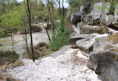
Trail Walking of 7.5 km to be discovered at Ile-de-France, Essonne, Saint-Chéron. This trail is proposed by Pirrovani.
Positioning
Country:
France
Region :
Ile-de-France
Department/Province :
Essonne
Municipality :
Saint-Chéron
Location:
Unknown
Start:(Dec)
Start:(UTM)
434911 ; 5378587 (31U) N.
Comments
Trails nearby
Les Pétales de Souzy
Walking
Difficult
(1)
Saint-Sulpice-de-Favières,
Ile-de-France,
Essonne,
France
4h 49min
Yes
Boucle au départ du château de Courson
Walking
Easy
Courson-Monteloup,
Ile-de-France,
Essonne,
France
23 km | 27 km-effort
5h 7min
Yes
Boucle 18 km St Sulpice de Favières
On foot
Medium
Saint-Sulpice-de-Favières,
Ile-de-France,
Essonne,
France
18 km | 22 km-effort
4h 59min
Yes
Boucle St Maurice Montcouronne - Brigitte
Walking
Very easy
Saint-Maurice-Montcouronne,
Ile-de-France,
Essonne,
France
21 km | 24 km-effort
4h 19min
Yes
St Sulpice
Walking
Medium
(1)
Saint-Sulpice-de-Favières,
Ile-de-France,
Essonne,
France
8 km | 10.1 km-effort
2h 18min
Yes
2018-09-26 Rando Sermaise
Walking
Easy
(1)
Sermaise,
Ile-de-France,
Essonne,
France
12.3 km | 15 km-effort
3h 15min
Yes
Saint-Cheron - l'Orge
Walking
Medium
Saint-Chéron,
Ile-de-France,
Essonne,
France
8.3 km | 10.4 km-effort
2h 21min
Yes
De Saint Chéron à Dourdan par les côteaux de la rive gauche
Walking
Difficult
(1)
Saint-Chéron,
Ile-de-France,
Essonne,
France
13.5 km | 17 km-effort
3h 51min
No
Villeconin
Walking
Medium
Villeconin,
Ile-de-France,
Essonne,
France
8.5 km | 10.9 km-effort
2h 11min
Yes