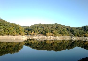
Trail Bicycle tourism Fontenay-le-Comte - CŒUR DE VILLE - Photo
 Gandon91
Gandon91

User

© OpenStreetMap contributors
Length
Length
6.1 km
Max alt
Max alt
41 m
Uphill gradient
Uphill gradient
88 m
Km-Effort
Km-Effort  
7.3 km
Min alt
Min alt
4 m
Downhill gradient
Downhill gradient
90 m
Boucle
Boucle
No
Creation date :
2021-10-15 15:24:44.302
Updated on :
2022-08-13 06:50:32.1

(0 Reviews)

Bicycle tourism
Bicycle tourism
--
Difficulty : Very easy

Scan this QR Code to open this trail in the SityTrail application

FREE GPS app for hiking

Logo SityTrail SityTrail

IGN / Geographical institutes

Download SityTrail from the App Store Download SityTrail from Google Play

Logo SityTrail SityTrail World

The world is yours!

Download SityTrail from the App Store Download SityTrail from Google Play Download SityTrail on Huawei AppGallery

About

Trail Bicycle tourism of 6.1 km to be discovered at Pays de la Loire, Vendée, Fontenay-le-Comte. This trail is proposed by Gandon91.

Elevation profile

Points of interest

Point of interest Fontenay-le-Comte - Parc Espierre - Photo
Gandon91
FONTENAY-LE-COMTE 
Point of interest Fontenay-le-Comte - Parc Baron - Photo
Gandon91
FONTENAY-LE-COMTE 
Point of interest Fontenay-le-Comte - Fontaine des Quatre-Tias - Photo
Gandon91
FONTENAY-LE-COMTE 

Positioning

Country:
France
Region :
Pays de la Loire
Department/Province :
Vendée
Municipality :
Fontenay-le-Comte
Location:
Unknown
Start:(UTM)
668490 ; 5148095 (30T) N.

Trails nearby

Trail Walking L'Orbrie - Boucle Mervent  - Photo
Walking
RayFab

Walking

Difficult
L'Orbrie, Pays de la Loire, Vendée, France
12.1 km | 15.4 km-effort
3h 30min
Yes
Trail Walking Pissotte - Lac de Mervent - Gd tour depuis Pissotte  - Photo
Walking
meunier.ph.

Walking

Medium
Pissotte, Pays de la Loire, Vendée, France
26 km | 33 km-effort
5h 15min
Yes
Trail Walking L'Orbrie - balingue - Photo
Walking
penaud

Walking

Medium
L'Orbrie, Pays de la Loire, Vendée, France
7 km | 8.5 km-effort
5h 32min
Yes
Trail Walking Pissotte - Ph. 2017-02 Pissotte : Barrage et forêt de Mervent - Photo
Walking
meunier.ph.

Walking

Difficult
Pissotte, Pays de la Loire, Vendée, France
12.4 km | 15.8 km-effort
2h 25min
Yes
Trail Walking Pissotte - Du barrage de Mervent à la Balingue - Pissotte - Photo
Walking
tracegps

Walking

Medium
(1)
Pissotte, Pays de la Loire, Vendée, France
14.9 km | 19.1 km-effort
3h 10min
Yes
Trail Mountain bike L'Orbrie - Boucle de la Balingue - Photo
Mountain bike
tracegps

Mountain bike

Very difficult
L'Orbrie, Pays de la Loire, Vendée, France
10.1 km | 12.7 km-effort
1h 0min
Yes
Trail Horseback riding Pissotte - Parking gâcher - barrage  - Photo
Horseback riding
Anais Lemonnier

Horseback riding

Medium
Pissotte, Pays de la Loire, Vendée, France
10.4 km | 12.5 km-effort
1h 51min
No
Trail Horseback riding Fontenay-le-Comte - Mervent sans pont - Photo
Horseback riding
Anais Lemonnier

Horseback riding

Easy
Fontenay-le-Comte, Pays de la Loire, Vendée, France
16 km | 20 km-effort
3h 0min
No
Trail On foot Sérigné - n°39 Les Meules à Sérigné  (guide des sentiers de randonnée pédestre FFR VENDEE) - Photo
On foot
cath310

On foot

Easy
Sérigné, Pays de la Loire, Vendée, France
13.5 km | 16.4 km-effort
3h 43min
Yes


Close
My subscriptions