Trail Walking Longny les Villages - Longny-au-Perche - Le Coteau de la Bandonnière - Photo

Longny-au-Perche - Le Coteau de la Bandonnière

 guydu41
guydu41

User

© OpenStreetMap contributors
Length
Length
957 m
Max alt
Max alt
209 m
Uphill gradient
Uphill gradient
34 m
Km-Effort
Km-Effort  
1.4 km
Min alt
Min alt
172 m
Downhill gradient
Downhill gradient
32 m
Boucle
Boucle
Yes
Creation date :
2021-10-10 14:10:09.495
Updated on :
2021-10-11 22:46:42.823

(0 Reviews)

Walking
Walking
33m
Difficulty : Easy

Scan this QR Code to open this trail in the SityTrail application

FREE GPS app for hiking

Logo SityTrail SityTrail

IGN / Geographical institutes

Download SityTrail from the App Store Download SityTrail from Google Play

Logo SityTrail SityTrail World

The world is yours!

Download SityTrail from the App Store Download SityTrail from Google Play Download SityTrail on Huawei AppGallery

About

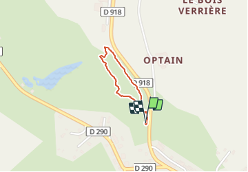
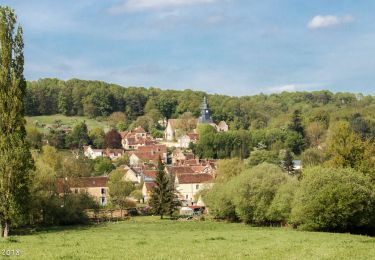
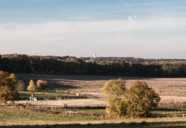
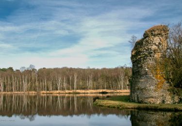
Trail Walking of 957 m to be discovered at Normandy, Orne, Longny les Villages. This trail is proposed by guydu41.

Description

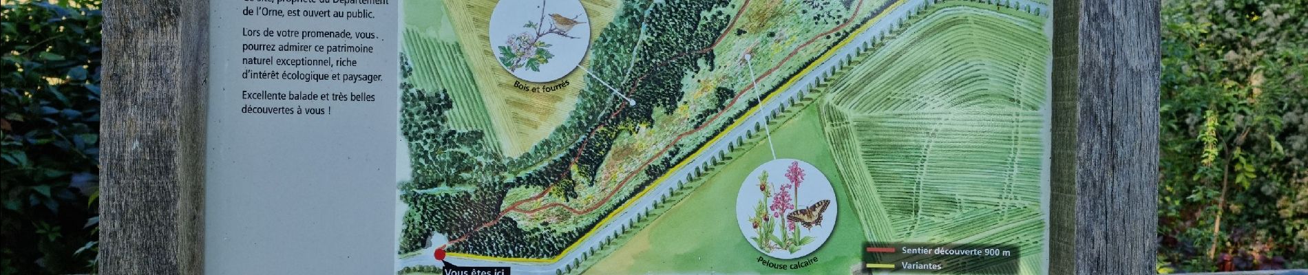
Circuit de découverte dans un très bel espace naturel sensible.
Ce petit parcours en boucle emprunte un sentier descendant au fond d'une vallée assez profonde, suit une petite rivière, remonte en lacet sur le haut du coteau, le longe pour revenir au parking de départ.
Les points de vue sur la vallée sont impressionnants.
Des moutons et chèvres assurent l'entretien d'une végétation extraordinaire dans ce coin du Perche.
Un guide est téléchargeable sur le site départemental de l'Orne.
Départ/Arrivée : Parking du Coteau de la Bandonnière sur la D918 à Longny-les-Villages.

Elevation profile

Photos

23 photos in total. Please click on a photo to see them all in the gallery.

Positioning

Country:
France
Region :
Normandy
Department/Province :
Orne
Municipality :
Longny les Villages
Location:
Longny-au-Perche
Start:(UTM)
333750 ; 5378211 (31U) N.

Trails nearby

Trail Walking Longny les Villages - [Itinéraire] La Brisardière - Photo
Walking
ODDAD78

Walking

Easy
Longny les Villages, Normandy, Orne, France
3.5 km | 4.4 km-effort
1h 0min
Yes
Trail Walking Bizou - [Itinéraire] Les sables du Perche - Photo
Walking
ODDAD78

Walking

Medium
Bizou, Normandy, Orne, France
9.2 km | 11 km-effort
2h 29min
Yes
Trail On foot Longny les Villages - Attelage - Forêt et Panoramas - forêt de Réno-Valdieu - Photo
On foot
GUIDE+

On foot

Easy
Longny les Villages, Normandy, Orne, France
7.6 km | 9.3 km-effort
2h 7min
No
Trail Walking Longny les Villages - La Fonte - Malétable 7,8 km - Photo
Walking
ODDAD78

Walking

Easy
Longny les Villages, Normandy, Orne, France
7.8 km | 9.2 km-effort
21min
Yes
Trail Walking Le Mage - Le Mage - Longny-au-Perche (Longny les Villages) 11 km - Photo
Walking

Walking

Difficult
Le Mage, Normandy, Orne, France
11.2 km | 13.5 km-effort
3h 17min
No
Trail Walking Le Mage - Le Mage - Moutiers-au-Perche 9,2 km - Photo
Walking

Walking

Medium
Le Mage, Normandy, Orne, France
9.2 km | 11.5 km-effort
2h 33min
No
Trail Walking Longny les Villages - Longny-au-Perche (Longny-les-Villages) - Moutiers-au-Perche 13 km - Photo
Walking

Walking

Easy
Longny les Villages, Normandy, Orne, France
13.2 km | 16.6 km-effort
2h 44min
No
Trail Walking Longny les Villages - Longny-au-Perche (Longny-les-Villages) - Tourouvre 22 km - Photo
Walking

Walking

Easy
Longny les Villages, Normandy, Orne, France
22 km | 26 km-effort
5h 42min
No
Trail Walking Bizou - Bizou 10.1 Km - Photo
Walking
ODDAD78

Walking

Difficult
Bizou, Normandy, Orne, France
10.1 km | 12 km-effort
2h 44min
Yes


Close
My subscriptions