Trail On foot Basse-Pointe -  SLNA Projet de tracé - Photo

SLNA Projet de tracé

 Lamartiniere
Lamartiniere

User GUIDE

© OpenStreetMap contributors
Length
Length
11.4 km
Max alt
Max alt
193 m
Uphill gradient
Uphill gradient
333 m
Km-Effort
Km-Effort  
15.7 km
Min alt
Min alt
15 m
Downhill gradient
Downhill gradient
279 m
Boucle
Boucle
No
Creation date :
2021-10-09 12:32:08.843
Updated on :
2021-10-13 23:22:18.18

(0 Reviews)

On foot
On foot
3h33
Difficulty : Easy
Walking
Walking
3h33
Difficulty : Difficult

Scan this QR Code to open this trail in the SityTrail application

FREE GPS app for hiking

Logo SityTrail SityTrail

IGN / Geographical institutes

Download SityTrail from the App Store Download SityTrail from Google Play

Logo SityTrail SityTrail World

The world is yours!

Download SityTrail from the App Store Download SityTrail from Google Play Download SityTrail on Huawei AppGallery

About

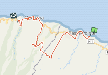
Trail On foot of 11.4 km to be discovered at Martinique, Unknown, Basse-Pointe. This trail is proposed by Lamartiniere.

Description

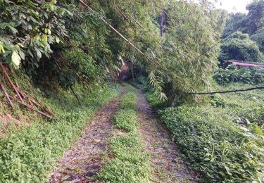
Sentier Littoral Nord-Atlantique, (SLNA) projet de tracé

Ce projet de tracé qui évite le plus possible d’emprunter la voie publique, permet de faire la jonction du SLNA en partant du terrain de pétanque de Basse-Pointe situé à Tapis-Vert vers le départ du circuit Désiles placé sur la D10 au niveau d’Hbt Cheneaux à Macouba.

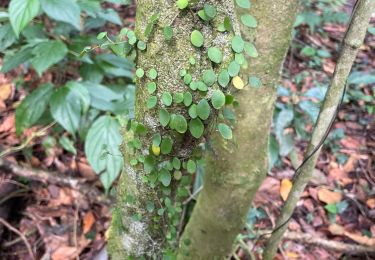
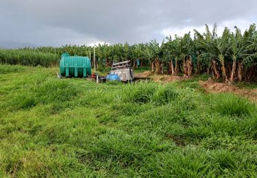
Le circuit proposé, d’une longueur de 11 kms environ, au dénivelé de 330 ms, traverse plusieurs exploitations agricoles, en l’occurrence, Hbt Gradis, Hbt  Hackaert, Hbt Bellevue ainsi qu'une petite canneraie à la sortie du gué de rivière Hackaert.

Au niveau de Gros-Morne, un gué autorise la traversée de la rivière Hackaert, par beau temps vers le secteur Théolade.

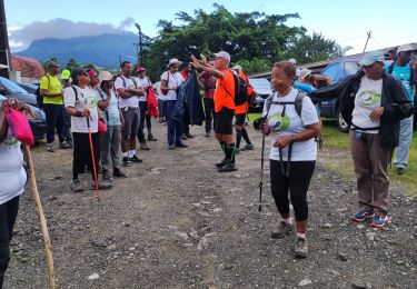
Des autorisations de passages seront nécessaires pour l'évolution des randonneurs

Quelques points d’intérêts sur cet itinéraire :

-Basse-Pointe :
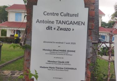
-Le Centre Culturel Tiers-Lieu Antoine Tangamen.

-Macouba :
-Rhumerie de Fonds Preville, à Rivière Roche (JM)
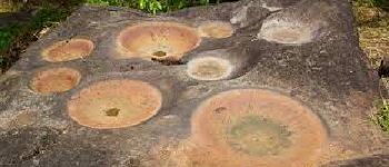
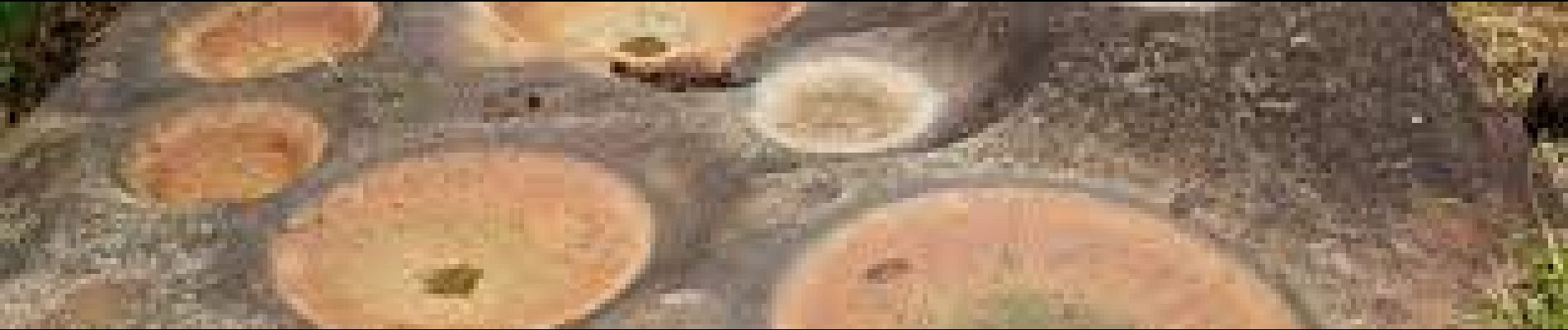
-Au niveau de Terre-Patate, « La roche à BonDieu ».
-A noter  également la possibilité pour le marcheur de faire un aller-retour sur l’ancien quartier Nord-Plage où est installé un chemin de croix et un oratoire, puis  reprise du parcours initial sur la D10.

Fernand LAMARTINIERE.
2ème Vice-Président  et Administrateur
Comité de la Randonnée Pédestre de la Martinique

Elevation profile

Photos

Points of interest

Point of interest Macouba - La Roche à Bon Dieu - Photo
Lamartiniere

Positioning

Country:
France
Region :
Martinique
Department/Province :
Unknown
Municipality :
Basse-Pointe
Location:
Unknown
Start:(UTM)
703464 ; 1644373 (20P) N.

Trails nearby

Trail Walking Basse-Pointe - Exploitations agricoles en boucle N°1 - Photo
Walking
GUIDE
Lamartiniere

Walking

Medium
Basse-Pointe, Martinique, Unknown, France
13.2 km | 16.5 km-effort
4h 0min
Yes
Trail Walking Le Lorrain - Fond capot oceanic fond cani morne Degras - Photo
Walking
GUIDE
manuelPerez

Walking

Le Lorrain, Martinique, Unknown, France
8.5 km | 11.9 km-effort
3h 44min
Yes
Trail Walking Le Lorrain - Mornes Capot / Lorrain Martinique - Photo
Walking
GUIDE
GabyG

Walking

Medium
(1)
Le Lorrain, Martinique, Unknown, France
8.5 km | 11.8 km-effort
3h 41min
Yes
Trail Walking Basse-Pointe - Boucle de chalvet, Pécoule vers Chalvet. - Photo
Walking
GUIDE
GabyG

Walking

Medium
Basse-Pointe, Martinique, Unknown, France
6.5 km | 7.8 km-effort
3h 2min
Yes
Trail Walking L'Ajoupa-Bouillon - Défi 2022 étoile - Photo
Walking
GUIDE
manuelPerez

Walking

L'Ajoupa-Bouillon, Martinique, Unknown, France
9.1 km | 15.6 km-effort
3h 33min
No
Trail Walking Basse-Pointe - Grande Boucle sur Basse pointe. - Photo
Walking
GUIDE
GabyG

Walking

Very difficult
Basse-Pointe, Martinique, Unknown, France
14.1 km | 17.6 km-effort
4h 55min
Yes
Trail Walking Le Lorrain - trace des Amérindiens - Photo
Walking
GUIDE
GabyG

Walking

Medium
Le Lorrain, Martinique, Unknown, France
5.1 km | 6.6 km-effort
2h 40min
No
Trail Walking Le Lorrain - Boucle La Crabiere - Hbt Assier - Photo
Walking
GUIDE
Lamartiniere

Walking

Medium
Le Lorrain, Martinique, Unknown, France
8.5 km | 11.7 km-effort
3h 0min
Yes
Trail Walking Basse-Pointe - Stèle Anse  Chalvet - Boulodrome Basse-Pointe  - Photo
Walking
GUIDE
Lamartiniere

Walking

Medium
Basse-Pointe, Martinique, Unknown, France
3.3 km | 4.1 km-effort
2h 57min
No


Close
My subscriptions