![](/images/other/stat-length.png)
![Trail Walking Barzan - Barzan plage- Le Fâ - Le caillaud - Photo](https://media.geolcdn.com/t/1900/400/99bff97a-4dbd-477c-b93a-7fdde91cd2a7.jpg&format=pjpeg&maxdim=2)
Barzan plage- Le Fâ - Le caillaud
Gef50
User
![Length](/images/other/stat-length.png)
![Max alt](https://static1.geolcdn.com/siteimages/upload/files/1508320355ic_sort_altitude_max_24dp.png)
![Uphill gradient](https://static1.geolcdn.com/siteimages/upload/files/1508320355ic_sort_den_pos_24dp.png)
![Km-Effort](/images/other/stat-length.png)
![Min alt](https://static1.geolcdn.com/siteimages/upload/files/1508320355ic_sort_altitude_min_24dp.png)
![Downhill gradient](https://static1.geolcdn.com/siteimages/upload/files/1508320355ic_sort_den_neg_24dp.png)
![Boucle](https://static1.geolcdn.com/siteimages/upload/files/16400158638029165_repeat_loop_refresh_sync_direction_icon.png)
![Walking](https://static1.geolcdn.com/sitytour/trail-icons/101.png)
3h55
Difficulty : Medium
![Scan this QR Code to open this trail in the SityTrail application](https://capi.geolives.com/qq0zvz2zws4bq2lad0pu/sitytour/trails/2962486/qr.png?size=200)
FREE GPS app for hiking
About
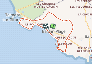
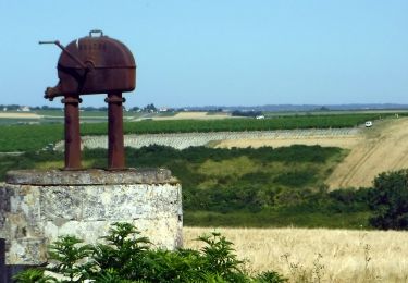
Trail Walking of 9.4 km to be discovered at New Aquitaine, Charente-Maritime, Barzan. This trail is proposed by Gef50.
Description
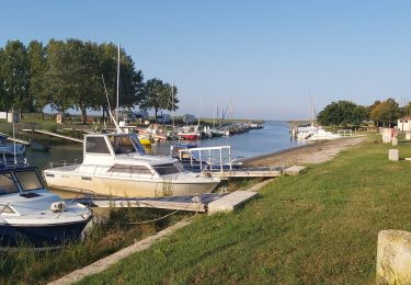
Parking Barzan plage près de l'aire de camping-cars.
Face à l'estuaire partir à gauche sur le chemin blanc (piste vélo route des 2 mers)
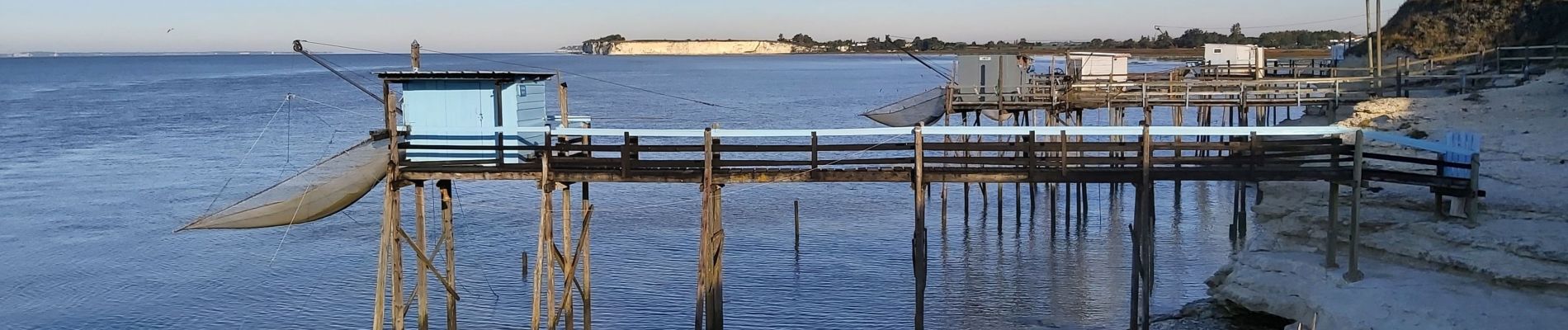
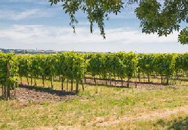
Continuer par le chemin en herbe balisé en bleu et contourner la roche Batard puis longer les vignes jusqu'aux carrelets.
Suivre la berge, prendre le virage à gauche et rejoindre la route goudronnée du Pilou.
Prendre à gauche sur 170m puis tourner à droite et longer la clotûre en bordure de champ.
Longer les vignes (gauche-droite) et tourner à droite en surplomb de la n145 et descendre sur la route.
A gauche sur 100m et prendre à droite en direction du Fâ. A la fourche (100m) continuer sur la gauche et après 1km tourner à gauche sur la petite route goudronnée.
Après 200m tourner à droite sur le chemin (le long des poteaux électriques).
Passer devant le musée Gallo-Romain (ouvert en juillet et août)
Au bout tourner à gauche et continuer tout droit pour rejoindre le hameau La Couture et prendre légèrement à droite ( balisage GR barré)
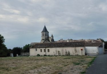
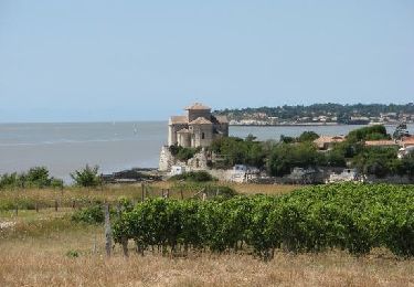
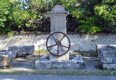
Retraverser la n145 continuer malgré les panneaux interdits aux véhicules sauf vignettes Talmont, passer devant la fontaine et les timbres puis près du château de la Fond
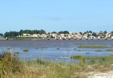
Arrivée face à Talmont près de la dame blanche et prendre à gauche sur 60m puis tourner à droite en direction de l'estuaire par la falaise du Caillaud.
Continuer sur le chemin blanc (route des 2 mers) jusqu'à la route.
Longer la n145 par le chemin et arrivée au parking.
Positioning
Comments
Trails nearby
![Trail On foot Arces - Arces 17 8km500 - Photo](https://media.geolcdn.com/t/375/260/801369d0-0da1-41ce-adc3-6926a888ffce.jpg&format=jpg&maxdim=2)
![On foot On foot](https://static1.geolcdn.com/sitytour/trail-icons/100.png)
On foot
![](/images/other/stat-length.png)
![](https://static1.geolcdn.com/siteimages/upload/files/16400158638029165_repeat_loop_refresh_sync_direction_icon.png)
![Walking Walking](https://static1.geolcdn.com/sitytour/trail-icons/101.png)
Walking
![](/images/other/stat-length.png)
![](https://static1.geolcdn.com/siteimages/upload/files/16400158638029165_repeat_loop_refresh_sync_direction_icon.png)
![Trail Walking Chenac-Saint-Seurin-d'Uzet - 2021-10-02_08h47m34_SityTrail - 2911110 - st-seurin-dxuzet - Photo](https://media.geolcdn.com/t/375/260/a1b82f24-37a0-4523-853d-4c66b187e131.jpg&format=jpg&maxdim=2)
![Walking Walking](https://static1.geolcdn.com/sitytour/trail-icons/101.png)
Walking
![](/images/other/stat-length.png)
![](https://static1.geolcdn.com/siteimages/upload/files/16400158638029165_repeat_loop_refresh_sync_direction_icon.png)
![Trail On foot Arces - Arces - Bardecille 17 (8km9) - Photo](https://media.geolcdn.com/t/375/260/999920b0-0de7-4afd-829e-4404e9c96776.jpg&format=jpg&maxdim=2)
![On foot On foot](https://static1.geolcdn.com/sitytour/trail-icons/100.png)
On foot
![](/images/other/stat-length.png)
![](https://static1.geolcdn.com/siteimages/upload/files/16400158638029165_repeat_loop_refresh_sync_direction_icon.png)
![Trail On foot Talmont-sur-Gironde - Talmont-Barzan 17 -8km6 - Photo](https://media.geolcdn.com/t/375/260/4b7ec9ef-5e25-4e15-b261-633a96f83875.jpg&format=jpg&maxdim=2)
![On foot On foot](https://static1.geolcdn.com/sitytour/trail-icons/100.png)
On foot
![](/images/other/stat-length.png)
![](https://static1.geolcdn.com/siteimages/upload/files/16400158638029165_repeat_loop_refresh_sync_direction_icon.png)
![Trail Road bike Barzan - Barzan plage vers Mécher sur Gironde et Talmon - Photo](https://media.geolcdn.com/t/375/260/ext.jpg?maxdim=2&url=https%3A%2F%2Fstatic1.geolcdn.com%2Fsiteimages%2Fupload%2Ffiles%2F1524743154velo.jpg)
![Road bike Road bike](https://static1.geolcdn.com/sitytour/trail-icons/201.png)
Road bike
![](/images/other/stat-length.png)
![](https://static1.geolcdn.com/siteimages/upload/files/16400158638029165_repeat_loop_refresh_sync_direction_icon.png)
![Walking Walking](https://static1.geolcdn.com/sitytour/trail-icons/101.png)
Walking
![](/images/other/stat-length.png)
![](https://static1.geolcdn.com/siteimages/upload/files/16400158638029165_repeat_loop_refresh_sync_direction_icon.png)
![Trail Walking Meschers-sur-Gironde - Mes cher Talmon - Photo](https://media.geolcdn.com/t/375/260/ext.jpg?maxdim=2&url=https%3A%2F%2Fstatic1.geolcdn.com%2Fsiteimages%2Fupload%2Ffiles%2F1553511878bg_sport_marche.png)
![Walking Walking](https://static1.geolcdn.com/sitytour/trail-icons/101.png)
Walking
![](/images/other/stat-length.png)
![](https://static1.geolcdn.com/siteimages/upload/files/16400158638029165_repeat_loop_refresh_sync_direction_icon.png)
![On foot On foot](https://static1.geolcdn.com/sitytour/trail-icons/100.png)
On foot
![](/images/other/stat-length.png)
![](https://static1.geolcdn.com/siteimages/upload/files/16400158638029165_repeat_loop_refresh_sync_direction_icon.png)