Trail Walking Charix - Tour du Cret Torcet; Sème - Photo

Tour du Cret Torcet; Sème

 HB01
HB01

User

© OpenStreetMap contributors
Length
Length
15.5 km
Max alt
Max alt
987 m
Uphill gradient
Uphill gradient
453 m
Km-Effort
Km-Effort  
22 km
Min alt
Min alt
776 m
Downhill gradient
Downhill gradient
453 m
Boucle
Boucle
Yes
Creation date :
2021-10-07 08:39:08.129
Updated on :
2021-10-07 17:18:27.147

(0 Reviews)

Walking
Walking
4h07
Difficulty : Medium

Scan this QR Code to open this trail in the SityTrail application

FREE GPS app for hiking

Logo SityTrail SityTrail

IGN / Geographical institutes

Download SityTrail from the App Store Download SityTrail from Google Play

Logo SityTrail SityTrail World

The world is yours!

Download SityTrail from the App Store Download SityTrail from Google Play Download SityTrail on Huawei AppGallery

About

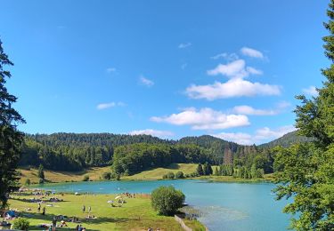
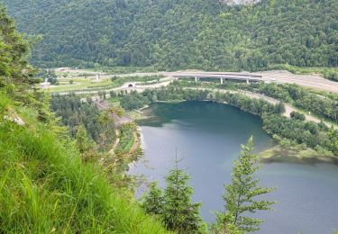
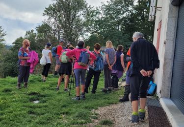
Trail Walking of 15.5 km to be discovered at Auvergne-Rhône-Alpes, Ain, Charix. This trail is proposed by HB01.

Description

Départ de Charix. Tour du crêt Torcet. Point de  vue rochers de Sème.

Elevation profile

Positioning

Country:
France
Region :
Auvergne-Rhône-Alpes
Department/Province :
Ain
Municipality :
Charix
Location:
Unknown
Start:(UTM)
707209 ; 5118019 (31T) N.

Trails nearby

Trail Walking Charix - lac de genin - bretouze /  retour - Photo
Walking
GUIDE
stef789

Walking

Medium
Charix, Auvergne-Rhône-Alpes, Ain, France
10.9 km | 16.7 km-effort
4h 17min
Yes
Trail Walking Le Poizat-Lalleyriat - Le poizat - Photo
Walking
GUIDE
loca.yves

Walking

Easy
Le Poizat-Lalleyriat, Auvergne-Rhône-Alpes, Ain, France
10.1 km | 14 km-effort
3h 38min
Yes
Trail Motor Charix - Tour de l'ain moto 2/4 - Photo
Motor
cub69

Motor

Difficult
(1)
Charix, Auvergne-Rhône-Alpes, Ain, France
93 km | 152 km-effort
Unknown
No
Trail Walking Charix - charix lac genin - Photo
Walking
GUIDE
loca.yves

Walking

Very easy
Charix, Auvergne-Rhône-Alpes, Ain, France
13.8 km | 19.3 km-effort
4h 30min
Yes
Trail Walking Charix - charix - Photo
Walking
GUIDE
loca.yves

Walking

Very difficult
Charix, Auvergne-Rhône-Alpes, Ain, France
15.7 km | 22 km-effort
4h 42min
Yes
Trail Walking Le Poizat-Lalleyriat - lalleyriat - Photo
Walking
GUIDE
loca.yves

Walking

Easy
Le Poizat-Lalleyriat, Auvergne-Rhône-Alpes, Ain, France
11.5 km | 17.6 km-effort
3h 52min
Yes
Trail On foot Charix - Le Tour du Plateau 6 - Photo
On foot
GUIDE+

On foot

Medium
Charix, Auvergne-Rhône-Alpes, Ain, France
17.2 km | 24 km-effort
5h 25min
Yes
Trail On foot Nantua - Tour d'Horizon - Photo
On foot
GUIDE+

On foot

Easy
Nantua, Auvergne-Rhône-Alpes, Ain, France
5.5 km | 7.8 km-effort
1h 46min
No
Trail On foot Apremont - Le Lac Genin - Photo
On foot
GUIDE+

On foot

Easy
Apremont, Auvergne-Rhône-Alpes, Ain, France
9.3 km | 14.6 km-effort
3h 19min
Yes


Close
My subscriptions